Alt Mädewitz, Altmädewitz
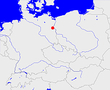
Diese Karte zeigt die Position oder den Umriss des Objekts. Haben Sie einen Fehler entdeckt? Dann würden wir uns über eine Nachricht freuen.
Übergeordnete Objekte
Legende
| | politische Verwaltung |
| | kirchliche Verwaltung |
| | gerichtliche Verwaltung |
| | Wohnplatz |
| | geographische Typen |
| | Verkehrswesen |
Übergeordnete Objekte
- Bad Freienwalde (Landkreis)
- Brandenburg, Brandenburg, Kraj Bramborska (Bundesland)
- Bundesrepublik Deutschland, Deutschland, Federal Republic of Germany, Герма́ния, Vokietija, Nemecká spolková republika, Germany, Tyskland, Duitsland, Allemagne, Niemcy (Bundesstaat)
- Europäische Wirtschaftsgemeinschaft, Europäische Gemeinschaft, Europäische Union, Evropské hospodářské společenství, Euroopan talousyhteisö, Európske hospodárske spoločenstvo, Communauté économique européenne, Comhphobal Eacnamaíochta na hEorpa, Europese Economische Gemeenschap, European Economic Community, Comunità Economica Europea, Comunidad Económica Europea, Europese Gemeenschap, Evropské společenství, Communauté européenne, Európske spoločenstvo, Comhphobal Eorpach, Comunità Europea, Comunidad Europea, European Community, Euroopan Yhteisö, Evropská unie, Unione Europea, Euroopan Unioni, Aontais Eorpaigh, European Union, Unión Europea, Europese Unie, Union européenne, Európska únia (Staatenbund)
- Vereinte Nationen, Verenigde Naties, Организация Объединённых Наций, Organisation des Nations unies, 联合国, Organización de las Naciones Unidas, United Nations, الأمم المتحدة, Organizácia Spojených národov (Staatenbund)
- Frankfurt (Bezirk)
- Wriezen (Amtsgericht)
- Oberbarnim (Kreis Landkreis)
- Alt Wriezen (Amtsbezirk)
- Alt Wriezen (Standesamt)
- Oberbarnim (Kreis Landkreis)
- Bad Freienwalde (Landkreis)
- Brandenburg, Brandenburg, Kraj Bramborska (Bundesland)
- Bundesrepublik Deutschland, Deutschland, Federal Republic of Germany, Герма́ния, Vokietija, Nemecká spolková republika, Germany, Tyskland, Duitsland, Allemagne, Niemcy (Bundesstaat)
- Europäische Wirtschaftsgemeinschaft, Europäische Gemeinschaft, Europäische Union, Evropské hospodářské společenství, Euroopan talousyhteisö, Európske hospodárske spoločenstvo, Communauté économique européenne, Comhphobal Eacnamaíochta na hEorpa, Europese Economische Gemeenschap, European Economic Community, Comunità Economica Europea, Comunidad Económica Europea, Europese Gemeenschap, Evropské společenství, Communauté européenne, Európske spoločenstvo, Comhphobal Eorpach, Comunità Europea, Comunidad Europea, European Community, Euroopan Yhteisö, Evropská unie, Unione Europea, Euroopan Unioni, Aontais Eorpaigh, European Union, Unión Europea, Europese Unie, Union européenne, Európska únia (Staatenbund)
- Vereinte Nationen, Verenigde Naties, Организация Объединённых Наций, Organisation des Nations unies, 联合国, Organización de las Naciones Unidas, United Nations, الأمم المتحدة, Organizácia Spojených národov (Staatenbund)
- Frankfurt (Bezirk)
Quicktext
GOSHAL_W8432
	has 1875 population 376 sagt source_263605,
	has 1890 population 323 sagt source_263605,
	has 1895-12-02 area 6.049 sagt source_1023281 (S. 30 / 31),
	has 1895-12-02 households 59 sagt source_1023281 (S. 30 / 31),
	has 1895-12-02 population 308 sagt source_1023281 (S. 30 / 31),
	has 1910-12-01 population 264 sagt source_263605 sagt source_265044,
	has 1925 population 252 sagt source_190312 sagt source_263605,
	has 1933 population 236 sagt source_190312 sagt source_263605,
	has 1939 population 237 sagt source_190312,
	has 1946 population 295 sagt source_284918,
	has 1987 population 19 sagt source_320250,
	has external reference  BLO:5375,
	has from 1993-07-01 postal code 92339,
	has name (in deu) Alt Mädewitz sagt source_1023281 (S. 30 / 31) sagt source_265044,
	has name (in deu) Altmädewitz sagt source_190312,
	has name (in deu) Gösselthal sagt source_320250,
	has until 1974-02-28 postal code O1311,
	has until 1993-06-30 postal code W8432,
	is (in deu) Weiler sagt source_320250,
	is 1895-12-02 part of object_1165013 sagt source_1023281 (S. 30 / 31),
	is 1895-12-02 part of object_285728 sagt source_1023281 (S. 30 / 31),
	is from 1874-10-02 part of object_1147263 sagt source_1023281 (S. 30 / 31) sagt source_1331590 sagt source_1331591 sagt source_1335057 (Beilage S. 9 Nr. 35),
	is from 1935-04-01 until 1974-02-28 (in deu) Gemeinde sagt source_190312 sagt source_284918,
	is from 1952-07-25 until 1974-02-28 part of adm_142012 sagt source_290784,
	is part of BEIIE1JN59RA sagt source_320250,
	is until 1935-03-31 (in deu) Landgemeinde sagt source_1023281 (Nr. 12 Seite 30 / 31) sagt source_265044,
	is until 1952-07-24 part of object_263367 sagt source_1023281 (Seite 30 / 31) sagt source_284918,
	located at 49.0549°N 11.4645°O;
