Bruchmühle
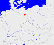
Diese Karte zeigt die Position oder den Umriss des Objekts. Haben Sie einen Fehler entdeckt? Dann würden wir uns über eine Nachricht freuen.
Übergeordnete Objekte
Legende
| | politische Verwaltung |
| | kirchliche Verwaltung |
| | gerichtliche Verwaltung |
| | Wohnplatz |
| | geographische Typen |
| | Verkehrswesen |
Übergeordnete Objekte
- Altlandsberg (Amt)
- Strausberg (Landkreis)
- Brandenburg, Brandenburg, Kraj Bramborska (Bundesland)
- Bundesrepublik Deutschland, Deutschland, Federal Republic of Germany, Герма́ния, Vokietija, Nemecká spolková republika, Germany, Tyskland, Duitsland, Allemagne, Niemcy (Bundesstaat)
- Europäische Wirtschaftsgemeinschaft, Europäische Gemeinschaft, Europäische Union, Evropské hospodářské společenství, Euroopan talousyhteisö, Európske hospodárske spoločenstvo, Communauté économique européenne, Comhphobal Eacnamaíochta na hEorpa, Europese Economische Gemeenschap, European Economic Community, Comunità Economica Europea, Comunidad Económica Europea, Europese Gemeenschap, Evropské společenství, Communauté européenne, Európske spoločenstvo, Comhphobal Eorpach, Comunità Europea, Comunidad Europea, European Community, Euroopan Yhteisö, Evropská unie, Unione Europea, Euroopan Unioni, Aontais Eorpaigh, European Union, Unión Europea, Europese Unie, Union européenne, Európska únia (Staatenbund)
- Vereinte Nationen, Verenigde Naties, Организация Объединённых Наций, Organisation des Nations unies, 联合国, Organización de las Naciones Unidas, United Nations, الأمم المتحدة, Organizácia Spojených národov (Staatenbund)
- Frankfurt (Bezirk)
- Märkisch-Oderland (Landkreis)
- Brandenburg, Brandenburg, Kraj Bramborska (Bundesland)
- Bundesrepublik Deutschland, Deutschland, Federal Republic of Germany, Герма́ния, Vokietija, Nemecká spolková republika, Germany, Tyskland, Duitsland, Allemagne, Niemcy (Bundesstaat)
- Europäische Wirtschaftsgemeinschaft, Europäische Gemeinschaft, Europäische Union, Evropské hospodářské společenství, Euroopan talousyhteisö, Európske hospodárske spoločenstvo, Communauté économique européenne, Comhphobal Eacnamaíochta na hEorpa, Europese Economische Gemeenschap, European Economic Community, Comunità Economica Europea, Comunidad Económica Europea, Europese Gemeenschap, Evropské společenství, Communauté européenne, Európske spoločenstvo, Comhphobal Eorpach, Comunità Europea, Comunidad Europea, European Community, Euroopan Yhteisö, Evropská unie, Unione Europea, Euroopan Unioni, Aontais Eorpaigh, European Union, Unión Europea, Europese Unie, Union européenne, Európska únia (Staatenbund)
- Vereinte Nationen, Verenigde Naties, Организация Объединённых Наций, Organisation des Nations unies, 联合国, Organización de las Naciones Unidas, United Nations, الأمم المتحدة, Organizácia Spojených národov (Staatenbund)
- Strausberg (Landkreis)
- Brandenburg, Brandenburg, Kraj Bramborska (Bundesland)
- Bundesrepublik Deutschland, Deutschland, Federal Republic of Germany, Герма́ния, Vokietija, Nemecká spolková republika, Germany, Tyskland, Duitsland, Allemagne, Niemcy (Bundesstaat)
- Europäische Wirtschaftsgemeinschaft, Europäische Gemeinschaft, Europäische Union, Evropské hospodářské společenství, Euroopan talousyhteisö, Európske hospodárske spoločenstvo, Communauté économique européenne, Comhphobal Eacnamaíochta na hEorpa, Europese Economische Gemeenschap, European Economic Community, Comunità Economica Europea, Comunidad Económica Europea, Europese Gemeenschap, Evropské společenství, Communauté européenne, Európske spoločenstvo, Comhphobal Eorpach, Comunità Europea, Comunidad Europea, European Community, Euroopan Yhteisö, Evropská unie, Unione Europea, Euroopan Unioni, Aontais Eorpaigh, European Union, Unión Europea, Europese Unie, Union européenne, Európska únia (Staatenbund)
- Vereinte Nationen, Verenigde Naties, Организация Объединённых Наций, Organisation des Nations unies, 联合国, Organización de las Naciones Unidas, United Nations, الأمم المتحدة, Organizácia Spojených národov (Staatenbund)
- Frankfurt (Bezirk)
- Niederbarnim (Kreis Landkreis)
- Märkisch-Oderland (Landkreis)
- Brandenburg, Brandenburg, Kraj Bramborska (Bundesland)
- Bundesrepublik Deutschland, Deutschland, Federal Republic of Germany, Герма́ния, Vokietija, Nemecká spolková republika, Germany, Tyskland, Duitsland, Allemagne, Niemcy (Bundesstaat)
- Europäische Wirtschaftsgemeinschaft, Europäische Gemeinschaft, Europäische Union, Evropské hospodářské společenství, Euroopan talousyhteisö, Európske hospodárske spoločenstvo, Communauté économique européenne, Comhphobal Eacnamaíochta na hEorpa, Europese Economische Gemeenschap, European Economic Community, Comunità Economica Europea, Comunidad Económica Europea, Europese Gemeenschap, Evropské společenství, Communauté européenne, Európske spoločenstvo, Comhphobal Eorpach, Comunità Europea, Comunidad Europea, European Community, Euroopan Yhteisö, Evropská unie, Unione Europea, Euroopan Unioni, Aontais Eorpaigh, European Union, Unión Europea, Europese Unie, Union européenne, Európska únia (Staatenbund)
- Vereinte Nationen, Verenigde Naties, Организация Объединённых Наций, Organisation des Nations unies, 联合国, Organización de las Naciones Unidas, United Nations, الأمم المتحدة, Organizácia Spojených národov (Staatenbund)
- Altlandsberg (Amtsgericht)
- Alt Landsberg, Altlandsberg (Standesamt)
- Strausberg (Landkreis)
- Brandenburg, Brandenburg, Kraj Bramborska (Bundesland)
- Bundesrepublik Deutschland, Deutschland, Federal Republic of Germany, Герма́ния, Vokietija, Nemecká spolková republika, Germany, Tyskland, Duitsland, Allemagne, Niemcy (Bundesstaat)
- Europäische Wirtschaftsgemeinschaft, Europäische Gemeinschaft, Europäische Union, Evropské hospodářské společenství, Euroopan talousyhteisö, Európske hospodárske spoločenstvo, Communauté économique européenne, Comhphobal Eacnamaíochta na hEorpa, Europese Economische Gemeenschap, European Economic Community, Comunità Economica Europea, Comunidad Económica Europea, Europese Gemeenschap, Evropské společenství, Communauté européenne, Európske spoločenstvo, Comhphobal Eorpach, Comunità Europea, Comunidad Europea, European Community, Euroopan Yhteisö, Evropská unie, Unione Europea, Euroopan Unioni, Aontais Eorpaigh, European Union, Unión Europea, Europese Unie, Union européenne, Európska únia (Staatenbund)
- Vereinte Nationen, Verenigde Naties, Организация Объединённых Наций, Organisation des Nations unies, 联合国, Organización de las Naciones Unidas, United Nations, الأمم المتحدة, Organizácia Spojených národov (Staatenbund)
- Frankfurt (Bezirk)
- Niederbarnim (Kreis Landkreis)
- Bruchmühle (Amtsbezirk)
- Bruchmühle (Standesamt)
Untergeordnete Objekte
| Name |
Typ |
GOV-Kennung |
Zeitraum |
| Friedhof Bruchmühle |
Friedhof
|
BRUHL1JO62VN |
|
| Bruchmühle |
VorwerkWohnplatzOrtsteil
|
BRUHL2JO62VN |
(1910-10-01 - 2002-12-30) |
| Radebrück |
WohnplatzGemeindeteil
|
RADUCKJO62VN |
(1910-10-01 - 2002-12-30) |
Quicktext
object_1048393
	 TEXT:01.10.1910 Neubildung der Landgemeinde Bruchmühle aus Teilen des Gutsbezirkes Amt Alt Landsberg.:TEXT sagt source_265044,
	has 1910-12-01 population 502 sagt source_265044,
	has 1925 population 751 sagt source_190312,
	has 1933 population 895 sagt source_190312,
	has 1939 population 1011 sagt source_190312,
	has 1946 population 1039 sagt source_284918,
	has 1993 population 871 sagt source_263605,
	has 1994 population 897 sagt source_263605,
	has 1995 population 957 sagt source_263605,
	has 1996 population 1078 sagt source_263605,
	has 1997 population 1225 sagt source_263605,
	has 1998 population 1380 sagt source_263605,
	has 1999 population 1444 sagt source_263605,
	has 2000 population 1511 sagt source_263605,
	has 2001 population 1558 sagt source_263605,
	has 2006 population 1717 sagt source_284734,
	has from 1991-07-01 until 1993-12-05 municipal id 12045040 sagt source_1077051,
	has from 1993-07-01 postal code 15370,
	has from 1993-12-06 until 2002-12-30 municipal id 12064072 sagt source_290784,
	has name (in deu) Bruchmühle,
	has name (in deu) Wustrow,
	has until 1993-06-30 postal code O1273,
	is 1932 part of object_1184317 sagt source_1023282 (S. 62 Nr. 14),
	is 1932 part of object_285641 sagt source_1023282 (S. 62 Nr. 14),
	is 1992-12-31 part of object_1154030 sagt source_1331592,
	is from 1910-10-01 until 1935-03-31 (in deu) Landgemeinde sagt source_265044,
	is from 1910-10-01 until 1952-07-24 part of object_263366 sagt source_149277 sagt source_265044 sagt source_284918,
	is from 1935-04-01 until 2002-12-30 (in deu) Gemeinde sagt source_1077051 sagt source_190312 sagt source_284918 sagt source_290784,
	is from 1952-07-25 until 1993-12-05 part of adm_142045 sagt source_290784,
	is from 1993-06-23 until 2002-12-30 part of object_264395 sagt source_264453 sagt source_290784,
	is from 1993-12-06 until 2002-12-30 part of adm_142064 sagt source_290784,
	is part of object_1184316 sagt source_1023282 (S. 62 Nr. 14) sagt source_1331590 sagt source_1331591,
	is until 1945 (in deu) Amtsbezirk sagt source_1023281 sagt source_1023282,
	is until 1945 part of object_190196 sagt source_1023281 sagt source_1023282;
