Gahro
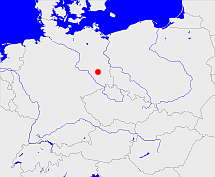
Diese Karte zeigt die Position oder den Umriss des Objekts. Haben Sie einen Fehler entdeckt? Dann würden wir uns über eine Nachricht freuen.
Übergeordnete Objekte
Legende
| | politische Verwaltung |
| | kirchliche Verwaltung |
| | gerichtliche Verwaltung |
| | Wohnplatz |
| | geographische Typen |
| | Verkehrswesen |
Übergeordnete Objekte
- Elbe-Elster, Wokrjes Łobje-Hałštrowy, Wokrejs Łobjo-Hałštrow (Landkreis)
- Brandenburg, Brandenburg, Kraj Bramborska (Bundesland)
- Bundesrepublik Deutschland, Deutschland, Federal Republic of Germany, Герма́ния, Vokietija, Nemecká spolková republika, Germany, Tyskland, Duitsland, Allemagne, Niemcy (Bundesstaat)
- Europäische Wirtschaftsgemeinschaft, Europäische Gemeinschaft, Europäische Union, Evropské hospodářské společenství, Euroopan talousyhteisö, Európske hospodárske spoločenstvo, Communauté économique européenne, Comhphobal Eacnamaíochta na hEorpa, Europese Economische Gemeenschap, European Economic Community, Comunità Economica Europea, Comunidad Económica Europea, Europese Gemeenschap, Evropské společenství, Communauté européenne, Európske spoločenstvo, Comhphobal Eorpach, Comunità Europea, Comunidad Europea, European Community, Euroopan Yhteisö, Evropská unie, Unione Europea, Euroopan Unioni, Aontais Eorpaigh, European Union, Unión Europea, Europese Unie, Union européenne, Európska únia (Staatenbund)
- Vereinte Nationen, Verenigde Naties, Организация Объединённых Наций, Organisation des Nations unies, 联合国, Organización de las Naciones Unidas, United Nations, الأمم المتحدة, Organizácia Spojených národov (Staatenbund)
- Beesdau (Amtsbezirk)
- Luckau (Landkreis Kreis)
- Brandenburg, Brandenburg, Kraj Bramborska (Bundesland)
- Bundesrepublik Deutschland, Deutschland, Federal Republic of Germany, Герма́ния, Vokietija, Nemecká spolková republika, Germany, Tyskland, Duitsland, Allemagne, Niemcy (Bundesstaat)
- Europäische Wirtschaftsgemeinschaft, Europäische Gemeinschaft, Europäische Union, Evropské hospodářské společenství, Euroopan talousyhteisö, Európske hospodárske spoločenstvo, Communauté économique européenne, Comhphobal Eacnamaíochta na hEorpa, Europese Economische Gemeenschap, European Economic Community, Comunità Economica Europea, Comunidad Económica Europea, Europese Gemeenschap, Evropské společenství, Communauté européenne, Európske spoločenstvo, Comhphobal Eorpach, Comunità Europea, Comunidad Europea, European Community, Euroopan Yhteisö, Evropská unie, Unione Europea, Euroopan Unioni, Aontais Eorpaigh, European Union, Unión Europea, Europese Unie, Union européenne, Európska únia (Staatenbund)
- Vereinte Nationen, Verenigde Naties, Организация Объединённых Наций, Organisation des Nations unies, 联合国, Organización de las Naciones Unidas, United Nations, الأمم المتحدة, Organizácia Spojených národov (Staatenbund)
- Cottbus (Bezirk)
- Frankfurt (Oder) (Regierungsbezirk)
- Luckau (Amtsgericht)
- Luckau (Landkreis Kreis)
- Brandenburg, Brandenburg, Kraj Bramborska (Bundesland)
- Bundesrepublik Deutschland, Deutschland, Federal Republic of Germany, Герма́ния, Vokietija, Nemecká spolková republika, Germany, Tyskland, Duitsland, Allemagne, Niemcy (Bundesstaat)
- Europäische Wirtschaftsgemeinschaft, Europäische Gemeinschaft, Europäische Union, Evropské hospodářské společenství, Euroopan talousyhteisö, Európske hospodárske spoločenstvo, Communauté économique européenne, Comhphobal Eacnamaíochta na hEorpa, Europese Economische Gemeenschap, European Economic Community, Comunità Economica Europea, Comunidad Económica Europea, Europese Gemeenschap, Evropské společenství, Communauté européenne, Európske spoločenstvo, Comhphobal Eorpach, Comunità Europea, Comunidad Europea, European Community, Euroopan Yhteisö, Evropská unie, Unione Europea, Euroopan Unioni, Aontais Eorpaigh, European Union, Unión Europea, Europese Unie, Union européenne, Európska únia (Staatenbund)
- Vereinte Nationen, Verenigde Naties, Организация Объединённых Наций, Organisation des Nations unies, 联合国, Organización de las Naciones Unidas, United Nations, الأمم المتحدة, Organizácia Spojených národov (Staatenbund)
- Cottbus (Bezirk)
- Frankfurt (Oder) (Regierungsbezirk)
- Kleine Elster (Niederlausitz) (Amt)
- Elbe-Elster, Wokrjes Łobje-Hałštrowy, Wokrejs Łobjo-Hałštrow (Landkreis)
- Brandenburg, Brandenburg, Kraj Bramborska (Bundesland)
- Bundesrepublik Deutschland, Deutschland, Federal Republic of Germany, Герма́ния, Vokietija, Nemecká spolková republika, Germany, Tyskland, Duitsland, Allemagne, Niemcy (Bundesstaat)
- Europäische Wirtschaftsgemeinschaft, Europäische Gemeinschaft, Europäische Union, Evropské hospodářské společenství, Euroopan talousyhteisö, Európske hospodárske spoločenstvo, Communauté économique européenne, Comhphobal Eacnamaíochta na hEorpa, Europese Economische Gemeenschap, European Economic Community, Comunità Economica Europea, Comunidad Económica Europea, Europese Gemeenschap, Evropské společenství, Communauté européenne, Európske spoločenstvo, Comhphobal Eorpach, Comunità Europea, Comunidad Europea, European Community, Euroopan Yhteisö, Evropská unie, Unione Europea, Euroopan Unioni, Aontais Eorpaigh, European Union, Unión Europea, Europese Unie, Union européenne, Európska únia (Staatenbund)
- Vereinte Nationen, Verenigde Naties, Организация Объединённых Наций, Organisation des Nations unies, 联合国, Organización de las Naciones Unidas, United Nations, الأمم المتحدة, Organizácia Spojených národov (Staatenbund)
- Finsterwalde (Kreis)
- Cottbus (Bezirk)
- Brandenburg, Brandenburg, Kraj Bramborska (Bundesland)
- Bundesrepublik Deutschland, Deutschland, Federal Republic of Germany, Герма́ния, Vokietija, Nemecká spolková republika, Germany, Tyskland, Duitsland, Allemagne, Niemcy (Bundesstaat)
- Europäische Wirtschaftsgemeinschaft, Europäische Gemeinschaft, Europäische Union, Evropské hospodářské společenství, Euroopan talousyhteisö, Európske hospodárske spoločenstvo, Communauté économique européenne, Comhphobal Eacnamaíochta na hEorpa, Europese Economische Gemeenschap, European Economic Community, Comunità Economica Europea, Comunidad Económica Europea, Europese Gemeenschap, Evropské společenství, Communauté européenne, Európske spoločenstvo, Comhphobal Eorpach, Comunità Europea, Comunidad Europea, European Community, Euroopan Yhteisö, Evropská unie, Unione Europea, Euroopan Unioni, Aontais Eorpaigh, European Union, Unión Europea, Europese Unie, Union européenne, Európska únia (Staatenbund)
- Vereinte Nationen, Verenigde Naties, Организация Объединённых Наций, Organisation des Nations unies, 联合国, Organización de las Naciones Unidas, United Nations, الأمم المتحدة, Organizácia Spojených národov (Staatenbund)
- Crinitz (Standesamt)
- Luckau (Landkreis Kreis)
- Brandenburg, Brandenburg, Kraj Bramborska (Bundesland)
- Bundesrepublik Deutschland, Deutschland, Federal Republic of Germany, Герма́ния, Vokietija, Nemecká spolková republika, Germany, Tyskland, Duitsland, Allemagne, Niemcy (Bundesstaat)
- Europäische Wirtschaftsgemeinschaft, Europäische Gemeinschaft, Europäische Union, Evropské hospodářské společenství, Euroopan talousyhteisö, Európske hospodárske spoločenstvo, Communauté économique européenne, Comhphobal Eacnamaíochta na hEorpa, Europese Economische Gemeenschap, European Economic Community, Comunità Economica Europea, Comunidad Económica Europea, Europese Gemeenschap, Evropské společenství, Communauté européenne, Európske spoločenstvo, Comhphobal Eorpach, Comunità Europea, Comunidad Europea, European Community, Euroopan Yhteisö, Evropská unie, Unione Europea, Euroopan Unioni, Aontais Eorpaigh, European Union, Unión Europea, Europese Unie, Union européenne, Európska únia (Staatenbund)
- Vereinte Nationen, Verenigde Naties, Организация Объединённых Наций, Organisation des Nations unies, 联合国, Organización de las Naciones Unidas, United Nations, الأمم المتحدة, Organizácia Spojených národov (Staatenbund)
- Cottbus (Bezirk)
- Frankfurt (Oder) (Regierungsbezirk)
- Finsterwalde (Kreis)
- Cottbus (Bezirk)
- Brandenburg, Brandenburg, Kraj Bramborska (Bundesland)
- Bundesrepublik Deutschland, Deutschland, Federal Republic of Germany, Герма́ния, Vokietija, Nemecká spolková republika, Germany, Tyskland, Duitsland, Allemagne, Niemcy (Bundesstaat)
- Europäische Wirtschaftsgemeinschaft, Europäische Gemeinschaft, Europäische Union, Evropské hospodářské společenství, Euroopan talousyhteisö, Európske hospodárske spoločenstvo, Communauté économique européenne, Comhphobal Eacnamaíochta na hEorpa, Europese Economische Gemeenschap, European Economic Community, Comunità Economica Europea, Comunidad Económica Europea, Europese Gemeenschap, Evropské společenství, Communauté européenne, Európske spoločenstvo, Comhphobal Eorpach, Comunità Europea, Comunidad Europea, European Community, Euroopan Yhteisö, Evropská unie, Unione Europea, Euroopan Unioni, Aontais Eorpaigh, European Union, Unión Europea, Europese Unie, Union européenne, Európska únia (Staatenbund)
- Vereinte Nationen, Verenigde Naties, Организация Объединённых Наций, Organisation des Nations unies, 联合国, Organización de las Naciones Unidas, United Nations, الأمم المتحدة, Organizácia Spojených národov (Staatenbund)
- Beesdau (Standesamt)
- Luckau (Landkreis Kreis)
- Brandenburg, Brandenburg, Kraj Bramborska (Bundesland)
- Bundesrepublik Deutschland, Deutschland, Federal Republic of Germany, Герма́ния, Vokietija, Nemecká spolková republika, Germany, Tyskland, Duitsland, Allemagne, Niemcy (Bundesstaat)
- Europäische Wirtschaftsgemeinschaft, Europäische Gemeinschaft, Europäische Union, Evropské hospodářské společenství, Euroopan talousyhteisö, Európske hospodárske spoločenstvo, Communauté économique européenne, Comhphobal Eacnamaíochta na hEorpa, Europese Economische Gemeenschap, European Economic Community, Comunità Economica Europea, Comunidad Económica Europea, Europese Gemeenschap, Evropské společenství, Communauté européenne, Európske spoločenstvo, Comhphobal Eorpach, Comunità Europea, Comunidad Europea, European Community, Euroopan Yhteisö, Evropská unie, Unione Europea, Euroopan Unioni, Aontais Eorpaigh, European Union, Unión Europea, Europese Unie, Union européenne, Európska únia (Staatenbund)
- Vereinte Nationen, Verenigde Naties, Организация Объединённых Наций, Organisation des Nations unies, 联合国, Organización de las Naciones Unidas, United Nations, الأمم المتحدة, Organizácia Spojených národov (Staatenbund)
- Cottbus (Bezirk)
- Frankfurt (Oder) (Regierungsbezirk)
Untergeordnete Objekte
| Name |
Typ |
GOV-Kennung |
Zeitraum |
| Gahroer Pechhütte |
Wohnplatz
|
GAHTTEJO61UR |
(- 2003-10-25) |
| Gahro |
DorfOrtsteil
|
GAHHR1JO61UR |
(- 2003-10-25) |
Quicktext
HIRORFJN77VE
	has 1875 population 243 sagt source_284411,
	has 1890 population 257 sagt source_284411,
	has 1895-12-02 area 4.118 sagt source_1023281 (S. 242 / 243),
	has 1895-12-02 households 47 sagt source_1023281 (S. 242 / 243),
	has 1895-12-02 population 203 sagt source_1023281 (S. 242 / 243),
	has 1910-12-01 population 222 sagt source_265044,
	has 1922 population 170 sagt source_1336800 (p. 694),
	has 1925 population 234 sagt source_284411,
	has 1933 population 226 sagt source_190312 sagt source_284411,
	has 1939 population 229 sagt source_190312,
	has 1946 population 407 sagt source_284918,
	has 1961-06-06 population 146 sagt source_1081178 (p. 66),
	has 1970-05-27 population 360 sagt source_1082104 (p. 58),
	has 1993 population 221 sagt source_284411,
	has 1994 population 225 sagt source_284411,
	has 1995 population 223 sagt source_284411,
	has 1996 population 228 sagt source_284411,
	has 1997 population 219 sagt source_284411,
	has 1998 population 213 sagt source_284411,
	has 1999 population 204 sagt source_284411,
	has 2000 population 207 sagt source_284411,
	has 2001 population 205 sagt source_284411,
	has 2002 population 199 sagt source_284411,
	has external reference  geonames:2776194,
	has external reference  geonames:2923342,
	has external reference  opengeodb:16798,
	has external reference  opengeodb:29476,
	has from 1991-07-01 until 1993-12-05 municipal id 12022210 sagt source_1077051,
	has from 1993-07-01 postal code 03246,
	has from 1993-12-06 until 2003-10-25 municipal id 12062168 sagt source_290784,
	has name (in deu) Gahro,
	has name (in deu) Hirnsdorf,
	has name (in deu) Rosendahl,
	has postal code 8221,
	has until 1993-06-30 postal code O7981,
	is (in deu) Ort,
	is 1895-12-02 part of object_1277893 sagt source_1023281 (S. 242 / 243),
	is 1895-12-02 part of object_285664 sagt source_1023281 (S. 242 / 243),
	is from 1874-10-01 part of object_1151231 sagt source_1023281 (S. 242 / 243) sagt source_1331590 sagt source_1335058 (Außerordentliche Beilage S. 14 Nr. 17) sagt source_1336431 (§ 55),
	is from 1889 until 1948 part of object_270160 sagt source_270159,
	is from 1935-04-01 until 2003-10-25 (in deu) Gemeinde sagt source_1077051 sagt source_190312 sagt source_284918 sagt source_290784,
	is from 1948 until 1970-03-31 part of object_269936 sagt source_1081178 (p. 66) sagt source_1087428 (p. 241) sagt source_270159,
	is from 1952-07-25 until 1993-12-05 part of adm_142022 sagt source_290784 sagt source_299598 (Seite 26),
	is from 1970-04-01 until 2007-12-31 part of object_152839 sagt source_1082104 (p. 58) sagt source_270159,
	is from 1970-04-26 until 1974-01-31 part of adm_131054,
	is from 1992-07-21 until 2003-10-25 part of object_152417 sagt source_290784,
	is from 1993-12-06 until 2003-10-25 part of adm_142062 sagt source_284411 sagt source_290784,
	is from 2008-01-01 part of object_299609,
	is part of object_1280755,
	is part of object_1333165 sagt source_1331591 sagt source_1331592,
	is until 1935-03-31 (in deu) Landgemeinde sagt source_1023281 (Nr. 37 Seite 242 / 243) sagt source_265044,
	is until 1952-07-24 part of adm_142032 sagt source_1023281 (Seite 242 / 243) sagt source_190312 sagt source_265044 sagt source_284918 sagt source_299598 (Seite 26),
	is until 1970-04-25 part of object_214367,
	is until 1974-01-31 (in deu) Gemeinde,
	located at 47.193°N 15.829°O;
