Neulietzegöricke
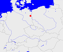
Diese Karte zeigt die Position oder den Umriss des Objekts. Haben Sie einen Fehler entdeckt? Dann würden wir uns über eine Nachricht freuen.
Übergeordnete Objekte
Legende
| | politische Verwaltung |
| | kirchliche Verwaltung |
| | gerichtliche Verwaltung |
| | Wohnplatz |
| | geographische Typen |
| | Verkehrswesen |
Übergeordnete Objekte
- Wriezen (Amtsgericht)
- Neu Lietzegöricke (Standesamt)
- Oberbarnim (Kreis Landkreis)
- Bad Freienwalde (Landkreis)
- Brandenburg, Brandenburg, Kraj Bramborska (Bundesland)
- Bundesrepublik Deutschland, Deutschland, Federal Republic of Germany, Герма́ния, Vokietija, Nemecká spolková republika, Germany, Tyskland, Duitsland, Allemagne, Niemcy (Bundesstaat)
- Europäische Wirtschaftsgemeinschaft, Europäische Gemeinschaft, Europäische Union, Evropské hospodářské společenství, Euroopan talousyhteisö, Európske hospodárske spoločenstvo, Communauté économique européenne, Comhphobal Eacnamaíochta na hEorpa, Europese Economische Gemeenschap, European Economic Community, Comunità Economica Europea, Comunidad Económica Europea, Europese Gemeenschap, Evropské společenství, Communauté européenne, Európske spoločenstvo, Comhphobal Eorpach, Comunità Europea, Comunidad Europea, European Community, Euroopan Yhteisö, Evropská unie, Unione Europea, Euroopan Unioni, Aontais Eorpaigh, European Union, Unión Europea, Europese Unie, Union européenne, Európska únia (Staatenbund)
- Vereinte Nationen, Verenigde Naties, Организация Объединённых Наций, Organisation des Nations unies, 联合国, Organización de las Naciones Unidas, United Nations, الأمم المتحدة, Organizácia Spojených národov (Staatenbund)
- Frankfurt (Bezirk)
- Freienwalde (Standesamt)
- Oberbarnim (Kreis Landkreis)
- Bad Freienwalde (Landkreis)
- Brandenburg, Brandenburg, Kraj Bramborska (Bundesland)
- Bundesrepublik Deutschland, Deutschland, Federal Republic of Germany, Герма́ния, Vokietija, Nemecká spolková republika, Germany, Tyskland, Duitsland, Allemagne, Niemcy (Bundesstaat)
- Europäische Wirtschaftsgemeinschaft, Europäische Gemeinschaft, Europäische Union, Evropské hospodářské společenství, Euroopan talousyhteisö, Európske hospodárske spoločenstvo, Communauté économique européenne, Comhphobal Eacnamaíochta na hEorpa, Europese Economische Gemeenschap, European Economic Community, Comunità Economica Europea, Comunidad Económica Europea, Europese Gemeenschap, Evropské společenství, Communauté européenne, Európske spoločenstvo, Comhphobal Eorpach, Comunità Europea, Comunidad Europea, European Community, Euroopan Yhteisö, Evropská unie, Unione Europea, Euroopan Unioni, Aontais Eorpaigh, European Union, Unión Europea, Europese Unie, Union européenne, Európska únia (Staatenbund)
- Vereinte Nationen, Verenigde Naties, Организация Объединённых Наций, Organisation des Nations unies, 联合国, Organización de las Naciones Unidas, United Nations, الأمم المتحدة, Organizácia Spojených národov (Staatenbund)
- Frankfurt (Bezirk)
- Oberbarnim (Kreis Landkreis)
- Wriezen-Land, Barnim-Oderbruch (Amt)
- Märkisch-Oderland (Landkreis)
- Brandenburg, Brandenburg, Kraj Bramborska (Bundesland)
- Bundesrepublik Deutschland, Deutschland, Federal Republic of Germany, Герма́ния, Vokietija, Nemecká spolková republika, Germany, Tyskland, Duitsland, Allemagne, Niemcy (Bundesstaat)
- Europäische Wirtschaftsgemeinschaft, Europäische Gemeinschaft, Europäische Union, Evropské hospodářské společenství, Euroopan talousyhteisö, Európske hospodárske spoločenstvo, Communauté économique européenne, Comhphobal Eacnamaíochta na hEorpa, Europese Economische Gemeenschap, European Economic Community, Comunità Economica Europea, Comunidad Económica Europea, Europese Gemeenschap, Evropské společenství, Communauté européenne, Európske spoločenstvo, Comhphobal Eorpach, Comunità Europea, Comunidad Europea, European Community, Euroopan Yhteisö, Evropská unie, Unione Europea, Euroopan Unioni, Aontais Eorpaigh, European Union, Unión Europea, Europese Unie, Union européenne, Európska únia (Staatenbund)
- Vereinte Nationen, Verenigde Naties, Организация Объединённых Наций, Organisation des Nations unies, 联合国, Organización de las Naciones Unidas, United Nations, الأمم المتحدة, Organizácia Spojených národov (Staatenbund)
- Bad Freienwalde (Landkreis)
- Brandenburg, Brandenburg, Kraj Bramborska (Bundesland)
- Bundesrepublik Deutschland, Deutschland, Federal Republic of Germany, Герма́ния, Vokietija, Nemecká spolková republika, Germany, Tyskland, Duitsland, Allemagne, Niemcy (Bundesstaat)
- Europäische Wirtschaftsgemeinschaft, Europäische Gemeinschaft, Europäische Union, Evropské hospodářské společenství, Euroopan talousyhteisö, Európske hospodárske spoločenstvo, Communauté économique européenne, Comhphobal Eacnamaíochta na hEorpa, Europese Economische Gemeenschap, European Economic Community, Comunità Economica Europea, Comunidad Económica Europea, Europese Gemeenschap, Evropské společenství, Communauté européenne, Európske spoločenstvo, Comhphobal Eorpach, Comunità Europea, Comunidad Europea, European Community, Euroopan Yhteisö, Evropská unie, Unione Europea, Euroopan Unioni, Aontais Eorpaigh, European Union, Unión Europea, Europese Unie, Union européenne, Európska únia (Staatenbund)
- Vereinte Nationen, Verenigde Naties, Организация Объединённых Наций, Organisation des Nations unies, 联合国, Organización de las Naciones Unidas, United Nations, الأمم المتحدة, Organizácia Spojených národov (Staatenbund)
- Frankfurt (Bezirk)
- Wustrow (Amtsbezirk)
- Wustrow (Standesamt)
- Märkisch-Oderland (Landkreis)
- Brandenburg, Brandenburg, Kraj Bramborska (Bundesland)
- Bundesrepublik Deutschland, Deutschland, Federal Republic of Germany, Герма́ния, Vokietija, Nemecká spolková republika, Germany, Tyskland, Duitsland, Allemagne, Niemcy (Bundesstaat)
- Europäische Wirtschaftsgemeinschaft, Europäische Gemeinschaft, Europäische Union, Evropské hospodářské společenství, Euroopan talousyhteisö, Európske hospodárske spoločenstvo, Communauté économique européenne, Comhphobal Eacnamaíochta na hEorpa, Europese Economische Gemeenschap, European Economic Community, Comunità Economica Europea, Comunidad Económica Europea, Europese Gemeenschap, Evropské společenství, Communauté européenne, Európske spoločenstvo, Comhphobal Eorpach, Comunità Europea, Comunidad Europea, European Community, Euroopan Yhteisö, Evropská unie, Unione Europea, Euroopan Unioni, Aontais Eorpaigh, European Union, Unión Europea, Europese Unie, Union européenne, Európska únia (Staatenbund)
- Vereinte Nationen, Verenigde Naties, Организация Объединённых Наций, Organisation des Nations unies, 联合国, Organización de las Naciones Unidas, United Nations, الأمم المتحدة, Organizácia Spojených národov (Staatenbund)
- Königsberg (Neumark) (Landkreis)
Quicktext
STOACHJN87CP
	 TEXT: Zerstreute Häuser :TEXT,
	has 1875 population 603 sagt source_263605,
	has 1890 population 533 sagt source_263605,
	has 1895-12-02 area 3.291 sagt source_1023281 (S. 146 / 147),
	has 1895-12-02 population 497 sagt source_1023281 (S. 146 / 147),
	has 1910 population 429 sagt source_263605,
	has 1910-12-01 population 372 sagt source_265044,
	has 1925 households 110 sagt source_1023282 (Seite 40),
	has 1925 population 458 sagt source_263605,
	has 1925-06-16 population 458 sagt source_1023282 (p. 40),
	has 1931 area 5.282 sagt source_1023282 (p. 40),
	has 1933 population 396 sagt source_190312 sagt source_263605,
	has 1939 population 363 sagt source_190312,
	has 1946 population 574 sagt source_284918,
	has 1993 population 229 sagt source_263605,
	has 1994 population 239 sagt source_263605,
	has 1995 population 240 sagt source_263605,
	has 1996 population 237 sagt source_263605,
	has 1997 population 240 sagt source_263605,
	has 1998 population 233 sagt source_263605,
	has 1999 population 244 sagt source_263605,
	has 2000 population 237 sagt source_263605,
	has 2001 population 237 sagt source_263605,
	has 2002 population 238 sagt source_263605,
	has external reference  geonames:2864607,
	has external reference  opengeodb:21506,
	has from 1991-07-01 until 1993-12-05 municipal id 12012340 sagt source_1077051,
	has from 1993-07-01 postal code 16259,
	has from 1993-12-06 until 2003-10-25 municipal id 12064352 sagt source_290784,
	has municipal id 32325,
	has name (in deu) Neulietzegöricke,
	has name (in deu) Stögersbach,
	has postal code A-2833,
	has until 1993-06-30 postal code O1311,
	is (in deu) Gebäude sagt source_306239 (p. 362),
	is 1952-01-01 part of object_1333305 sagt source_1331591,
	is 1992-12-31 part of object_1147232 sagt source_1331592,
	is from 1816 until 1946 part of object_190196 sagt source_1023281 sagt source_190312 sagt source_265044 sagt source_298444,
	is from 1874-10-01 part of object_1048327 sagt source_1023281 (S. 146 / 147) sagt source_1023282 (p. 40) sagt source_1331590 sagt source_1335058 (Außerordentliche Beilage S. 8 Nr. 31) sagt source_1336431 (§ 55),
	is from 1935-04-01 until 2003-10-25 (in deu) Gemeinde sagt source_190312 sagt source_284918,
	is from 1946 until 1952-07-24 part of object_263367 sagt source_284918,
	is from 1952-07-25 until 1993-12-05 part of adm_142012 sagt source_290784,
	is from 1992-06-19 until 2003-10-25 part of object_152434 sagt source_290784,
	is from 1993-12-06 until 2003-10-25 part of adm_142064 sagt source_290784,
	is part of SCHTENJN87CP sagt source_306239 (p. 362),
	is until 1935-03-31 (in deu) Landgemeinde sagt source_265044,
	is until 1945 part of object_1048393 sagt source_1023281 (S. 146 / 147) sagt source_1023282 (p. 40),
	is until 1945 part of object_285728 sagt source_1023281 (Seite 146 / 147) sagt source_1023282 (p. 40),
	located at 47.658°N 16.208°O;
