Weißbach, Weissbach, Bílý Potok, Bílý Potok pod Smrkem
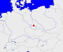
Diese Karte zeigt die Position oder den Umriss des Objekts. Haben Sie einen Fehler entdeckt? Dann würden wir uns über eine Nachricht freuen.
Übergeordnete Objekte
Legende
| | politische Verwaltung |
| | kirchliche Verwaltung |
| | gerichtliche Verwaltung |
| | Wohnplatz |
| | geographische Typen |
| | Verkehrswesen |
Übergeordnete Objekte
- Haindorf, Hejnice (Gemeinde)
- Reichenberg, Liberec (Kreis Bezirkshauptmannschaft Landkreis Kreis)
- Aussig, Ústí nad Labem (Regierungsbezirk)
- Reichenberger Region, Liberecký kraj (Region)
- Tschechische Republik, Tschechien, República Checa, Czech Republic, Czechia (Czech Republic), Česká republika, Tsjechië, Czechia, République tchèque (Republik)
- Europäische Wirtschaftsgemeinschaft, Europäische Gemeinschaft, Europäische Union, Evropské hospodářské společenství, Euroopan talousyhteisö, Európske hospodárske spoločenstvo, Communauté économique européenne, Comhphobal Eacnamaíochta na hEorpa, Europese Economische Gemeenschap, European Economic Community, Comunità Economica Europea, Comunidad Económica Europea, Europese Gemeenschap, Evropské společenství, Communauté européenne, Európske spoločenstvo, Comhphobal Eorpach, Comunità Europea, Comunidad Europea, European Community, Euroopan Yhteisö, Evropská unie, Unione Europea, Euroopan Unioni, Aontais Eorpaigh, European Union, Unión Europea, Europese Unie, Union européenne, Európska únia (Staatenbund)
- Vereinte Nationen, Verenigde Naties, Организация Объединённых Наций, Organisation des Nations unies, 联合国, Organización de las Naciones Unidas, United Nations, الأمم المتحدة, Organizácia Spojených národov (Staatenbund)
- Böhmen, Země Česká, Bohemia, Království české (Herzogtum Königreich Land)
- Heiliges Römisches Reich, Heiliges Römisches Reich deutscher Nation, Heiliges Römisches Reich, Sacrum Imperium, Sacrum Romanum Imperium, Sacrum Romanum Imperium Nationis Germanicæ (Königreich Kaiserreich)
- Reichsprotektorat Böhmen und Mähren, Protektorát Čechy a Morava (Protektorat)
- Tschechoslowakei, Tschecho-Slowakische Republik, Tschechoslowakei, Tschechoslowakische Republik, Tschechoslowakische Sozialistische Republik, Tschechische und Slowakische Föderative Republik, Tschechoslowakei, Československo, Československo, Česko-Slovenská Republika (ČSR), Česko-Slovenská Republika (ČSR), Československo, Československá republika, Československá Republika (ČSR), Czechoslovak Republic, Československá socialistická republika (ČSSR), Česká a Slovenská Federativní Republika (ČSFR), Česká a Slovenská Federatívna Republika (ČSFR), Tsjecho-Slowakije, Tsjechoslowakije (Republik Republik)
- Tschechoslowakei, Tschecho-Slowakische Republik, Tschechoslowakei, Tschechoslowakische Republik, Tschechoslowakische Sozialistische Republik, Tschechische und Slowakische Föderative Republik, Tschechoslowakei, Československo, Československo, Česko-Slovenská Republika (ČSR), Česko-Slovenská Republika (ČSR), Československo, Československá republika, Československá Republika (ČSR), Czechoslovak Republic, Československá socialistická republika (ČSSR), Česká a Slovenská Federativní Republika (ČSFR), Česká a Slovenská Federatívna Republika (ČSFR), Tsjecho-Slowakije, Tsjechoslowakije (Republik Republik)
- Kaiserthum Österreich, Cisleithanien, Österreichische Länder, Impero Austriaco, Předlitavsko (Kaiserreich Reichshälfte)
- Böhmisch Leipaer Kreis, Böhmisch-Leippaer Kreis, Českolipský kraj (Region)
- Böhmen, Země Česká, Bohemia, Království české (Herzogtum Königreich Land)
- Heiliges Römisches Reich, Heiliges Römisches Reich deutscher Nation, Heiliges Römisches Reich, Sacrum Imperium, Sacrum Romanum Imperium, Sacrum Romanum Imperium Nationis Germanicæ (Königreich Kaiserreich)
- Reichsprotektorat Böhmen und Mähren, Protektorát Čechy a Morava (Protektorat)
- Tschechoslowakei, Tschecho-Slowakische Republik, Tschechoslowakei, Tschechoslowakische Republik, Tschechoslowakische Sozialistische Republik, Tschechische und Slowakische Föderative Republik, Tschechoslowakei, Československo, Československo, Česko-Slovenská Republika (ČSR), Česko-Slovenská Republika (ČSR), Československo, Československá republika, Československá Republika (ČSR), Czechoslovak Republic, Československá socialistická republika (ČSSR), Česká a Slovenská Federativní Republika (ČSFR), Česká a Slovenská Federatívna Republika (ČSFR), Tsjecho-Slowakije, Tsjechoslowakije (Republik Republik)
- Tschechoslowakei, Tschecho-Slowakische Republik, Tschechoslowakei, Tschechoslowakische Republik, Tschechoslowakische Sozialistische Republik, Tschechische und Slowakische Föderative Republik, Tschechoslowakei, Československo, Československo, Česko-Slovenská Republika (ČSR), Česko-Slovenská Republika (ČSR), Československo, Československá republika, Československá Republika (ČSR), Czechoslovak Republic, Československá socialistická republika (ČSSR), Česká a Slovenská Federativní Republika (ČSFR), Česká a Slovenská Federatívna Republika (ČSFR), Tsjecho-Slowakije, Tsjechoslowakije (Republik Republik)
- Kaiserthum Österreich, Cisleithanien, Österreichische Länder, Impero Austriaco, Předlitavsko (Kaiserreich Reichshälfte)
- Bunzlauer Kreis, Boleslavský kraj (Region)
- Böhmen, Země Česká, Bohemia, Království české (Herzogtum Königreich Land)
- Heiliges Römisches Reich, Heiliges Römisches Reich deutscher Nation, Heiliges Römisches Reich, Sacrum Imperium, Sacrum Romanum Imperium, Sacrum Romanum Imperium Nationis Germanicæ (Königreich Kaiserreich)
- Reichsprotektorat Böhmen und Mähren, Protektorát Čechy a Morava (Protektorat)
- Tschechoslowakei, Tschecho-Slowakische Republik, Tschechoslowakei, Tschechoslowakische Republik, Tschechoslowakische Sozialistische Republik, Tschechische und Slowakische Föderative Republik, Tschechoslowakei, Československo, Československo, Česko-Slovenská Republika (ČSR), Česko-Slovenská Republika (ČSR), Československo, Československá republika, Československá Republika (ČSR), Czechoslovak Republic, Československá socialistická republika (ČSSR), Česká a Slovenská Federativní Republika (ČSFR), Česká a Slovenská Federatívna Republika (ČSFR), Tsjecho-Slowakije, Tsjechoslowakije (Republik Republik)
- Tschechoslowakei, Tschecho-Slowakische Republik, Tschechoslowakei, Tschechoslowakische Republik, Tschechoslowakische Sozialistische Republik, Tschechische und Slowakische Föderative Republik, Tschechoslowakei, Československo, Československo, Česko-Slovenská Republika (ČSR), Česko-Slovenská Republika (ČSR), Československo, Československá republika, Československá Republika (ČSR), Czechoslovak Republic, Československá socialistická republika (ČSSR), Česká a Slovenská Federativní Republika (ČSFR), Česká a Slovenská Federatívna Republika (ČSFR), Tsjecho-Slowakije, Tsjechoslowakije (Republik Republik)
- Kaiserthum Österreich, Cisleithanien, Österreichische Länder, Impero Austriaco, Předlitavsko (Kaiserreich Reichshälfte)
- Friedland, Frýdlant (Bezirkshauptmannschaft Bezirkshauptmannschaft Landkreis)
- Aussig, Ústí nad Labem (Regierungsbezirk)
- Böhmen, Země Česká, Bohemia, Království české (Herzogtum Königreich Land)
- Heiliges Römisches Reich, Heiliges Römisches Reich deutscher Nation, Heiliges Römisches Reich, Sacrum Imperium, Sacrum Romanum Imperium, Sacrum Romanum Imperium Nationis Germanicæ (Königreich Kaiserreich)
- Reichsprotektorat Böhmen und Mähren, Protektorát Čechy a Morava (Protektorat)
- Tschechoslowakei, Tschecho-Slowakische Republik, Tschechoslowakei, Tschechoslowakische Republik, Tschechoslowakische Sozialistische Republik, Tschechische und Slowakische Föderative Republik, Tschechoslowakei, Československo, Československo, Česko-Slovenská Republika (ČSR), Česko-Slovenská Republika (ČSR), Československo, Československá republika, Československá Republika (ČSR), Czechoslovak Republic, Československá socialistická republika (ČSSR), Česká a Slovenská Federativní Republika (ČSFR), Česká a Slovenská Federatívna Republika (ČSFR), Tsjecho-Slowakije, Tsjechoslowakije (Republik Republik)
- Tschechoslowakei, Tschecho-Slowakische Republik, Tschechoslowakei, Tschechoslowakische Republik, Tschechoslowakische Sozialistische Republik, Tschechische und Slowakische Föderative Republik, Tschechoslowakei, Československo, Československo, Česko-Slovenská Republika (ČSR), Česko-Slovenská Republika (ČSR), Československo, Československá republika, Československá Republika (ČSR), Czechoslovak Republic, Československá socialistická republika (ČSSR), Česká a Slovenská Federativní Republika (ČSFR), Česká a Slovenská Federatívna Republika (ČSFR), Tsjecho-Slowakije, Tsjechoslowakije (Republik Republik)
- Kaiserthum Österreich, Cisleithanien, Österreichische Länder, Impero Austriaco, Předlitavsko (Kaiserreich Reichshälfte)
- Böhmisch Leipaer Kreis, Böhmisch-Leippaer Kreis, Českolipský kraj (Region)
- Böhmen, Země Česká, Bohemia, Království české (Herzogtum Königreich Land)
- Heiliges Römisches Reich, Heiliges Römisches Reich deutscher Nation, Heiliges Römisches Reich, Sacrum Imperium, Sacrum Romanum Imperium, Sacrum Romanum Imperium Nationis Germanicæ (Königreich Kaiserreich)
- Reichsprotektorat Böhmen und Mähren, Protektorát Čechy a Morava (Protektorat)
- Tschechoslowakei, Tschecho-Slowakische Republik, Tschechoslowakei, Tschechoslowakische Republik, Tschechoslowakische Sozialistische Republik, Tschechische und Slowakische Föderative Republik, Tschechoslowakei, Československo, Československo, Česko-Slovenská Republika (ČSR), Česko-Slovenská Republika (ČSR), Československo, Československá republika, Československá Republika (ČSR), Czechoslovak Republic, Československá socialistická republika (ČSSR), Česká a Slovenská Federativní Republika (ČSFR), Česká a Slovenská Federatívna Republika (ČSFR), Tsjecho-Slowakije, Tsjechoslowakije (Republik Republik)
- Tschechoslowakei, Tschecho-Slowakische Republik, Tschechoslowakei, Tschechoslowakische Republik, Tschechoslowakische Sozialistische Republik, Tschechische und Slowakische Föderative Republik, Tschechoslowakei, Československo, Československo, Česko-Slovenská Republika (ČSR), Česko-Slovenská Republika (ČSR), Československo, Československá republika, Československá Republika (ČSR), Czechoslovak Republic, Československá socialistická republika (ČSSR), Česká a Slovenská Federativní Republika (ČSFR), Česká a Slovenská Federatívna Republika (ČSFR), Tsjecho-Slowakije, Tsjechoslowakije (Republik Republik)
- Kaiserthum Österreich, Cisleithanien, Österreichische Länder, Impero Austriaco, Předlitavsko (Kaiserreich Reichshälfte)
- Weißbach, Weissbach, Bílý Potok pod Smrkem, Bílý Potok (Gemeinde)
- Reichenberg, Liberec (Kreis Bezirkshauptmannschaft Landkreis Kreis)
- Aussig, Ústí nad Labem (Regierungsbezirk)
- Reichenberger Region, Liberecký kraj (Region)
- Tschechische Republik, Tschechien, República Checa, Czech Republic, Czechia (Czech Republic), Česká republika, Tsjechië, Czechia, République tchèque (Republik)
- Europäische Wirtschaftsgemeinschaft, Europäische Gemeinschaft, Europäische Union, Evropské hospodářské společenství, Euroopan talousyhteisö, Európske hospodárske spoločenstvo, Communauté économique européenne, Comhphobal Eacnamaíochta na hEorpa, Europese Economische Gemeenschap, European Economic Community, Comunità Economica Europea, Comunidad Económica Europea, Europese Gemeenschap, Evropské společenství, Communauté européenne, Európske spoločenstvo, Comhphobal Eorpach, Comunità Europea, Comunidad Europea, European Community, Euroopan Yhteisö, Evropská unie, Unione Europea, Euroopan Unioni, Aontais Eorpaigh, European Union, Unión Europea, Europese Unie, Union européenne, Európska únia (Staatenbund)
- Vereinte Nationen, Verenigde Naties, Организация Объединённых Наций, Organisation des Nations unies, 联合国, Organización de las Naciones Unidas, United Nations, الأمم المتحدة, Organizácia Spojených národov (Staatenbund)
- Böhmen, Země Česká, Bohemia, Království české (Herzogtum Königreich Land)
- Heiliges Römisches Reich, Heiliges Römisches Reich deutscher Nation, Heiliges Römisches Reich, Sacrum Imperium, Sacrum Romanum Imperium, Sacrum Romanum Imperium Nationis Germanicæ (Königreich Kaiserreich)
- Reichsprotektorat Böhmen und Mähren, Protektorát Čechy a Morava (Protektorat)
- Tschechoslowakei, Tschecho-Slowakische Republik, Tschechoslowakei, Tschechoslowakische Republik, Tschechoslowakische Sozialistische Republik, Tschechische und Slowakische Föderative Republik, Tschechoslowakei, Československo, Československo, Česko-Slovenská Republika (ČSR), Česko-Slovenská Republika (ČSR), Československo, Československá republika, Československá Republika (ČSR), Czechoslovak Republic, Československá socialistická republika (ČSSR), Česká a Slovenská Federativní Republika (ČSFR), Česká a Slovenská Federatívna Republika (ČSFR), Tsjecho-Slowakije, Tsjechoslowakije (Republik Republik)
- Tschechoslowakei, Tschecho-Slowakische Republik, Tschechoslowakei, Tschechoslowakische Republik, Tschechoslowakische Sozialistische Republik, Tschechische und Slowakische Föderative Republik, Tschechoslowakei, Československo, Československo, Česko-Slovenská Republika (ČSR), Česko-Slovenská Republika (ČSR), Československo, Československá republika, Československá Republika (ČSR), Czechoslovak Republic, Československá socialistická republika (ČSSR), Česká a Slovenská Federativní Republika (ČSFR), Česká a Slovenská Federatívna Republika (ČSFR), Tsjecho-Slowakije, Tsjechoslowakije (Republik Republik)
- Kaiserthum Österreich, Cisleithanien, Österreichische Länder, Impero Austriaco, Předlitavsko (Kaiserreich Reichshälfte)
- Böhmisch Leipaer Kreis, Böhmisch-Leippaer Kreis, Českolipský kraj (Region)
- Böhmen, Země Česká, Bohemia, Království české (Herzogtum Königreich Land)
- Heiliges Römisches Reich, Heiliges Römisches Reich deutscher Nation, Heiliges Römisches Reich, Sacrum Imperium, Sacrum Romanum Imperium, Sacrum Romanum Imperium Nationis Germanicæ (Königreich Kaiserreich)
- Reichsprotektorat Böhmen und Mähren, Protektorát Čechy a Morava (Protektorat)
- Tschechoslowakei, Tschecho-Slowakische Republik, Tschechoslowakei, Tschechoslowakische Republik, Tschechoslowakische Sozialistische Republik, Tschechische und Slowakische Föderative Republik, Tschechoslowakei, Československo, Československo, Česko-Slovenská Republika (ČSR), Česko-Slovenská Republika (ČSR), Československo, Československá republika, Československá Republika (ČSR), Czechoslovak Republic, Československá socialistická republika (ČSSR), Česká a Slovenská Federativní Republika (ČSFR), Česká a Slovenská Federatívna Republika (ČSFR), Tsjecho-Slowakije, Tsjechoslowakije (Republik Republik)
- Tschechoslowakei, Tschecho-Slowakische Republik, Tschechoslowakei, Tschechoslowakische Republik, Tschechoslowakische Sozialistische Republik, Tschechische und Slowakische Föderative Republik, Tschechoslowakei, Československo, Československo, Česko-Slovenská Republika (ČSR), Česko-Slovenská Republika (ČSR), Československo, Československá republika, Československá Republika (ČSR), Czechoslovak Republic, Československá socialistická republika (ČSSR), Česká a Slovenská Federativní Republika (ČSFR), Česká a Slovenská Federatívna Republika (ČSFR), Tsjecho-Slowakije, Tsjechoslowakije (Republik Republik)
- Kaiserthum Österreich, Cisleithanien, Österreichische Länder, Impero Austriaco, Předlitavsko (Kaiserreich Reichshälfte)
- Bunzlauer Kreis, Boleslavský kraj (Region)
- Böhmen, Země Česká, Bohemia, Království české (Herzogtum Königreich Land)
- Heiliges Römisches Reich, Heiliges Römisches Reich deutscher Nation, Heiliges Römisches Reich, Sacrum Imperium, Sacrum Romanum Imperium, Sacrum Romanum Imperium Nationis Germanicæ (Königreich Kaiserreich)
- Reichsprotektorat Böhmen und Mähren, Protektorát Čechy a Morava (Protektorat)
- Tschechoslowakei, Tschecho-Slowakische Republik, Tschechoslowakei, Tschechoslowakische Republik, Tschechoslowakische Sozialistische Republik, Tschechische und Slowakische Föderative Republik, Tschechoslowakei, Československo, Československo, Česko-Slovenská Republika (ČSR), Česko-Slovenská Republika (ČSR), Československo, Československá republika, Československá Republika (ČSR), Czechoslovak Republic, Československá socialistická republika (ČSSR), Česká a Slovenská Federativní Republika (ČSFR), Česká a Slovenská Federatívna Republika (ČSFR), Tsjecho-Slowakije, Tsjechoslowakije (Republik Republik)
- Tschechoslowakei, Tschecho-Slowakische Republik, Tschechoslowakei, Tschechoslowakische Republik, Tschechoslowakische Sozialistische Republik, Tschechische und Slowakische Föderative Republik, Tschechoslowakei, Československo, Československo, Česko-Slovenská Republika (ČSR), Česko-Slovenská Republika (ČSR), Československo, Československá republika, Československá Republika (ČSR), Czechoslovak Republic, Československá socialistická republika (ČSSR), Česká a Slovenská Federativní Republika (ČSFR), Česká a Slovenská Federatívna Republika (ČSFR), Tsjecho-Slowakije, Tsjechoslowakije (Republik Republik)
- Kaiserthum Österreich, Cisleithanien, Österreichische Länder, Impero Austriaco, Předlitavsko (Kaiserreich Reichshälfte)
- Böhmen, Země Česká, Bohemia, Království české (Herzogtum Königreich Land)
- Heiliges Römisches Reich, Heiliges Römisches Reich deutscher Nation, Heiliges Römisches Reich, Sacrum Imperium, Sacrum Romanum Imperium, Sacrum Romanum Imperium Nationis Germanicæ (Königreich Kaiserreich)
- Reichsprotektorat Böhmen und Mähren, Protektorát Čechy a Morava (Protektorat)
- Tschechoslowakei, Tschecho-Slowakische Republik, Tschechoslowakei, Tschechoslowakische Republik, Tschechoslowakische Sozialistische Republik, Tschechische und Slowakische Föderative Republik, Tschechoslowakei, Československo, Československo, Česko-Slovenská Republika (ČSR), Česko-Slovenská Republika (ČSR), Československo, Československá republika, Československá Republika (ČSR), Czechoslovak Republic, Československá socialistická republika (ČSSR), Česká a Slovenská Federativní Republika (ČSFR), Česká a Slovenská Federatívna Republika (ČSFR), Tsjecho-Slowakije, Tsjechoslowakije (Republik Republik)
- Tschechoslowakei, Tschecho-Slowakische Republik, Tschechoslowakei, Tschechoslowakische Republik, Tschechoslowakische Sozialistische Republik, Tschechische und Slowakische Föderative Republik, Tschechoslowakei, Československo, Československo, Česko-Slovenská Republika (ČSR), Česko-Slovenská Republika (ČSR), Československo, Československá republika, Československá Republika (ČSR), Czechoslovak Republic, Československá socialistická republika (ČSSR), Česká a Slovenská Federativní Republika (ČSFR), Česká a Slovenská Federatívna Republika (ČSFR), Tsjecho-Slowakije, Tsjechoslowakije (Republik Republik)
- Kaiserthum Österreich, Cisleithanien, Österreichische Länder, Impero Austriaco, Předlitavsko (Kaiserreich Reichshälfte)
- Friedland, Frýdlant (Bezirkshauptmannschaft Bezirkshauptmannschaft Landkreis)
- Aussig, Ústí nad Labem (Regierungsbezirk)
- Böhmen, Země Česká, Bohemia, Království české (Herzogtum Königreich Land)
- Heiliges Römisches Reich, Heiliges Römisches Reich deutscher Nation, Heiliges Römisches Reich, Sacrum Imperium, Sacrum Romanum Imperium, Sacrum Romanum Imperium Nationis Germanicæ (Königreich Kaiserreich)
- Reichsprotektorat Böhmen und Mähren, Protektorát Čechy a Morava (Protektorat)
- Tschechoslowakei, Tschecho-Slowakische Republik, Tschechoslowakei, Tschechoslowakische Republik, Tschechoslowakische Sozialistische Republik, Tschechische und Slowakische Föderative Republik, Tschechoslowakei, Československo, Československo, Česko-Slovenská Republika (ČSR), Česko-Slovenská Republika (ČSR), Československo, Československá republika, Československá Republika (ČSR), Czechoslovak Republic, Československá socialistická republika (ČSSR), Česká a Slovenská Federativní Republika (ČSFR), Česká a Slovenská Federatívna Republika (ČSFR), Tsjecho-Slowakije, Tsjechoslowakije (Republik Republik)
- Tschechoslowakei, Tschecho-Slowakische Republik, Tschechoslowakei, Tschechoslowakische Republik, Tschechoslowakische Sozialistische Republik, Tschechische und Slowakische Föderative Republik, Tschechoslowakei, Československo, Československo, Česko-Slovenská Republika (ČSR), Česko-Slovenská Republika (ČSR), Československo, Československá republika, Československá Republika (ČSR), Czechoslovak Republic, Československá socialistická republika (ČSSR), Česká a Slovenská Federativní Republika (ČSFR), Česká a Slovenská Federatívna Republika (ČSFR), Tsjecho-Slowakije, Tsjechoslowakije (Republik Republik)
- Kaiserthum Österreich, Cisleithanien, Österreichische Länder, Impero Austriaco, Předlitavsko (Kaiserreich Reichshälfte)
- Böhmisch Leipaer Kreis, Böhmisch-Leippaer Kreis, Českolipský kraj (Region)
- Böhmen, Země Česká, Bohemia, Království české (Herzogtum Königreich Land)
- Heiliges Römisches Reich, Heiliges Römisches Reich deutscher Nation, Heiliges Römisches Reich, Sacrum Imperium, Sacrum Romanum Imperium, Sacrum Romanum Imperium Nationis Germanicæ (Königreich Kaiserreich)
- Reichsprotektorat Böhmen und Mähren, Protektorát Čechy a Morava (Protektorat)
- Tschechoslowakei, Tschecho-Slowakische Republik, Tschechoslowakei, Tschechoslowakische Republik, Tschechoslowakische Sozialistische Republik, Tschechische und Slowakische Föderative Republik, Tschechoslowakei, Československo, Československo, Česko-Slovenská Republika (ČSR), Česko-Slovenská Republika (ČSR), Československo, Československá republika, Československá Republika (ČSR), Czechoslovak Republic, Československá socialistická republika (ČSSR), Česká a Slovenská Federativní Republika (ČSFR), Česká a Slovenská Federatívna Republika (ČSFR), Tsjecho-Slowakije, Tsjechoslowakije (Republik Republik)
- Tschechoslowakei, Tschecho-Slowakische Republik, Tschechoslowakei, Tschechoslowakische Republik, Tschechoslowakische Sozialistische Republik, Tschechische und Slowakische Föderative Republik, Tschechoslowakei, Československo, Československo, Česko-Slovenská Republika (ČSR), Česko-Slovenská Republika (ČSR), Československo, Československá republika, Československá Republika (ČSR), Czechoslovak Republic, Československá socialistická republika (ČSSR), Česká a Slovenská Federativní Republika (ČSFR), Česká a Slovenská Federatívna Republika (ČSFR), Tsjecho-Slowakije, Tsjechoslowakije (Republik Republik)
- Kaiserthum Österreich, Cisleithanien, Österreichische Länder, Impero Austriaco, Předlitavsko (Kaiserreich Reichshälfte)
- Haindorf, Hejnice (Gemeinde)
- Reichenberg, Liberec (Kreis Bezirkshauptmannschaft Landkreis Kreis)
- Aussig, Ústí nad Labem (Regierungsbezirk)
- Reichenberger Region, Liberecký kraj (Region)
- Tschechische Republik, Tschechien, República Checa, Czech Republic, Czechia (Czech Republic), Česká republika, Tsjechië, Czechia, République tchèque (Republik)
- Europäische Wirtschaftsgemeinschaft, Europäische Gemeinschaft, Europäische Union, Evropské hospodářské společenství, Euroopan talousyhteisö, Európske hospodárske spoločenstvo, Communauté économique européenne, Comhphobal Eacnamaíochta na hEorpa, Europese Economische Gemeenschap, European Economic Community, Comunità Economica Europea, Comunidad Económica Europea, Europese Gemeenschap, Evropské společenství, Communauté européenne, Európske spoločenstvo, Comhphobal Eorpach, Comunità Europea, Comunidad Europea, European Community, Euroopan Yhteisö, Evropská unie, Unione Europea, Euroopan Unioni, Aontais Eorpaigh, European Union, Unión Europea, Europese Unie, Union européenne, Európska únia (Staatenbund)
- Vereinte Nationen, Verenigde Naties, Организация Объединённых Наций, Organisation des Nations unies, 联合国, Organización de las Naciones Unidas, United Nations, الأمم المتحدة, Organizácia Spojených národov (Staatenbund)
- Böhmen, Země Česká, Bohemia, Království české (Herzogtum Königreich Land)
- Heiliges Römisches Reich, Heiliges Römisches Reich deutscher Nation, Heiliges Römisches Reich, Sacrum Imperium, Sacrum Romanum Imperium, Sacrum Romanum Imperium Nationis Germanicæ (Königreich Kaiserreich)
- Reichsprotektorat Böhmen und Mähren, Protektorát Čechy a Morava (Protektorat)
- Tschechoslowakei, Tschecho-Slowakische Republik, Tschechoslowakei, Tschechoslowakische Republik, Tschechoslowakische Sozialistische Republik, Tschechische und Slowakische Föderative Republik, Tschechoslowakei, Československo, Československo, Česko-Slovenská Republika (ČSR), Česko-Slovenská Republika (ČSR), Československo, Československá republika, Československá Republika (ČSR), Czechoslovak Republic, Československá socialistická republika (ČSSR), Česká a Slovenská Federativní Republika (ČSFR), Česká a Slovenská Federatívna Republika (ČSFR), Tsjecho-Slowakije, Tsjechoslowakije (Republik Republik)
- Tschechoslowakei, Tschecho-Slowakische Republik, Tschechoslowakei, Tschechoslowakische Republik, Tschechoslowakische Sozialistische Republik, Tschechische und Slowakische Föderative Republik, Tschechoslowakei, Československo, Československo, Česko-Slovenská Republika (ČSR), Česko-Slovenská Republika (ČSR), Československo, Československá republika, Československá Republika (ČSR), Czechoslovak Republic, Československá socialistická republika (ČSSR), Česká a Slovenská Federativní Republika (ČSFR), Česká a Slovenská Federatívna Republika (ČSFR), Tsjecho-Slowakije, Tsjechoslowakije (Republik Republik)
- Kaiserthum Österreich, Cisleithanien, Österreichische Länder, Impero Austriaco, Předlitavsko (Kaiserreich Reichshälfte)
- Böhmisch Leipaer Kreis, Böhmisch-Leippaer Kreis, Českolipský kraj (Region)
- Böhmen, Země Česká, Bohemia, Království české (Herzogtum Königreich Land)
- Heiliges Römisches Reich, Heiliges Römisches Reich deutscher Nation, Heiliges Römisches Reich, Sacrum Imperium, Sacrum Romanum Imperium, Sacrum Romanum Imperium Nationis Germanicæ (Königreich Kaiserreich)
- Reichsprotektorat Böhmen und Mähren, Protektorát Čechy a Morava (Protektorat)
- Tschechoslowakei, Tschecho-Slowakische Republik, Tschechoslowakei, Tschechoslowakische Republik, Tschechoslowakische Sozialistische Republik, Tschechische und Slowakische Föderative Republik, Tschechoslowakei, Československo, Československo, Česko-Slovenská Republika (ČSR), Česko-Slovenská Republika (ČSR), Československo, Československá republika, Československá Republika (ČSR), Czechoslovak Republic, Československá socialistická republika (ČSSR), Česká a Slovenská Federativní Republika (ČSFR), Česká a Slovenská Federatívna Republika (ČSFR), Tsjecho-Slowakije, Tsjechoslowakije (Republik Republik)
- Tschechoslowakei, Tschecho-Slowakische Republik, Tschechoslowakei, Tschechoslowakische Republik, Tschechoslowakische Sozialistische Republik, Tschechische und Slowakische Föderative Republik, Tschechoslowakei, Československo, Československo, Česko-Slovenská Republika (ČSR), Česko-Slovenská Republika (ČSR), Československo, Československá republika, Československá Republika (ČSR), Czechoslovak Republic, Československá socialistická republika (ČSSR), Česká a Slovenská Federativní Republika (ČSFR), Česká a Slovenská Federatívna Republika (ČSFR), Tsjecho-Slowakije, Tsjechoslowakije (Republik Republik)
- Kaiserthum Österreich, Cisleithanien, Österreichische Länder, Impero Austriaco, Předlitavsko (Kaiserreich Reichshälfte)
- Bunzlauer Kreis, Boleslavský kraj (Region)
- Böhmen, Země Česká, Bohemia, Království české (Herzogtum Königreich Land)
- Heiliges Römisches Reich, Heiliges Römisches Reich deutscher Nation, Heiliges Römisches Reich, Sacrum Imperium, Sacrum Romanum Imperium, Sacrum Romanum Imperium Nationis Germanicæ (Königreich Kaiserreich)
- Reichsprotektorat Böhmen und Mähren, Protektorát Čechy a Morava (Protektorat)
- Tschechoslowakei, Tschecho-Slowakische Republik, Tschechoslowakei, Tschechoslowakische Republik, Tschechoslowakische Sozialistische Republik, Tschechische und Slowakische Föderative Republik, Tschechoslowakei, Československo, Československo, Česko-Slovenská Republika (ČSR), Česko-Slovenská Republika (ČSR), Československo, Československá republika, Československá Republika (ČSR), Czechoslovak Republic, Československá socialistická republika (ČSSR), Česká a Slovenská Federativní Republika (ČSFR), Česká a Slovenská Federatívna Republika (ČSFR), Tsjecho-Slowakije, Tsjechoslowakije (Republik Republik)
- Tschechoslowakei, Tschecho-Slowakische Republik, Tschechoslowakei, Tschechoslowakische Republik, Tschechoslowakische Sozialistische Republik, Tschechische und Slowakische Föderative Republik, Tschechoslowakei, Československo, Československo, Česko-Slovenská Republika (ČSR), Česko-Slovenská Republika (ČSR), Československo, Československá republika, Československá Republika (ČSR), Czechoslovak Republic, Československá socialistická republika (ČSSR), Česká a Slovenská Federativní Republika (ČSFR), Česká a Slovenská Federatívna Republika (ČSFR), Tsjecho-Slowakije, Tsjechoslowakije (Republik Republik)
- Kaiserthum Österreich, Cisleithanien, Österreichische Länder, Impero Austriaco, Předlitavsko (Kaiserreich Reichshälfte)
- Böhmen, Země Česká, Bohemia, Království české (Herzogtum Königreich Land)
- Heiliges Römisches Reich, Heiliges Römisches Reich deutscher Nation, Heiliges Römisches Reich, Sacrum Imperium, Sacrum Romanum Imperium, Sacrum Romanum Imperium Nationis Germanicæ (Königreich Kaiserreich)
- Reichsprotektorat Böhmen und Mähren, Protektorát Čechy a Morava (Protektorat)
- Tschechoslowakei, Tschecho-Slowakische Republik, Tschechoslowakei, Tschechoslowakische Republik, Tschechoslowakische Sozialistische Republik, Tschechische und Slowakische Föderative Republik, Tschechoslowakei, Československo, Československo, Česko-Slovenská Republika (ČSR), Česko-Slovenská Republika (ČSR), Československo, Československá republika, Československá Republika (ČSR), Czechoslovak Republic, Československá socialistická republika (ČSSR), Česká a Slovenská Federativní Republika (ČSFR), Česká a Slovenská Federatívna Republika (ČSFR), Tsjecho-Slowakije, Tsjechoslowakije (Republik Republik)
- Tschechoslowakei, Tschecho-Slowakische Republik, Tschechoslowakei, Tschechoslowakische Republik, Tschechoslowakische Sozialistische Republik, Tschechische und Slowakische Föderative Republik, Tschechoslowakei, Československo, Československo, Česko-Slovenská Republika (ČSR), Česko-Slovenská Republika (ČSR), Československo, Československá republika, Československá Republika (ČSR), Czechoslovak Republic, Československá socialistická republika (ČSSR), Česká a Slovenská Federativní Republika (ČSFR), Česká a Slovenská Federatívna Republika (ČSFR), Tsjecho-Slowakije, Tsjechoslowakije (Republik Republik)
- Kaiserthum Österreich, Cisleithanien, Österreichische Länder, Impero Austriaco, Předlitavsko (Kaiserreich Reichshälfte)
- Friedland, Frýdlant (Bezirkshauptmannschaft Bezirkshauptmannschaft Landkreis)
- Aussig, Ústí nad Labem (Regierungsbezirk)
- Böhmen, Země Česká, Bohemia, Království české (Herzogtum Königreich Land)
- Heiliges Römisches Reich, Heiliges Römisches Reich deutscher Nation, Heiliges Römisches Reich, Sacrum Imperium, Sacrum Romanum Imperium, Sacrum Romanum Imperium Nationis Germanicæ (Königreich Kaiserreich)
- Reichsprotektorat Böhmen und Mähren, Protektorát Čechy a Morava (Protektorat)
- Tschechoslowakei, Tschecho-Slowakische Republik, Tschechoslowakei, Tschechoslowakische Republik, Tschechoslowakische Sozialistische Republik, Tschechische und Slowakische Föderative Republik, Tschechoslowakei, Československo, Československo, Česko-Slovenská Republika (ČSR), Česko-Slovenská Republika (ČSR), Československo, Československá republika, Československá Republika (ČSR), Czechoslovak Republic, Československá socialistická republika (ČSSR), Česká a Slovenská Federativní Republika (ČSFR), Česká a Slovenská Federatívna Republika (ČSFR), Tsjecho-Slowakije, Tsjechoslowakije (Republik Republik)
- Tschechoslowakei, Tschecho-Slowakische Republik, Tschechoslowakei, Tschechoslowakische Republik, Tschechoslowakische Sozialistische Republik, Tschechische und Slowakische Föderative Republik, Tschechoslowakei, Československo, Československo, Česko-Slovenská Republika (ČSR), Česko-Slovenská Republika (ČSR), Československo, Československá republika, Československá Republika (ČSR), Czechoslovak Republic, Československá socialistická republika (ČSSR), Česká a Slovenská Federativní Republika (ČSFR), Česká a Slovenská Federatívna Republika (ČSFR), Tsjecho-Slowakije, Tsjechoslowakije (Republik Republik)
- Kaiserthum Österreich, Cisleithanien, Österreichische Länder, Impero Austriaco, Předlitavsko (Kaiserreich Reichshälfte)
- Böhmisch Leipaer Kreis, Böhmisch-Leippaer Kreis, Českolipský kraj (Region)
- Böhmen, Země Česká, Bohemia, Království české (Herzogtum Königreich Land)
- Heiliges Römisches Reich, Heiliges Römisches Reich deutscher Nation, Heiliges Römisches Reich, Sacrum Imperium, Sacrum Romanum Imperium, Sacrum Romanum Imperium Nationis Germanicæ (Königreich Kaiserreich)
- Reichsprotektorat Böhmen und Mähren, Protektorát Čechy a Morava (Protektorat)
- Tschechoslowakei, Tschecho-Slowakische Republik, Tschechoslowakei, Tschechoslowakische Republik, Tschechoslowakische Sozialistische Republik, Tschechische und Slowakische Föderative Republik, Tschechoslowakei, Československo, Československo, Česko-Slovenská Republika (ČSR), Česko-Slovenská Republika (ČSR), Československo, Československá republika, Československá Republika (ČSR), Czechoslovak Republic, Československá socialistická republika (ČSSR), Česká a Slovenská Federativní Republika (ČSFR), Česká a Slovenská Federatívna Republika (ČSFR), Tsjecho-Slowakije, Tsjechoslowakije (Republik Republik)
- Tschechoslowakei, Tschecho-Slowakische Republik, Tschechoslowakei, Tschechoslowakische Republik, Tschechoslowakische Sozialistische Republik, Tschechische und Slowakische Föderative Republik, Tschechoslowakei, Československo, Československo, Česko-Slovenská Republika (ČSR), Česko-Slovenská Republika (ČSR), Československo, Československá republika, Československá Republika (ČSR), Czechoslovak Republic, Československá socialistická republika (ČSSR), Česká a Slovenská Federativní Republika (ČSFR), Česká a Slovenská Federatívna Republika (ČSFR), Tsjecho-Slowakije, Tsjechoslowakije (Republik Republik)
- Kaiserthum Österreich, Cisleithanien, Österreichische Länder, Impero Austriaco, Předlitavsko (Kaiserreich Reichshälfte)
- Weißbach, Weissbach, Bílý Potok pod Smrkem, Bílý Potok (Gemeinde)
- Reichenberg, Liberec (Kreis Bezirkshauptmannschaft Landkreis Kreis)
- Aussig, Ústí nad Labem (Regierungsbezirk)
- Reichenberger Region, Liberecký kraj (Region)
- Tschechische Republik, Tschechien, República Checa, Czech Republic, Czechia (Czech Republic), Česká republika, Tsjechië, Czechia, République tchèque (Republik)
- Europäische Wirtschaftsgemeinschaft, Europäische Gemeinschaft, Europäische Union, Evropské hospodářské společenství, Euroopan talousyhteisö, Európske hospodárske spoločenstvo, Communauté économique européenne, Comhphobal Eacnamaíochta na hEorpa, Europese Economische Gemeenschap, European Economic Community, Comunità Economica Europea, Comunidad Económica Europea, Europese Gemeenschap, Evropské společenství, Communauté européenne, Európske spoločenstvo, Comhphobal Eorpach, Comunità Europea, Comunidad Europea, European Community, Euroopan Yhteisö, Evropská unie, Unione Europea, Euroopan Unioni, Aontais Eorpaigh, European Union, Unión Europea, Europese Unie, Union européenne, Európska únia (Staatenbund)
- Vereinte Nationen, Verenigde Naties, Организация Объединённых Наций, Organisation des Nations unies, 联合国, Organización de las Naciones Unidas, United Nations, الأمم المتحدة, Organizácia Spojených národov (Staatenbund)
- Böhmen, Země Česká, Bohemia, Království české (Herzogtum Königreich Land)
- Heiliges Römisches Reich, Heiliges Römisches Reich deutscher Nation, Heiliges Römisches Reich, Sacrum Imperium, Sacrum Romanum Imperium, Sacrum Romanum Imperium Nationis Germanicæ (Königreich Kaiserreich)
- Reichsprotektorat Böhmen und Mähren, Protektorát Čechy a Morava (Protektorat)
- Tschechoslowakei, Tschecho-Slowakische Republik, Tschechoslowakei, Tschechoslowakische Republik, Tschechoslowakische Sozialistische Republik, Tschechische und Slowakische Föderative Republik, Tschechoslowakei, Československo, Československo, Česko-Slovenská Republika (ČSR), Česko-Slovenská Republika (ČSR), Československo, Československá republika, Československá Republika (ČSR), Czechoslovak Republic, Československá socialistická republika (ČSSR), Česká a Slovenská Federativní Republika (ČSFR), Česká a Slovenská Federatívna Republika (ČSFR), Tsjecho-Slowakije, Tsjechoslowakije (Republik Republik)
- Tschechoslowakei, Tschecho-Slowakische Republik, Tschechoslowakei, Tschechoslowakische Republik, Tschechoslowakische Sozialistische Republik, Tschechische und Slowakische Föderative Republik, Tschechoslowakei, Československo, Československo, Česko-Slovenská Republika (ČSR), Česko-Slovenská Republika (ČSR), Československo, Československá republika, Československá Republika (ČSR), Czechoslovak Republic, Československá socialistická republika (ČSSR), Česká a Slovenská Federativní Republika (ČSFR), Česká a Slovenská Federatívna Republika (ČSFR), Tsjecho-Slowakije, Tsjechoslowakije (Republik Republik)
- Kaiserthum Österreich, Cisleithanien, Österreichische Länder, Impero Austriaco, Předlitavsko (Kaiserreich Reichshälfte)
- Böhmisch Leipaer Kreis, Böhmisch-Leippaer Kreis, Českolipský kraj (Region)
- Böhmen, Země Česká, Bohemia, Království české (Herzogtum Königreich Land)
- Heiliges Römisches Reich, Heiliges Römisches Reich deutscher Nation, Heiliges Römisches Reich, Sacrum Imperium, Sacrum Romanum Imperium, Sacrum Romanum Imperium Nationis Germanicæ (Königreich Kaiserreich)
- Reichsprotektorat Böhmen und Mähren, Protektorát Čechy a Morava (Protektorat)
- Tschechoslowakei, Tschecho-Slowakische Republik, Tschechoslowakei, Tschechoslowakische Republik, Tschechoslowakische Sozialistische Republik, Tschechische und Slowakische Föderative Republik, Tschechoslowakei, Československo, Československo, Česko-Slovenská Republika (ČSR), Česko-Slovenská Republika (ČSR), Československo, Československá republika, Československá Republika (ČSR), Czechoslovak Republic, Československá socialistická republika (ČSSR), Česká a Slovenská Federativní Republika (ČSFR), Česká a Slovenská Federatívna Republika (ČSFR), Tsjecho-Slowakije, Tsjechoslowakije (Republik Republik)
- Tschechoslowakei, Tschecho-Slowakische Republik, Tschechoslowakei, Tschechoslowakische Republik, Tschechoslowakische Sozialistische Republik, Tschechische und Slowakische Föderative Republik, Tschechoslowakei, Československo, Československo, Česko-Slovenská Republika (ČSR), Česko-Slovenská Republika (ČSR), Československo, Československá republika, Československá Republika (ČSR), Czechoslovak Republic, Československá socialistická republika (ČSSR), Česká a Slovenská Federativní Republika (ČSFR), Česká a Slovenská Federatívna Republika (ČSFR), Tsjecho-Slowakije, Tsjechoslowakije (Republik Republik)
- Kaiserthum Österreich, Cisleithanien, Österreichische Länder, Impero Austriaco, Předlitavsko (Kaiserreich Reichshälfte)
- Bunzlauer Kreis, Boleslavský kraj (Region)
- Böhmen, Země Česká, Bohemia, Království české (Herzogtum Königreich Land)
- Heiliges Römisches Reich, Heiliges Römisches Reich deutscher Nation, Heiliges Römisches Reich, Sacrum Imperium, Sacrum Romanum Imperium, Sacrum Romanum Imperium Nationis Germanicæ (Königreich Kaiserreich)
- Reichsprotektorat Böhmen und Mähren, Protektorát Čechy a Morava (Protektorat)
- Tschechoslowakei, Tschecho-Slowakische Republik, Tschechoslowakei, Tschechoslowakische Republik, Tschechoslowakische Sozialistische Republik, Tschechische und Slowakische Föderative Republik, Tschechoslowakei, Československo, Československo, Česko-Slovenská Republika (ČSR), Česko-Slovenská Republika (ČSR), Československo, Československá republika, Československá Republika (ČSR), Czechoslovak Republic, Československá socialistická republika (ČSSR), Česká a Slovenská Federativní Republika (ČSFR), Česká a Slovenská Federatívna Republika (ČSFR), Tsjecho-Slowakije, Tsjechoslowakije (Republik Republik)
- Tschechoslowakei, Tschecho-Slowakische Republik, Tschechoslowakei, Tschechoslowakische Republik, Tschechoslowakische Sozialistische Republik, Tschechische und Slowakische Föderative Republik, Tschechoslowakei, Československo, Československo, Česko-Slovenská Republika (ČSR), Česko-Slovenská Republika (ČSR), Československo, Československá republika, Československá Republika (ČSR), Czechoslovak Republic, Československá socialistická republika (ČSSR), Česká a Slovenská Federativní Republika (ČSFR), Česká a Slovenská Federatívna Republika (ČSFR), Tsjecho-Slowakije, Tsjechoslowakije (Republik Republik)
- Kaiserthum Österreich, Cisleithanien, Österreichische Länder, Impero Austriaco, Předlitavsko (Kaiserreich Reichshälfte)
- Böhmen, Země Česká, Bohemia, Království české (Herzogtum Königreich Land)
- Heiliges Römisches Reich, Heiliges Römisches Reich deutscher Nation, Heiliges Römisches Reich, Sacrum Imperium, Sacrum Romanum Imperium, Sacrum Romanum Imperium Nationis Germanicæ (Königreich Kaiserreich)
- Reichsprotektorat Böhmen und Mähren, Protektorát Čechy a Morava (Protektorat)
- Tschechoslowakei, Tschecho-Slowakische Republik, Tschechoslowakei, Tschechoslowakische Republik, Tschechoslowakische Sozialistische Republik, Tschechische und Slowakische Föderative Republik, Tschechoslowakei, Československo, Československo, Česko-Slovenská Republika (ČSR), Česko-Slovenská Republika (ČSR), Československo, Československá republika, Československá Republika (ČSR), Czechoslovak Republic, Československá socialistická republika (ČSSR), Česká a Slovenská Federativní Republika (ČSFR), Česká a Slovenská Federatívna Republika (ČSFR), Tsjecho-Slowakije, Tsjechoslowakije (Republik Republik)
- Tschechoslowakei, Tschecho-Slowakische Republik, Tschechoslowakei, Tschechoslowakische Republik, Tschechoslowakische Sozialistische Republik, Tschechische und Slowakische Föderative Republik, Tschechoslowakei, Československo, Československo, Česko-Slovenská Republika (ČSR), Česko-Slovenská Republika (ČSR), Československo, Československá republika, Československá Republika (ČSR), Czechoslovak Republic, Československá socialistická republika (ČSSR), Česká a Slovenská Federativní Republika (ČSFR), Česká a Slovenská Federatívna Republika (ČSFR), Tsjecho-Slowakije, Tsjechoslowakije (Republik Republik)
- Kaiserthum Österreich, Cisleithanien, Österreichische Länder, Impero Austriaco, Předlitavsko (Kaiserreich Reichshälfte)
- Reichenberg, Liberec (Kreis Bezirkshauptmannschaft Landkreis Kreis)
- Aussig, Ústí nad Labem (Regierungsbezirk)
- Reichenberger Region, Liberecký kraj (Region)
- Tschechische Republik, Tschechien, República Checa, Czech Republic, Czechia (Czech Republic), Česká republika, Tsjechië, Czechia, République tchèque (Republik)
- Europäische Wirtschaftsgemeinschaft, Europäische Gemeinschaft, Europäische Union, Evropské hospodářské společenství, Euroopan talousyhteisö, Európske hospodárske spoločenstvo, Communauté économique européenne, Comhphobal Eacnamaíochta na hEorpa, Europese Economische Gemeenschap, European Economic Community, Comunità Economica Europea, Comunidad Económica Europea, Europese Gemeenschap, Evropské společenství, Communauté européenne, Európske spoločenstvo, Comhphobal Eorpach, Comunità Europea, Comunidad Europea, European Community, Euroopan Yhteisö, Evropská unie, Unione Europea, Euroopan Unioni, Aontais Eorpaigh, European Union, Unión Europea, Europese Unie, Union européenne, Európska únia (Staatenbund)
- Vereinte Nationen, Verenigde Naties, Организация Объединённых Наций, Organisation des Nations unies, 联合国, Organización de las Naciones Unidas, United Nations, الأمم المتحدة, Organizácia Spojených národov (Staatenbund)
- Böhmen, Země Česká, Bohemia, Království české (Herzogtum Königreich Land)
- Heiliges Römisches Reich, Heiliges Römisches Reich deutscher Nation, Heiliges Römisches Reich, Sacrum Imperium, Sacrum Romanum Imperium, Sacrum Romanum Imperium Nationis Germanicæ (Königreich Kaiserreich)
- Reichsprotektorat Böhmen und Mähren, Protektorát Čechy a Morava (Protektorat)
- Tschechoslowakei, Tschecho-Slowakische Republik, Tschechoslowakei, Tschechoslowakische Republik, Tschechoslowakische Sozialistische Republik, Tschechische und Slowakische Föderative Republik, Tschechoslowakei, Československo, Československo, Česko-Slovenská Republika (ČSR), Česko-Slovenská Republika (ČSR), Československo, Československá republika, Československá Republika (ČSR), Czechoslovak Republic, Československá socialistická republika (ČSSR), Česká a Slovenská Federativní Republika (ČSFR), Česká a Slovenská Federatívna Republika (ČSFR), Tsjecho-Slowakije, Tsjechoslowakije (Republik Republik)
- Tschechoslowakei, Tschecho-Slowakische Republik, Tschechoslowakei, Tschechoslowakische Republik, Tschechoslowakische Sozialistische Republik, Tschechische und Slowakische Föderative Republik, Tschechoslowakei, Československo, Československo, Česko-Slovenská Republika (ČSR), Česko-Slovenská Republika (ČSR), Československo, Československá republika, Československá Republika (ČSR), Czechoslovak Republic, Československá socialistická republika (ČSSR), Česká a Slovenská Federativní Republika (ČSFR), Česká a Slovenská Federatívna Republika (ČSFR), Tsjecho-Slowakije, Tsjechoslowakije (Republik Republik)
- Kaiserthum Österreich, Cisleithanien, Österreichische Länder, Impero Austriaco, Předlitavsko (Kaiserreich Reichshälfte)
- Böhmisch Leipaer Kreis, Böhmisch-Leippaer Kreis, Českolipský kraj (Region)
- Böhmen, Země Česká, Bohemia, Království české (Herzogtum Königreich Land)
- Heiliges Römisches Reich, Heiliges Römisches Reich deutscher Nation, Heiliges Römisches Reich, Sacrum Imperium, Sacrum Romanum Imperium, Sacrum Romanum Imperium Nationis Germanicæ (Königreich Kaiserreich)
- Reichsprotektorat Böhmen und Mähren, Protektorát Čechy a Morava (Protektorat)
- Tschechoslowakei, Tschecho-Slowakische Republik, Tschechoslowakei, Tschechoslowakische Republik, Tschechoslowakische Sozialistische Republik, Tschechische und Slowakische Föderative Republik, Tschechoslowakei, Československo, Československo, Česko-Slovenská Republika (ČSR), Česko-Slovenská Republika (ČSR), Československo, Československá republika, Československá Republika (ČSR), Czechoslovak Republic, Československá socialistická republika (ČSSR), Česká a Slovenská Federativní Republika (ČSFR), Česká a Slovenská Federatívna Republika (ČSFR), Tsjecho-Slowakije, Tsjechoslowakije (Republik Republik)
- Tschechoslowakei, Tschecho-Slowakische Republik, Tschechoslowakei, Tschechoslowakische Republik, Tschechoslowakische Sozialistische Republik, Tschechische und Slowakische Föderative Republik, Tschechoslowakei, Československo, Československo, Česko-Slovenská Republika (ČSR), Česko-Slovenská Republika (ČSR), Československo, Československá republika, Československá Republika (ČSR), Czechoslovak Republic, Československá socialistická republika (ČSSR), Česká a Slovenská Federativní Republika (ČSFR), Česká a Slovenská Federatívna Republika (ČSFR), Tsjecho-Slowakije, Tsjechoslowakije (Republik Republik)
- Kaiserthum Österreich, Cisleithanien, Österreichische Länder, Impero Austriaco, Předlitavsko (Kaiserreich Reichshälfte)
- Bunzlauer Kreis, Boleslavský kraj (Region)
- Böhmen, Země Česká, Bohemia, Království české (Herzogtum Königreich Land)
- Heiliges Römisches Reich, Heiliges Römisches Reich deutscher Nation, Heiliges Römisches Reich, Sacrum Imperium, Sacrum Romanum Imperium, Sacrum Romanum Imperium Nationis Germanicæ (Königreich Kaiserreich)
- Reichsprotektorat Böhmen und Mähren, Protektorát Čechy a Morava (Protektorat)
- Tschechoslowakei, Tschecho-Slowakische Republik, Tschechoslowakei, Tschechoslowakische Republik, Tschechoslowakische Sozialistische Republik, Tschechische und Slowakische Föderative Republik, Tschechoslowakei, Československo, Československo, Česko-Slovenská Republika (ČSR), Česko-Slovenská Republika (ČSR), Československo, Československá republika, Československá Republika (ČSR), Czechoslovak Republic, Československá socialistická republika (ČSSR), Česká a Slovenská Federativní Republika (ČSFR), Česká a Slovenská Federatívna Republika (ČSFR), Tsjecho-Slowakije, Tsjechoslowakije (Republik Republik)
- Tschechoslowakei, Tschecho-Slowakische Republik, Tschechoslowakei, Tschechoslowakische Republik, Tschechoslowakische Sozialistische Republik, Tschechische und Slowakische Föderative Republik, Tschechoslowakei, Československo, Československo, Česko-Slovenská Republika (ČSR), Česko-Slovenská Republika (ČSR), Československo, Československá republika, Československá Republika (ČSR), Czechoslovak Republic, Československá socialistická republika (ČSSR), Česká a Slovenská Federativní Republika (ČSFR), Česká a Slovenská Federatívna Republika (ČSFR), Tsjecho-Slowakije, Tsjechoslowakije (Republik Republik)
- Kaiserthum Österreich, Cisleithanien, Österreichische Länder, Impero Austriaco, Předlitavsko (Kaiserreich Reichshälfte)
- Böhmen, Země Česká, Bohemia, Království české (Herzogtum Königreich Land)
- Heiliges Römisches Reich, Heiliges Römisches Reich deutscher Nation, Heiliges Römisches Reich, Sacrum Imperium, Sacrum Romanum Imperium, Sacrum Romanum Imperium Nationis Germanicæ (Königreich Kaiserreich)
- Reichsprotektorat Böhmen und Mähren, Protektorát Čechy a Morava (Protektorat)
- Tschechoslowakei, Tschecho-Slowakische Republik, Tschechoslowakei, Tschechoslowakische Republik, Tschechoslowakische Sozialistische Republik, Tschechische und Slowakische Föderative Republik, Tschechoslowakei, Československo, Československo, Česko-Slovenská Republika (ČSR), Česko-Slovenská Republika (ČSR), Československo, Československá republika, Československá Republika (ČSR), Czechoslovak Republic, Československá socialistická republika (ČSSR), Česká a Slovenská Federativní Republika (ČSFR), Česká a Slovenská Federatívna Republika (ČSFR), Tsjecho-Slowakije, Tsjechoslowakije (Republik Republik)
- Tschechoslowakei, Tschecho-Slowakische Republik, Tschechoslowakei, Tschechoslowakische Republik, Tschechoslowakische Sozialistische Republik, Tschechische und Slowakische Föderative Republik, Tschechoslowakei, Československo, Československo, Česko-Slovenská Republika (ČSR), Česko-Slovenská Republika (ČSR), Československo, Československá republika, Československá Republika (ČSR), Czechoslovak Republic, Československá socialistická republika (ČSSR), Česká a Slovenská Federativní Republika (ČSFR), Česká a Slovenská Federatívna Republika (ČSFR), Tsjecho-Slowakije, Tsjechoslowakije (Republik Republik)
- Kaiserthum Österreich, Cisleithanien, Österreichische Länder, Impero Austriaco, Předlitavsko (Kaiserreich Reichshälfte)
- Friedland, Frýdlant (Bezirkshauptmannschaft Bezirkshauptmannschaft Landkreis)
- Aussig, Ústí nad Labem (Regierungsbezirk)
- Böhmen, Země Česká, Bohemia, Království české (Herzogtum Königreich Land)
- Heiliges Römisches Reich, Heiliges Römisches Reich deutscher Nation, Heiliges Römisches Reich, Sacrum Imperium, Sacrum Romanum Imperium, Sacrum Romanum Imperium Nationis Germanicæ (Königreich Kaiserreich)
- Reichsprotektorat Böhmen und Mähren, Protektorát Čechy a Morava (Protektorat)
- Tschechoslowakei, Tschecho-Slowakische Republik, Tschechoslowakei, Tschechoslowakische Republik, Tschechoslowakische Sozialistische Republik, Tschechische und Slowakische Föderative Republik, Tschechoslowakei, Československo, Československo, Česko-Slovenská Republika (ČSR), Česko-Slovenská Republika (ČSR), Československo, Československá republika, Československá Republika (ČSR), Czechoslovak Republic, Československá socialistická republika (ČSSR), Česká a Slovenská Federativní Republika (ČSFR), Česká a Slovenská Federatívna Republika (ČSFR), Tsjecho-Slowakije, Tsjechoslowakije (Republik Republik)
- Tschechoslowakei, Tschecho-Slowakische Republik, Tschechoslowakei, Tschechoslowakische Republik, Tschechoslowakische Sozialistische Republik, Tschechische und Slowakische Föderative Republik, Tschechoslowakei, Československo, Československo, Česko-Slovenská Republika (ČSR), Česko-Slovenská Republika (ČSR), Československo, Československá republika, Československá Republika (ČSR), Czechoslovak Republic, Československá socialistická republika (ČSSR), Česká a Slovenská Federativní Republika (ČSFR), Česká a Slovenská Federatívna Republika (ČSFR), Tsjecho-Slowakije, Tsjechoslowakije (Republik Republik)
- Kaiserthum Österreich, Cisleithanien, Österreichische Länder, Impero Austriaco, Předlitavsko (Kaiserreich Reichshälfte)
- Böhmisch Leipaer Kreis, Böhmisch-Leippaer Kreis, Českolipský kraj (Region)
- Böhmen, Země Česká, Bohemia, Království české (Herzogtum Königreich Land)
- Heiliges Römisches Reich, Heiliges Römisches Reich deutscher Nation, Heiliges Römisches Reich, Sacrum Imperium, Sacrum Romanum Imperium, Sacrum Romanum Imperium Nationis Germanicæ (Königreich Kaiserreich)
- Reichsprotektorat Böhmen und Mähren, Protektorát Čechy a Morava (Protektorat)
- Tschechoslowakei, Tschecho-Slowakische Republik, Tschechoslowakei, Tschechoslowakische Republik, Tschechoslowakische Sozialistische Republik, Tschechische und Slowakische Föderative Republik, Tschechoslowakei, Československo, Československo, Česko-Slovenská Republika (ČSR), Česko-Slovenská Republika (ČSR), Československo, Československá republika, Československá Republika (ČSR), Czechoslovak Republic, Československá socialistická republika (ČSSR), Česká a Slovenská Federativní Republika (ČSFR), Česká a Slovenská Federatívna Republika (ČSFR), Tsjecho-Slowakije, Tsjechoslowakije (Republik Republik)
- Tschechoslowakei, Tschecho-Slowakische Republik, Tschechoslowakei, Tschechoslowakische Republik, Tschechoslowakische Sozialistische Republik, Tschechische und Slowakische Föderative Republik, Tschechoslowakei, Československo, Československo, Česko-Slovenská Republika (ČSR), Česko-Slovenská Republika (ČSR), Československo, Československá republika, Československá Republika (ČSR), Czechoslovak Republic, Československá socialistická republika (ČSSR), Česká a Slovenská Federativní Republika (ČSFR), Česká a Slovenská Federatívna Republika (ČSFR), Tsjecho-Slowakije, Tsjechoslowakije (Republik Republik)
- Kaiserthum Österreich, Cisleithanien, Österreichische Länder, Impero Austriaco, Předlitavsko (Kaiserreich Reichshälfte)
Übergeordnete Objekte
| Name |
Zeitraum |
Typ |
Quelle |
|
Haindorf, Hejnice
|
(1950) |
Gemeinde
|
Quelle
|
|
Weißbach, Weissbach, Bílý Potok pod Smrkem, Bílý Potok
|
(1992-01-01 -) |
Gemeinde
|
|
|
Weißbach, Weissbach, Bílý Potok pod Smrkem, Bílý Potok
|
(1854-05-29 - 1930) |
Gemeinde
|
|
|
Haindorf, Hejnice
|
(1980-07-01 - 1991-12-31) |
Gemeinde
|
Quelle
|
|
Weißbach, Weissbach, Bílý Potok pod Smrkem, Bílý Potok
|
(1961 - 1980-06-30) |
Gemeinde
|
|
Quicktext
POTTECJO70OU
	has 1910-12-31 population 2012 sagt source_1052647 (p. 203),
	has URL  http://www.bily-potok.cz/,
	has URL  https://cs.wikipedia.org/wiki/B%C3%ADl%C3%BD_Potok,
	has external reference  NIMA:-541472,
	has name (in cze) Bílý Potok,
	has name (in cze) Bílý Potok pod Smrkem,
	has name (in deu) Weissbach,
	has name (in deu) Weißbach,
	has postal code 46362,
	is (in deu) Ort,
	is 1950 part of object_291034 sagt source_1285504,
	is from 1854-05-29 until 1930 part of object_290930,
	is from 1961 until 1980-06-30 part of object_290930,
	is from 1980-07-01 until 1991-12-31 part of object_291034 sagt source_1285504,
	is from 1992-01-01 part of object_290930,
	located at 50.8737408°N 15.2220936°O;
