Górki
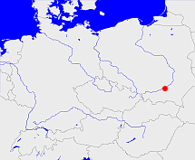
Diese Karte zeigt die Position oder den Umriss des Objekts. Haben Sie einen Fehler entdeckt? Dann würden wir uns über eine Nachricht freuen.
Übergeordnete Objekte
Legende
| | politische Verwaltung |
| | kirchliche Verwaltung |
| | gerichtliche Verwaltung |
| | Wohnplatz |
| | geographische Typen |
| | Verkehrswesen |
Übergeordnete Objekte
- Dąbrowa (Bezirkshauptmannschaft)
- Radgoszcz (Dorf)
- Radgoszcz (Landgemeinde PL)
- Powiat dąbrowski (Landkreis)
- Województwo małopolskie (Wojewodschaft)
- Polen (Dritte Republik), Polen, Poland (Third Republic), Polska - III Rzeczpospolita, La Pologne - IIIe République, Третья Речь Посполитая, Polaca - Tercera República (Republik)
- Europäische Wirtschaftsgemeinschaft, Europäische Gemeinschaft, Europäische Union, Evropské hospodářské společenství, Euroopan talousyhteisö, Európske hospodárske spoločenstvo, Communauté économique européenne, Comhphobal Eacnamaíochta na hEorpa, Europese Economische Gemeenschap, European Economic Community, Comunità Economica Europea, Comunidad Económica Europea, Europese Gemeenschap, Evropské společenství, Communauté européenne, Európske spoločenstvo, Comhphobal Eorpach, Comunità Europea, Comunidad Europea, European Community, Euroopan Yhteisö, Evropská unie, Unione Europea, Euroopan Unioni, Aontais Eorpaigh, European Union, Unión Europea, Europese Unie, Union européenne, Európska únia (Staatenbund)
- Vereinte Nationen, Verenigde Naties, Организация Объединённых Наций, Organisation des Nations unies, 联合国, Organización de las Naciones Unidas, United Nations, الأمم المتحدة, Organizácia Spojených národov (Staatenbund)
- Województwo tarnowskie (Wojewodschaft)
- Polen, Polen, República Popular de Polonia, Lenkijos Liaudies Respublika, Poland - People's Republic, La Pologne - République populaire, Польская Народная Республика, Rzeczpospolita Polska, Polska Rzeczpospolita Ludowa (Republik Volksrepublik)
- Polen (Dritte Republik), Polen, Poland (Third Republic), Polska - III Rzeczpospolita, La Pologne - IIIe République, Третья Речь Посполитая, Polaca - Tercera República (Republik)
- Europäische Wirtschaftsgemeinschaft, Europäische Gemeinschaft, Europäische Union, Evropské hospodářské společenství, Euroopan talousyhteisö, Európske hospodárske spoločenstvo, Communauté économique européenne, Comhphobal Eacnamaíochta na hEorpa, Europese Economische Gemeenschap, European Economic Community, Comunità Economica Europea, Comunidad Económica Europea, Europese Gemeenschap, Evropské společenství, Communauté européenne, Európske spoločenstvo, Comhphobal Eorpach, Comunità Europea, Comunidad Europea, European Community, Euroopan Yhteisö, Evropská unie, Unione Europea, Euroopan Unioni, Aontais Eorpaigh, European Union, Unión Europea, Europese Unie, Union européenne, Európska únia (Staatenbund)
- Vereinte Nationen, Verenigde Naties, Организация Объединённых Наций, Organisation des Nations unies, 联合国, Organización de las Naciones Unidas, United Nations, الأمم المتحدة, Organizácia Spojených národov (Staatenbund)
- Dąbrowa (Bezirkshauptmannschaft)
Quicktext
RADRKIKO00NE
	has 1875 population 3823 sagt source_190312 sagt source_263605,
	has 1880 population 4018 sagt source_190312,
	has 1890 population 3856 sagt source_190312 sagt source_263605,
	has 1895-12-02 area 57.536 sagt source_1023281 (S. 184 / 185),
	has 1895-12-02 households 947 sagt source_1023281 (S. 184 / 185),
	has 1895-12-02 population 3630 sagt source_1023281 (S. 184 / 185),
	has 1910-12-01 population 3740 sagt source_263605 sagt source_265044,
	has 1925 population 4284 sagt source_263605,
	has 1933 population 4819 sagt source_190312 sagt source_263605,
	has 1939 population 5181 sagt source_190312,
	has 1946 population 4701 sagt source_284918,
	has 1993 population 5226 sagt source_263605,
	has 1994 population 5527 sagt source_263605,
	has 1995 population 5992 sagt source_263605,
	has 1996 population 6017 sagt source_263605,
	has 1997 population 5996 sagt source_263605,
	has 1998 population 5872 sagt source_263605,
	has 1999 population 5891 sagt source_263605,
	has 2000 population 5823 sagt source_263605,
	has 2001 population 5680 sagt source_263605,
	has external reference  SIMC:1048397,
	has external reference  geonames:760801,
	has from 1993-07-01 postal code 15374,
	has name (in deu) Müncheberg,
	has name (in pol) Górki,
	has until 1993-06-30 postal code O1278,
	is (in deu) Ortsteil,
	is from 1999 part of RADZCZKO00NE sagt source_1079298,
	is part of object_306261,
	is until 2002-02-28 (in deu) Stadt (Gebietskörperschaft) sagt source_1023281 (Nr. 5 Seite 184 / 185) sagt source_190312 sagt source_265044 sagt source_284918,
	located at 50.1878°N 21.1269°O;
