Raifmass, Radvanov
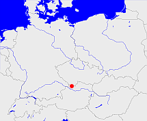
Diese Karte zeigt die Position oder den Umriss des Objekts. Haben Sie einen Fehler entdeckt? Dann würden wir uns über eine Nachricht freuen.
Übergeordnete Objekte
Legende
| | politische Verwaltung |
| | kirchliche Verwaltung |
| | gerichtliche Verwaltung |
| | Wohnplatz |
| | geographische Typen |
| | Verkehrswesen |
Übergeordnete Objekte
- Kaplitz, Kaplice (Bezirkshauptmannschaft Bezirkshauptmannschaft Landkreis Kreis)
- Budweiser Kreis (Region)
- Böhmen, Země Česká, Bohemia, Království české (Herzogtum Königreich Land)
- Heiliges Römisches Reich, Heiliges Römisches Reich deutscher Nation, Heiliges Römisches Reich, Sacrum Imperium, Sacrum Romanum Imperium, Sacrum Romanum Imperium Nationis Germanicæ (Königreich Kaiserreich)
- Reichsprotektorat Böhmen und Mähren, Protektorát Čechy a Morava (Protektorat)
- Tschechoslowakei, Tschecho-Slowakische Republik, Tschechoslowakei, Tschechoslowakische Republik, Tschechoslowakische Sozialistische Republik, Tschechische und Slowakische Föderative Republik, Tschechoslowakei, Československo, Československo, Česko-Slovenská Republika (ČSR), Česko-Slovenská Republika (ČSR), Československo, Československá republika, Československá Republika (ČSR), Czechoslovak Republic, Československá socialistická republika (ČSSR), Česká a Slovenská Federativní Republika (ČSFR), Česká a Slovenská Federatívna Republika (ČSFR), Tsjecho-Slowakije, Tsjechoslowakije (Republik Republik)
- Tschechoslowakei, Tschecho-Slowakische Republik, Tschechoslowakei, Tschechoslowakische Republik, Tschechoslowakische Sozialistische Republik, Tschechische und Slowakische Föderative Republik, Tschechoslowakei, Československo, Československo, Česko-Slovenská Republika (ČSR), Česko-Slovenská Republika (ČSR), Československo, Československá republika, Československá Republika (ČSR), Czechoslovak Republic, Československá socialistická republika (ČSSR), Česká a Slovenská Federativní Republika (ČSFR), Česká a Slovenská Federatívna Republika (ČSFR), Tsjecho-Slowakije, Tsjechoslowakije (Republik Republik)
- Kaiserthum Österreich, Cisleithanien, Österreichische Länder, Impero Austriaco, Předlitavsko (Kaiserreich Reichshälfte)
- Oberdonau (Land Reichsgau)
- Böhmen, Země Česká, Bohemia, Království české (Herzogtum Königreich Land)
- Heiliges Römisches Reich, Heiliges Römisches Reich deutscher Nation, Heiliges Römisches Reich, Sacrum Imperium, Sacrum Romanum Imperium, Sacrum Romanum Imperium Nationis Germanicæ (Königreich Kaiserreich)
- Reichsprotektorat Böhmen und Mähren, Protektorát Čechy a Morava (Protektorat)
- Tschechoslowakei, Tschecho-Slowakische Republik, Tschechoslowakei, Tschechoslowakische Republik, Tschechoslowakische Sozialistische Republik, Tschechische und Slowakische Föderative Republik, Tschechoslowakei, Československo, Československo, Česko-Slovenská Republika (ČSR), Česko-Slovenská Republika (ČSR), Československo, Československá republika, Československá Republika (ČSR), Czechoslovak Republic, Československá socialistická republika (ČSSR), Česká a Slovenská Federativní Republika (ČSFR), Česká a Slovenská Federatívna Republika (ČSFR), Tsjecho-Slowakije, Tsjechoslowakije (Republik Republik)
- Tschechoslowakei, Tschecho-Slowakische Republik, Tschechoslowakei, Tschechoslowakische Republik, Tschechoslowakische Sozialistische Republik, Tschechische und Slowakische Föderative Republik, Tschechoslowakei, Československo, Československo, Česko-Slovenská Republika (ČSR), Česko-Slovenská Republika (ČSR), Československo, Československá republika, Československá Republika (ČSR), Czechoslovak Republic, Československá socialistická republika (ČSSR), Česká a Slovenská Federativní Republika (ČSFR), Česká a Slovenská Federatívna Republika (ČSFR), Tsjecho-Slowakije, Tsjechoslowakije (Republik Republik)
- Kaiserthum Österreich, Cisleithanien, Österreichische Länder, Impero Austriaco, Předlitavsko (Kaiserreich Reichshälfte)
- Südböhmen, Budějovický kraj, Südböhmische Region, Jihočeský kraj (Region)
- Tschechische Republik, Tschechien, República Checa, Czech Republic, Czechia (Czech Republic), Česká republika, Tsjechië, Czechia, République tchèque (Republik)
- Europäische Wirtschaftsgemeinschaft, Europäische Gemeinschaft, Europäische Union, Evropské hospodářské společenství, Euroopan talousyhteisö, Európske hospodárske spoločenstvo, Communauté économique européenne, Comhphobal Eacnamaíochta na hEorpa, Europese Economische Gemeenschap, European Economic Community, Comunità Economica Europea, Comunidad Económica Europea, Europese Gemeenschap, Evropské společenství, Communauté européenne, Európske spoločenstvo, Comhphobal Eorpach, Comunità Europea, Comunidad Europea, European Community, Euroopan Yhteisö, Evropská unie, Unione Europea, Euroopan Unioni, Aontais Eorpaigh, European Union, Unión Europea, Europese Unie, Union européenne, Európska únia (Staatenbund)
- Vereinte Nationen, Verenigde Naties, Организация Объединённых Наций, Organisation des Nations unies, 联合国, Organización de las Naciones Unidas, United Nations, الأمم المتحدة, Organizácia Spojených národov (Staatenbund)
Quicktext
RAIASSJN78DN
	has 1895-12-02 area 7.876 sagt source_1023281 (S. 186 / 187),
	has 1895-12-02 households 397 sagt source_1023281 (S. 186 / 187),
	has 1895-12-02 population 1467 sagt source_1023281 (S. 186 / 187),
	has 1910-12-01 population 1302 sagt source_265044,
	has 1925 population 1591 sagt source_263605,
	has 1933 population 1544 sagt source_190312 sagt source_263605,
	has 1939 population 1420 sagt source_190312,
	has 1946 population 1549 sagt source_284918,
	has 1993 population 940 sagt source_263605,
	has 1994 population 925 sagt source_263605,
	has 1995 population 922 sagt source_263605,
	has 1996 population 915 sagt source_263605,
	has 2001 population 17 sagt source_265617,
	has external reference  NIMA:-553772,
	has external reference  opengeodb:43001504,
	has from 1991-07-01 until 1993-12-05 municipal id 12042210 sagt source_1077051,
	has from 1993-07-01 postal code 15306,
	has from 1993-12-06 until 1997-12-30 municipal id 12064188 sagt source_290784,
	has municipal id 20534,
	has name (in cze) Radvanov,
	has name (in deu) Gusow,
	has name (in deu) Pfannhof,
	has name (in deu) Raifmass,
	has until 1993-06-30 postal code O1211,
	is (in deu) Ort,
	is 1895-12-02 part of object_1284091 sagt source_1023281 (S. 186 / 187),
	is 1895-12-02 part of object_285672 sagt source_1023281 (S. 186 / 187),
	is 1992-12-31 part of object_1149712 sagt source_1331592,
	is from 1816 until 1993-12-05 part of adm_142042 sagt source_1023281 (Seite 186 / 187) sagt source_190312 sagt source_265044 sagt source_290784,
	is from 1874-10-01 part of object_1150356 sagt source_1023281 (S. 186 / 187) sagt source_1331590 sagt source_1331591 sagt source_1335058 (Außerordentliche Beilage S. 13 Nr. 39) sagt source_1336431 (§ 55),
	is from 1935-04-01 until 1997-12-30 (in deu) Gemeinde sagt source_1077051 sagt source_190312 sagt source_284918 sagt source_290784,
	is from 1992-07-16 until 1997-12-30 part of object_152441 sagt source_290784,
	is from 1993-12-06 until 1997-12-30 part of adm_142064 sagt source_290784,
	is part of object_215431,
	is part of object_280694,
	is part of object_284318,
	is until 1935-03-31 (in deu) Landgemeinde sagt source_1023281 (Nr. 44 Seite 186 / 187) sagt source_265044,
	located at 46.823°N 14.393°O 630m,
	located at 48.566667°N 14.333333°O;
