Sienna
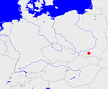
Diese Karte zeigt die Position oder den Umriss des Objekts. Haben Sie einen Fehler entdeckt? Dann würden wir uns über eine Nachricht freuen.
Übergeordnete Objekte
Legende
| | politische Verwaltung |
| | kirchliche Verwaltung |
| | gerichtliche Verwaltung |
| | Wohnplatz |
| | geographische Typen |
| | Verkehrswesen |
Übergeordnete Objekte
- Gródek nad Dunajcem (Landgemeinde PL)
- Powiat nowosądecki (Landkreis)
- Województwo małopolskie (Wojewodschaft)
- Polen (Dritte Republik), Polen, Poland (Third Republic), Polska - III Rzeczpospolita, La Pologne - IIIe République, Третья Речь Посполитая, Polaca - Tercera República (Republik)
- Europäische Wirtschaftsgemeinschaft, Europäische Gemeinschaft, Europäische Union, Evropské hospodářské společenství, Euroopan talousyhteisö, Európske hospodárske spoločenstvo, Communauté économique européenne, Comhphobal Eacnamaíochta na hEorpa, Europese Economische Gemeenschap, European Economic Community, Comunità Economica Europea, Comunidad Económica Europea, Europese Gemeenschap, Evropské společenství, Communauté européenne, Európske spoločenstvo, Comhphobal Eorpach, Comunità Europea, Comunidad Europea, European Community, Euroopan Yhteisö, Evropská unie, Unione Europea, Euroopan Unioni, Aontais Eorpaigh, European Union, Unión Europea, Europese Unie, Union européenne, Európska únia (Staatenbund)
- Vereinte Nationen, Verenigde Naties, Организация Объединённых Наций, Organisation des Nations unies, 联合国, Organización de las Naciones Unidas, United Nations, الأمم المتحدة, Organizácia Spojených národov (Staatenbund)
- Neu-Sandec, Neusandez, Nowy Sącz (Bezirkshauptmannschaft)
- Zbyszyce (Gemeinde)
Untergeordnete Objekte
| Name |
Typ |
GOV-Kennung |
Zeitraum |
| Wilkonosza |
DorfOrtsteil
|
WILSZAKN09IR |
(1999 -) |
Quicktext
BUCNAU_W2332
	has 1875 population 249 sagt source_263605,
	has 1890 population 218 sagt source_263605,
	has 1895-12-02 area 7.983 sagt source_1023281 (S. 188 / 189),
	has 1895-12-02 households 35 sagt source_1023281 (S. 188 / 189),
	has 1895-12-02 population 202 sagt source_1023281 (S. 188 / 189),
	has 1910-12-01 population 197 sagt source_263605 sagt source_265044,
	has 1925 population 207 sagt source_263605,
	has 1933 population 181 sagt source_190312 sagt source_263605,
	has 1939 population 179 sagt source_190312,
	has 1946 population 181 sagt source_284918,
	has 1961-06-06 population 17 sagt source_1081178 (p. 16),
	has 1970-05-27 population 11 sagt source_1082104 (p. 110),
	has 1993 population 155 sagt source_263605,
	has 1994 population 149 sagt source_263605,
	has 1995 population 152 sagt source_263605,
	has 1996 population 154 sagt source_263605,
	has 1997 population 161 sagt source_263605,
	has from 1991-07-01 until 1993-12-05 municipal id 12042490 sagt source_1077051,
	has from 1993-07-01 postal code 15326,
	has from 1993-07-01 postal code 24354,
	has from 1993-12-06 until 1998-12-30 municipal id 12064440 sagt source_290784,
	has name (in deu) Büchenau,
	has name (in deu) Schönfließ,
	has until 1993-06-30 postal code O1211,
	has until 1993-06-30 postal code W2332,
	is (in deu) Gut (Gebäude) sagt source_1081178 (p. 16) sagt source_1082104 (p. 110),
	is 1890 part of object_184893 sagt source_387809 (p. 22),
	is 1890 part of object_289954 sagt source_387809 (p. 22),
	is 1895-12-02 part of object_1284098 sagt source_1023281 (S. 188 / 189),
	is 1895-12-02 part of object_256152 sagt source_1023281 (S. 188 / 189),
	is 1907 part of object_289954 sagt source_1260391 (p. 138),
	is 1992-12-31 part of object_1154965 sagt source_1331592,
	is from 1816 until 1993-12-05 part of adm_142042 sagt source_1023281 (Seite 188 / 189) sagt source_190312 sagt source_265044 sagt source_290784,
	is from 1874-10-01 part of object_1150854 sagt source_1023281 (S. 188 / 189) sagt source_1331590 sagt source_1331591 sagt source_1335058 (Außerordentliche Beilage S. 13 Nr. 47) sagt source_1336431 (§ 55),
	is from 1920 until 1939 part of object_1255569 sagt source_1074216,
	is from 1935-04-01 until 1998-12-30 (in deu) Gemeinde sagt source_1077051 sagt source_190312 sagt source_284918 sagt source_290784,
	is from 1992-05-22 until 1998-12-30 part of object_152438 sagt source_290784,
	is from 1993-12-06 until 1998-12-30 part of adm_142064 sagt source_290784,
	is from 1999 part of object_1072579 sagt source_1079298,
	is part of object_290087 sagt source_1081178 (p. 16) sagt source_1082104 (p. 110),
	is part of object_306289,
	is until 1935-03-31 (in deu) Landgemeinde sagt source_1023281 (Nr. 110 Seite 188 / 189) sagt source_265044,
	located at 49.7123°N 20.7085°O,
	located at 54.5558°N 9.8653°O;
