Theisseil
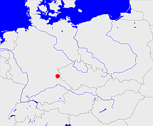
Diese Karte zeigt die Position oder den Umriss des Objekts. Haben Sie einen Fehler entdeckt? Dann würden wir uns über eine Nachricht freuen.
Übergeordnete Objekte
Legende
| | politische Verwaltung |
| | kirchliche Verwaltung |
| | gerichtliche Verwaltung |
| | Wohnplatz |
| | geographische Typen |
| | Verkehrswesen |
Übergeordnete Objekte
- Theisseil (Gemeinde)
- Neustadt an der Waldnaab (Bezirksamt Landkreis)
- Regenkreis, Oberpfalz und Regensburg, Oberpfalz, Upper Palatinate (Kreis Regierungsbezirk Regierungsbezirk)
- Bayern, Beieren, Bavaria, Bavière, Бавария (Bundesland)
- Südostzone, US-Besatzungszone, amerikanische Besatzungszone, American Zone of Occupation (Besatzungszone)
- Bundesrepublik Deutschland, Deutschland, Federal Republic of Germany, Герма́ния, Vokietija, Nemecká spolková republika, Germany, Tyskland, Duitsland, Allemagne, Niemcy (Bundesstaat)
- Europäische Wirtschaftsgemeinschaft, Europäische Gemeinschaft, Europäische Union, Evropské hospodářské společenství, Euroopan talousyhteisö, Európske hospodárske spoločenstvo, Communauté économique européenne, Comhphobal Eacnamaíochta na hEorpa, Europese Economische Gemeenschap, European Economic Community, Comunità Economica Europea, Comunidad Económica Europea, Europese Gemeenschap, Evropské společenství, Communauté européenne, Európske spoločenstvo, Comhphobal Eorpach, Comunità Europea, Comunidad Europea, European Community, Euroopan Yhteisö, Evropská unie, Unione Europea, Euroopan Unioni, Aontais Eorpaigh, European Union, Unión Europea, Europese Unie, Union européenne, Európska únia (Staatenbund)
- Vereinte Nationen, Verenigde Naties, Организация Объединённых Наций, Organisation des Nations unies, 联合国, Organización de las Naciones Unidas, United Nations, الأمم المتحدة, Organizácia Spojených národov (Staatenbund)
- Baiern, Pfalz-Baiern, Churpfalz-Baiern, Kurpfalz-Bayern, Bayern, Bavaria (Herzogtum Königreich Freistaat)
- Niederbayern und Oberpfalz (Regierungsbezirk)
- Bayern, Beieren, Bavaria, Bavière, Бавария (Bundesland)
- Südostzone, US-Besatzungszone, amerikanische Besatzungszone, American Zone of Occupation (Besatzungszone)
- Bundesrepublik Deutschland, Deutschland, Federal Republic of Germany, Герма́ния, Vokietija, Nemecká spolková republika, Germany, Tyskland, Duitsland, Allemagne, Niemcy (Bundesstaat)
- Europäische Wirtschaftsgemeinschaft, Europäische Gemeinschaft, Europäische Union, Evropské hospodářské společenství, Euroopan talousyhteisö, Európske hospodárske spoločenstvo, Communauté économique européenne, Comhphobal Eacnamaíochta na hEorpa, Europese Economische Gemeenschap, European Economic Community, Comunità Economica Europea, Comunidad Económica Europea, Europese Gemeenschap, Evropské společenství, Communauté européenne, Európske spoločenstvo, Comhphobal Eorpach, Comunità Europea, Comunidad Europea, European Community, Euroopan Yhteisö, Evropská unie, Unione Europea, Euroopan Unioni, Aontais Eorpaigh, European Union, Unión Europea, Europese Unie, Union européenne, Európska únia (Staatenbund)
- Vereinte Nationen, Verenigde Naties, Организация Объединённых Наций, Organisation des Nations unies, 联合国, Organización de las Naciones Unidas, United Nations, الأمم المتحدة, Organizácia Spojených národov (Staatenbund)
- Baiern, Pfalz-Baiern, Churpfalz-Baiern, Kurpfalz-Bayern, Bayern, Bavaria (Herzogtum Königreich Freistaat)
- Neustadt a. d. Waldnaab, Neustadt, Neustadt an der Nab (Landgericht Amtsgericht)
- Neustadt an der Waldnaab (Verwaltungsgemeinschaft)
- Neustadt an der Waldnaab (Bezirksamt Landkreis)
- Regenkreis, Oberpfalz und Regensburg, Oberpfalz, Upper Palatinate (Kreis Regierungsbezirk Regierungsbezirk)
- Bayern, Beieren, Bavaria, Bavière, Бавария (Bundesland)
- Südostzone, US-Besatzungszone, amerikanische Besatzungszone, American Zone of Occupation (Besatzungszone)
- Bundesrepublik Deutschland, Deutschland, Federal Republic of Germany, Герма́ния, Vokietija, Nemecká spolková republika, Germany, Tyskland, Duitsland, Allemagne, Niemcy (Bundesstaat)
- Europäische Wirtschaftsgemeinschaft, Europäische Gemeinschaft, Europäische Union, Evropské hospodářské společenství, Euroopan talousyhteisö, Európske hospodárske spoločenstvo, Communauté économique européenne, Comhphobal Eacnamaíochta na hEorpa, Europese Economische Gemeenschap, European Economic Community, Comunità Economica Europea, Comunidad Económica Europea, Europese Gemeenschap, Evropské společenství, Communauté européenne, Európske spoločenstvo, Comhphobal Eorpach, Comunità Europea, Comunidad Europea, European Community, Euroopan Yhteisö, Evropská unie, Unione Europea, Euroopan Unioni, Aontais Eorpaigh, European Union, Unión Europea, Europese Unie, Union européenne, Európska únia (Staatenbund)
- Vereinte Nationen, Verenigde Naties, Организация Объединённых Наций, Organisation des Nations unies, 联合国, Organización de las Naciones Unidas, United Nations, الأمم المتحدة, Organizácia Spojených národov (Staatenbund)
- Baiern, Pfalz-Baiern, Churpfalz-Baiern, Kurpfalz-Bayern, Bayern, Bavaria (Herzogtum Königreich Freistaat)
- Regenkreis, Oberpfalz und Regensburg, Oberpfalz, Upper Palatinate (Kreis Regierungsbezirk Regierungsbezirk)
- Bayern, Beieren, Bavaria, Bavière, Бавария (Bundesland)
- Südostzone, US-Besatzungszone, amerikanische Besatzungszone, American Zone of Occupation (Besatzungszone)
- Bundesrepublik Deutschland, Deutschland, Federal Republic of Germany, Герма́ния, Vokietija, Nemecká spolková republika, Germany, Tyskland, Duitsland, Allemagne, Niemcy (Bundesstaat)
- Europäische Wirtschaftsgemeinschaft, Europäische Gemeinschaft, Europäische Union, Evropské hospodářské společenství, Euroopan talousyhteisö, Európske hospodárske spoločenstvo, Communauté économique européenne, Comhphobal Eacnamaíochta na hEorpa, Europese Economische Gemeenschap, European Economic Community, Comunità Economica Europea, Comunidad Económica Europea, Europese Gemeenschap, Evropské společenství, Communauté européenne, Európske spoločenstvo, Comhphobal Eorpach, Comunità Europea, Comunidad Europea, European Community, Euroopan Yhteisö, Evropská unie, Unione Europea, Euroopan Unioni, Aontais Eorpaigh, European Union, Unión Europea, Europese Unie, Union européenne, Európska únia (Staatenbund)
- Vereinte Nationen, Verenigde Naties, Организация Объединённых Наций, Organisation des Nations unies, 联合国, Organización de las Naciones Unidas, United Nations, الأمم المتحدة, Organizácia Spojených národov (Staatenbund)
- Baiern, Pfalz-Baiern, Churpfalz-Baiern, Kurpfalz-Bayern, Bayern, Bavaria (Herzogtum Königreich Freistaat)
- Niederbayern und Oberpfalz (Regierungsbezirk)
- Bayern, Beieren, Bavaria, Bavière, Бавария (Bundesland)
- Südostzone, US-Besatzungszone, amerikanische Besatzungszone, American Zone of Occupation (Besatzungszone)
- Bundesrepublik Deutschland, Deutschland, Federal Republic of Germany, Герма́ния, Vokietija, Nemecká spolková republika, Germany, Tyskland, Duitsland, Allemagne, Niemcy (Bundesstaat)
- Europäische Wirtschaftsgemeinschaft, Europäische Gemeinschaft, Europäische Union, Evropské hospodářské společenství, Euroopan talousyhteisö, Európske hospodárske spoločenstvo, Communauté économique européenne, Comhphobal Eacnamaíochta na hEorpa, Europese Economische Gemeenschap, European Economic Community, Comunità Economica Europea, Comunidad Económica Europea, Europese Gemeenschap, Evropské společenství, Communauté européenne, Európske spoločenstvo, Comhphobal Eorpach, Comunità Europea, Comunidad Europea, European Community, Euroopan Yhteisö, Evropská unie, Unione Europea, Euroopan Unioni, Aontais Eorpaigh, European Union, Unión Europea, Europese Unie, Union européenne, Európska únia (Staatenbund)
- Vereinte Nationen, Verenigde Naties, Организация Объединённых Наций, Organisation des Nations unies, 联合国, Organización de las Naciones Unidas, United Nations, الأمم المتحدة, Organizácia Spojených národov (Staatenbund)
- Baiern, Pfalz-Baiern, Churpfalz-Baiern, Kurpfalz-Bayern, Bayern, Bavaria (Herzogtum Königreich Freistaat)
- Weiden, Weiden in der Oberpfalz (Landgericht Amtsgericht)
- Regenkreis, Oberpfalz und Regensburg, Oberpfalz, Upper Palatinate (Kreis Regierungsbezirk Regierungsbezirk)
- Bayern, Beieren, Bavaria, Bavière, Бавария (Bundesland)
- Südostzone, US-Besatzungszone, amerikanische Besatzungszone, American Zone of Occupation (Besatzungszone)
- Bundesrepublik Deutschland, Deutschland, Federal Republic of Germany, Герма́ния, Vokietija, Nemecká spolková republika, Germany, Tyskland, Duitsland, Allemagne, Niemcy (Bundesstaat)
- Europäische Wirtschaftsgemeinschaft, Europäische Gemeinschaft, Europäische Union, Evropské hospodářské společenství, Euroopan talousyhteisö, Európske hospodárske spoločenstvo, Communauté économique européenne, Comhphobal Eacnamaíochta na hEorpa, Europese Economische Gemeenschap, European Economic Community, Comunità Economica Europea, Comunidad Económica Europea, Europese Gemeenschap, Evropské společenství, Communauté européenne, Európske spoločenstvo, Comhphobal Eorpach, Comunità Europea, Comunidad Europea, European Community, Euroopan Yhteisö, Evropská unie, Unione Europea, Euroopan Unioni, Aontais Eorpaigh, European Union, Unión Europea, Europese Unie, Union européenne, Európska únia (Staatenbund)
- Vereinte Nationen, Verenigde Naties, Организация Объединённых Наций, Organisation des Nations unies, 联合国, Organización de las Naciones Unidas, United Nations, الأمم المتحدة, Organizácia Spojených národov (Staatenbund)
- Baiern, Pfalz-Baiern, Churpfalz-Baiern, Kurpfalz-Bayern, Bayern, Bavaria (Herzogtum Königreich Freistaat)
- Weiden, Weiden in der Oberpfalz (Landgericht)
- Edeldorf (Gemeinde)
- Neustadt an der Waldnaab (Bezirksamt Landkreis)
- Regenkreis, Oberpfalz und Regensburg, Oberpfalz, Upper Palatinate (Kreis Regierungsbezirk Regierungsbezirk)
- Bayern, Beieren, Bavaria, Bavière, Бавария (Bundesland)
- Südostzone, US-Besatzungszone, amerikanische Besatzungszone, American Zone of Occupation (Besatzungszone)
- Bundesrepublik Deutschland, Deutschland, Federal Republic of Germany, Герма́ния, Vokietija, Nemecká spolková republika, Germany, Tyskland, Duitsland, Allemagne, Niemcy (Bundesstaat)
- Europäische Wirtschaftsgemeinschaft, Europäische Gemeinschaft, Europäische Union, Evropské hospodářské společenství, Euroopan talousyhteisö, Európske hospodárske spoločenstvo, Communauté économique européenne, Comhphobal Eacnamaíochta na hEorpa, Europese Economische Gemeenschap, European Economic Community, Comunità Economica Europea, Comunidad Económica Europea, Europese Gemeenschap, Evropské společenství, Communauté européenne, Európske spoločenstvo, Comhphobal Eorpach, Comunità Europea, Comunidad Europea, European Community, Euroopan Yhteisö, Evropská unie, Unione Europea, Euroopan Unioni, Aontais Eorpaigh, European Union, Unión Europea, Europese Unie, Union européenne, Európska únia (Staatenbund)
- Vereinte Nationen, Verenigde Naties, Организация Объединённых Наций, Organisation des Nations unies, 联合国, Organización de las Naciones Unidas, United Nations, الأمم المتحدة, Organizácia Spojených národov (Staatenbund)
- Baiern, Pfalz-Baiern, Churpfalz-Baiern, Kurpfalz-Bayern, Bayern, Bavaria (Herzogtum Königreich Freistaat)
- Regenkreis, Oberpfalz und Regensburg, Oberpfalz, Upper Palatinate (Kreis Regierungsbezirk Regierungsbezirk)
- Bayern, Beieren, Bavaria, Bavière, Бавария (Bundesland)
- Südostzone, US-Besatzungszone, amerikanische Besatzungszone, American Zone of Occupation (Besatzungszone)
- Bundesrepublik Deutschland, Deutschland, Federal Republic of Germany, Герма́ния, Vokietija, Nemecká spolková republika, Germany, Tyskland, Duitsland, Allemagne, Niemcy (Bundesstaat)
- Europäische Wirtschaftsgemeinschaft, Europäische Gemeinschaft, Europäische Union, Evropské hospodářské společenství, Euroopan talousyhteisö, Európske hospodárske spoločenstvo, Communauté économique européenne, Comhphobal Eacnamaíochta na hEorpa, Europese Economische Gemeenschap, European Economic Community, Comunità Economica Europea, Comunidad Económica Europea, Europese Gemeenschap, Evropské společenství, Communauté européenne, Európske spoločenstvo, Comhphobal Eorpach, Comunità Europea, Comunidad Europea, European Community, Euroopan Yhteisö, Evropská unie, Unione Europea, Euroopan Unioni, Aontais Eorpaigh, European Union, Unión Europea, Europese Unie, Union européenne, Európska únia (Staatenbund)
- Vereinte Nationen, Verenigde Naties, Организация Объединённых Наций, Organisation des Nations unies, 联合国, Organización de las Naciones Unidas, United Nations, الأمم المتحدة, Organizácia Spojených národov (Staatenbund)
- Baiern, Pfalz-Baiern, Churpfalz-Baiern, Kurpfalz-Bayern, Bayern, Bavaria (Herzogtum Königreich Freistaat)
- Niederbayern und Oberpfalz (Regierungsbezirk)
- Bayern, Beieren, Bavaria, Bavière, Бавария (Bundesland)
- Südostzone, US-Besatzungszone, amerikanische Besatzungszone, American Zone of Occupation (Besatzungszone)
- Bundesrepublik Deutschland, Deutschland, Federal Republic of Germany, Герма́ния, Vokietija, Nemecká spolková republika, Germany, Tyskland, Duitsland, Allemagne, Niemcy (Bundesstaat)
- Europäische Wirtschaftsgemeinschaft, Europäische Gemeinschaft, Europäische Union, Evropské hospodářské společenství, Euroopan talousyhteisö, Európske hospodárske spoločenstvo, Communauté économique européenne, Comhphobal Eacnamaíochta na hEorpa, Europese Economische Gemeenschap, European Economic Community, Comunità Economica Europea, Comunidad Económica Europea, Europese Gemeenschap, Evropské společenství, Communauté européenne, Európske spoločenstvo, Comhphobal Eorpach, Comunità Europea, Comunidad Europea, European Community, Euroopan Yhteisö, Evropská unie, Unione Europea, Euroopan Unioni, Aontais Eorpaigh, European Union, Unión Europea, Europese Unie, Union européenne, Európska únia (Staatenbund)
- Vereinte Nationen, Verenigde Naties, Организация Объединённых Наций, Organisation des Nations unies, 联合国, Organización de las Naciones Unidas, United Nations, الأمم المتحدة, Organizácia Spojených národov (Staatenbund)
- Baiern, Pfalz-Baiern, Churpfalz-Baiern, Kurpfalz-Bayern, Bayern, Bavaria (Herzogtum Königreich Freistaat)
Quicktext
object_171821
	has 1875 population 457 sagt source_284410,
	has 1890 population 450 sagt source_284410,
	has 1895-12-02 area 5.714 sagt source_1023281 (S. 64 / 65),
	has 1895-12-02 households 92 sagt source_1023281 (S. 64 / 65),
	has 1895-12-02 population 410 sagt source_1023281 (S. 64 / 65),
	has 1910-12-01 population 353 sagt source_265044 sagt source_284410,
	has 1925 population 327 sagt source_284410,
	has 1933 population 296 sagt source_190312 sagt source_284410,
	has 1939 population 306 sagt source_190312,
	has 1946 population 404 sagt source_284918,
	has 1961 population 68 sagt source_379404 (Spalte 562),
	has 1987 population 90 sagt source_320250,
	has 1993 population 259 sagt source_284410,
	has 1994 population 249 sagt source_284410,
	has 1995 population 242 sagt source_284410,
	has 1996 population 240 sagt source_284410,
	has 1997 population 239 sagt source_284410,
	has 1998 population 237 sagt source_284410,
	has 1999 population 236 sagt source_284410,
	has 2000 population 227 sagt source_284410,
	has URL  https://de.wikipedia.org/wiki/Theisseil,
	has denomination ev,
	has external reference  BLO:30248,
	has external reference  geonames:2822883,
	has from 1991-07-01 until 1993-12-05 municipal id 12031340 sagt source_1077051,
	has from 1993-07-01 postal code 15910,
	has from 1993-07-01 postal code 92637,
	has from 1993-12-06 until 2001-12-30 municipal id 12061304 sagt source_290784,
	has from 2011 name (in deu) Mark-Westtünnen,
	has name (in deu) Leibsch,
	has name (in deu) Theisseil,
	has until 1993-06-30 postal code O7551,
	has until 1993-06-30 postal code W8480,
	has until 2010 name (in deu) Mark,
	is (in deu) Dorf,
	is (in deu) Kirchengemeinde,
	is 1895-12-02 part of object_1165203 sagt source_1023281 (S. 64 / 65),
	is 1895-12-02 part of object_285674 sagt source_1023281 (S. 64 / 65),
	is 1992-12-31 part of object_1153925 sagt source_1331592,
	is from 1874-10-02 part of object_1150529 sagt source_1023281 (S. 64 / 65) sagt source_1331590 sagt source_1331591 sagt source_1335057 (Beilage S. 10 Nr. 21),
	is from 1935-04-01 until 2001-12-30 (in deu) Gemeinde sagt source_1077051 sagt source_190312 sagt source_284918 sagt source_290784,
	is from 1950-07-01 until 1993-12-05 part of adm_142031 sagt source_284918 sagt source_290784 sagt source_298652,
	is from 1972-07-01 part of THEEILJN69CQ sagt source_388589 (p. 636),
	is from 1992-10-26 until 2001-12-30 part of object_152414 sagt source_290784,
	is from 1993-12-06 until 2001-12-30 part of adm_142061 sagt source_290784,
	is part of object_171426,
	is until 1935-03-31 (in deu) Landgemeinde sagt source_1023281 (Nr. 62 Seite 64 / 65) sagt source_265044,
	is until 1950-06-30 part of adm_142024 sagt source_1023281 (Seite 64 / 65) sagt source_190312 sagt source_265044 sagt source_298652,
	is until 1972-06-30 part of object_1350723 sagt source_388589 (p. 636),
	located at 49.6909°N 12.2266°O;
