Weichensdorf
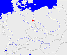
Diese Karte zeigt die Position oder den Umriss des Objekts. Haben Sie einen Fehler entdeckt? Dann würden wir uns über eine Nachricht freuen.
Übergeordnete Objekte
Legende
| | politische Verwaltung |
| | kirchliche Verwaltung |
| | gerichtliche Verwaltung |
| | Wohnplatz |
| | geographische Typen |
| | Verkehrswesen |
Übergeordnete Objekte
- Beeskow (Landkreis)
- Frankfurt (Bezirk)
- Brandenburg, Brandenburg, Kraj Bramborska (Bundesland)
- Bundesrepublik Deutschland, Deutschland, Federal Republic of Germany, Герма́ния, Vokietija, Nemecká spolková republika, Germany, Tyskland, Duitsland, Allemagne, Niemcy (Bundesstaat)
- Europäische Wirtschaftsgemeinschaft, Europäische Gemeinschaft, Europäische Union, Evropské hospodářské společenství, Euroopan talousyhteisö, Európske hospodárske spoločenstvo, Communauté économique européenne, Comhphobal Eacnamaíochta na hEorpa, Europese Economische Gemeenschap, European Economic Community, Comunità Economica Europea, Comunidad Económica Europea, Europese Gemeenschap, Evropské společenství, Communauté européenne, Európske spoločenstvo, Comhphobal Eorpach, Comunità Europea, Comunidad Europea, European Community, Euroopan Yhteisö, Evropská unie, Unione Europea, Euroopan Unioni, Aontais Eorpaigh, European Union, Unión Europea, Europese Unie, Union européenne, Európska únia (Staatenbund)
- Vereinte Nationen, Verenigde Naties, Организация Объединённых Наций, Organisation des Nations unies, 联合国, Organización de las Naciones Unidas, United Nations, الأمم المتحدة, Organizácia Spojených národov (Staatenbund)
- Beeskow (Amtsgericht)
- Günthersdorf (Standesamt)
- Frankfurt (Oder) (Landkreis)
- Lübben, Wokrejs Lubin (Landkreis Kreis)
- Cottbus (Bezirk)
- Frankfurt (Oder) (Regierungsbezirk)
- Brandenburg, Brandenburg, Kraj Bramborska (Bundesland)
- Bundesrepublik Deutschland, Deutschland, Federal Republic of Germany, Герма́ния, Vokietija, Nemecká spolková republika, Germany, Tyskland, Duitsland, Allemagne, Niemcy (Bundesstaat)
- Europäische Wirtschaftsgemeinschaft, Europäische Gemeinschaft, Europäische Union, Evropské hospodářské společenství, Euroopan talousyhteisö, Európske hospodárske spoločenstvo, Communauté économique européenne, Comhphobal Eacnamaíochta na hEorpa, Europese Economische Gemeenschap, European Economic Community, Comunità Economica Europea, Comunidad Económica Europea, Europese Gemeenschap, Evropské společenství, Communauté européenne, Európske spoločenstvo, Comhphobal Eorpach, Comunità Europea, Comunidad Europea, European Community, Euroopan Yhteisö, Evropská unie, Unione Europea, Euroopan Unioni, Aontais Eorpaigh, European Union, Unión Europea, Europese Unie, Union européenne, Európska únia (Staatenbund)
- Vereinte Nationen, Verenigde Naties, Организация Объединённых Наций, Organisation des Nations unies, 联合国, Organización de las Naciones Unidas, United Nations, الأمم المتحدة, Organizácia Spojených národov (Staatenbund)
- Friedland (Standesamt)
- Lübben, Wokrejs Lubin (Landkreis Kreis)
- Cottbus (Bezirk)
- Frankfurt (Oder) (Regierungsbezirk)
- Brandenburg, Brandenburg, Kraj Bramborska (Bundesland)
- Bundesrepublik Deutschland, Deutschland, Federal Republic of Germany, Герма́ния, Vokietija, Nemecká spolková republika, Germany, Tyskland, Duitsland, Allemagne, Niemcy (Bundesstaat)
- Europäische Wirtschaftsgemeinschaft, Europäische Gemeinschaft, Europäische Union, Evropské hospodářské společenství, Euroopan talousyhteisö, Európske hospodárske spoločenstvo, Communauté économique européenne, Comhphobal Eacnamaíochta na hEorpa, Europese Economische Gemeenschap, European Economic Community, Comunità Economica Europea, Comunidad Económica Europea, Europese Gemeenschap, Evropské společenství, Communauté européenne, Európske spoločenstvo, Comhphobal Eorpach, Comunità Europea, Comunidad Europea, European Community, Euroopan Yhteisö, Evropská unie, Unione Europea, Euroopan Unioni, Aontais Eorpaigh, European Union, Unión Europea, Europese Unie, Union européenne, Európska únia (Staatenbund)
- Vereinte Nationen, Verenigde Naties, Организация Объединённых Наций, Organisation des Nations unies, 联合国, Organización de las Naciones Unidas, United Nations, الأمم المتحدة, Organizácia Spojených národov (Staatenbund)
- Frankfurt (Oder) (Landkreis)
- Beeskow (Landkreis)
- Frankfurt (Bezirk)
- Brandenburg, Brandenburg, Kraj Bramborska (Bundesland)
- Bundesrepublik Deutschland, Deutschland, Federal Republic of Germany, Герма́ния, Vokietija, Nemecká spolková republika, Germany, Tyskland, Duitsland, Allemagne, Niemcy (Bundesstaat)
- Europäische Wirtschaftsgemeinschaft, Europäische Gemeinschaft, Europäische Union, Evropské hospodářské společenství, Euroopan talousyhteisö, Európske hospodárske spoločenstvo, Communauté économique européenne, Comhphobal Eacnamaíochta na hEorpa, Europese Economische Gemeenschap, European Economic Community, Comunità Economica Europea, Comunidad Económica Europea, Europese Gemeenschap, Evropské společenství, Communauté européenne, Európske spoločenstvo, Comhphobal Eorpach, Comunità Europea, Comunidad Europea, European Community, Euroopan Yhteisö, Evropská unie, Unione Europea, Euroopan Unioni, Aontais Eorpaigh, European Union, Unión Europea, Europese Unie, Union européenne, Európska únia (Staatenbund)
- Vereinte Nationen, Verenigde Naties, Организация Объединённых Наций, Organisation des Nations unies, 联合国, Organización de las Naciones Unidas, United Nations, الأمم المتحدة, Organizácia Spojených národov (Staatenbund)
- Oder-Spree, Wokrejs Odra-Sprjewja (Landkreis)
- Brandenburg, Brandenburg, Kraj Bramborska (Bundesland)
- Bundesrepublik Deutschland, Deutschland, Federal Republic of Germany, Герма́ния, Vokietija, Nemecká spolková republika, Germany, Tyskland, Duitsland, Allemagne, Niemcy (Bundesstaat)
- Europäische Wirtschaftsgemeinschaft, Europäische Gemeinschaft, Europäische Union, Evropské hospodářské společenství, Euroopan talousyhteisö, Európske hospodárske spoločenstvo, Communauté économique européenne, Comhphobal Eacnamaíochta na hEorpa, Europese Economische Gemeenschap, European Economic Community, Comunità Economica Europea, Comunidad Económica Europea, Europese Gemeenschap, Evropské společenství, Communauté européenne, Európske spoločenstvo, Comhphobal Eorpach, Comunità Europea, Comunidad Europea, European Community, Euroopan Yhteisö, Evropská unie, Unione Europea, Euroopan Unioni, Aontais Eorpaigh, European Union, Unión Europea, Europese Unie, Union européenne, Európska únia (Staatenbund)
- Vereinte Nationen, Verenigde Naties, Организация Объединённых Наций, Organisation des Nations unies, 联合国, Organización de las Naciones Unidas, United Nations, الأمم المتحدة, Organizácia Spojených národov (Staatenbund)
- Friedland (Niederlausitz) (Amt)
- Oder-Spree, Wokrejs Odra-Sprjewja (Landkreis)
- Brandenburg, Brandenburg, Kraj Bramborska (Bundesland)
- Bundesrepublik Deutschland, Deutschland, Federal Republic of Germany, Герма́ния, Vokietija, Nemecká spolková republika, Germany, Tyskland, Duitsland, Allemagne, Niemcy (Bundesstaat)
- Europäische Wirtschaftsgemeinschaft, Europäische Gemeinschaft, Europäische Union, Evropské hospodářské společenství, Euroopan talousyhteisö, Európske hospodárske spoločenstvo, Communauté économique européenne, Comhphobal Eacnamaíochta na hEorpa, Europese Economische Gemeenschap, European Economic Community, Comunità Economica Europea, Comunidad Económica Europea, Europese Gemeenschap, Evropské společenství, Communauté européenne, Európske spoločenstvo, Comhphobal Eorpach, Comunità Europea, Comunidad Europea, European Community, Euroopan Yhteisö, Evropská unie, Unione Europea, Euroopan Unioni, Aontais Eorpaigh, European Union, Unión Europea, Europese Unie, Union européenne, Európska únia (Staatenbund)
- Vereinte Nationen, Verenigde Naties, Организация Объединённых Наций, Organisation des Nations unies, 联合国, Organización de las Naciones Unidas, United Nations, الأمم المتحدة, Organizácia Spojených národov (Staatenbund)
- Beeskow (Landkreis)
- Frankfurt (Bezirk)
- Brandenburg, Brandenburg, Kraj Bramborska (Bundesland)
- Bundesrepublik Deutschland, Deutschland, Federal Republic of Germany, Герма́ния, Vokietija, Nemecká spolková republika, Germany, Tyskland, Duitsland, Allemagne, Niemcy (Bundesstaat)
- Europäische Wirtschaftsgemeinschaft, Europäische Gemeinschaft, Europäische Union, Evropské hospodářské společenství, Euroopan talousyhteisö, Európske hospodárske spoločenstvo, Communauté économique européenne, Comhphobal Eacnamaíochta na hEorpa, Europese Economische Gemeenschap, European Economic Community, Comunità Economica Europea, Comunidad Económica Europea, Europese Gemeenschap, Evropské společenství, Communauté européenne, Európske spoločenstvo, Comhphobal Eorpach, Comunità Europea, Comunidad Europea, European Community, Euroopan Yhteisö, Evropská unie, Unione Europea, Euroopan Unioni, Aontais Eorpaigh, European Union, Unión Europea, Europese Unie, Union européenne, Európska únia (Staatenbund)
- Vereinte Nationen, Verenigde Naties, Организация Объединённых Наций, Organisation des Nations unies, 联合国, Organización de las Naciones Unidas, United Nations, الأمم المتحدة, Organizácia Spojených národov (Staatenbund)
- Lübben, Wokrejs Lubin (Landkreis Kreis)
- Cottbus (Bezirk)
- Frankfurt (Oder) (Regierungsbezirk)
- Brandenburg, Brandenburg, Kraj Bramborska (Bundesland)
- Bundesrepublik Deutschland, Deutschland, Federal Republic of Germany, Герма́ния, Vokietija, Nemecká spolková republika, Germany, Tyskland, Duitsland, Allemagne, Niemcy (Bundesstaat)
- Europäische Wirtschaftsgemeinschaft, Europäische Gemeinschaft, Europäische Union, Evropské hospodářské společenství, Euroopan talousyhteisö, Európske hospodárske spoločenstvo, Communauté économique européenne, Comhphobal Eacnamaíochta na hEorpa, Europese Economische Gemeenschap, European Economic Community, Comunità Economica Europea, Comunidad Económica Europea, Europese Gemeenschap, Evropské společenství, Communauté européenne, Európske spoločenstvo, Comhphobal Eorpach, Comunità Europea, Comunidad Europea, European Community, Euroopan Yhteisö, Evropská unie, Unione Europea, Euroopan Unioni, Aontais Eorpaigh, European Union, Unión Europea, Europese Unie, Union européenne, Európska únia (Staatenbund)
- Vereinte Nationen, Verenigde Naties, Организация Объединённых Наций, Organisation des Nations unies, 联合国, Organización de las Naciones Unidas, United Nations, الأمم المتحدة, Organizácia Spojených národov (Staatenbund)
- Frankfurt (Oder) (Landkreis)
- Günthersdorf (Amtsbezirk)
- Lübben, Wokrejs Lubin (Landkreis Kreis)
- Cottbus (Bezirk)
- Frankfurt (Oder) (Regierungsbezirk)
- Brandenburg, Brandenburg, Kraj Bramborska (Bundesland)
- Bundesrepublik Deutschland, Deutschland, Federal Republic of Germany, Герма́ния, Vokietija, Nemecká spolková republika, Germany, Tyskland, Duitsland, Allemagne, Niemcy (Bundesstaat)
- Europäische Wirtschaftsgemeinschaft, Europäische Gemeinschaft, Europäische Union, Evropské hospodářské společenství, Euroopan talousyhteisö, Európske hospodárske spoločenstvo, Communauté économique européenne, Comhphobal Eacnamaíochta na hEorpa, Europese Economische Gemeenschap, European Economic Community, Comunità Economica Europea, Comunidad Económica Europea, Europese Gemeenschap, Evropské společenství, Communauté européenne, Európske spoločenstvo, Comhphobal Eorpach, Comunità Europea, Comunidad Europea, European Community, Euroopan Yhteisö, Evropská unie, Unione Europea, Euroopan Unioni, Aontais Eorpaigh, European Union, Unión Europea, Europese Unie, Union européenne, Európska únia (Staatenbund)
- Vereinte Nationen, Verenigde Naties, Организация Объединённых Наций, Organisation des Nations unies, 联合国, Organización de las Naciones Unidas, United Nations, الأمم المتحدة, Organizácia Spojených národov (Staatenbund)
Quicktext
WEIORFJO72EC
	 TEXT:1929 Umwandlung des Gutsbezirks Weichensdorf in eine gleichnamige Landgemeinde mit Ausnahme der Forstfläche. Die Forstfläche wurde mit der Landgemeinde Ullersdorf vereinigt.:TEXT sagt source_1193459 (Seite 337 Nr. 678 / 31),
	has 1890 population 100 sagt source_284413,
	has 1895-12-02 area 4.962 sagt source_1023281 (S. 240 / 241),
	has 1895-12-02 households 24 sagt source_1023281 (S. 240 / 241),
	has 1895-12-02 population 116 sagt source_1023281 (S. 240 / 241),
	has 1910-12-01 population 137 sagt source_265044,
	has 1925 population 158 sagt source_284413,
	has 1933 population 165 sagt source_190312 sagt source_284413,
	has 1939 population 126 sagt source_190312,
	has 1946 population 298 sagt source_284918,
	has 1993 population 272 sagt source_284413,
	has 1994 population 271 sagt source_284413,
	has 1995 population 274 sagt source_284413,
	has 1996 population 260 sagt source_284413,
	has 1997 population 240 sagt source_284413,
	has 1998 population 241 sagt source_284413,
	has 1999 population 241 sagt source_284413,
	has 2000 population 242 sagt source_284413,
	has from 1991-07-01 until 1993-12-05 municipal id 12014790 sagt source_1077051,
	has from 1993-07-01 postal code 15848,
	has from 1993-12-06 until 2001-03-30 municipal id 12067512 sagt source_290784,
	has name (in deu) Weichensdorf,
	has until 1993-06-30 postal code O1231,
	is 1895-12-02 part of object_1273142 sagt source_1023281 (S. 240 / 241),
	is 1895-12-02 part of object_285668 sagt source_1023281 (S. 240 / 241),
	is 1992-12-31 part of object_1155305 sagt source_1331592,
	is from 1874-10-01 part of object_1149808 sagt source_1023281 (S. 240 / 241) sagt source_1331590 sagt source_1335058 (Außerordentliche Beilage S. 16 Nr. 24) sagt source_1336431 (§ 55),
	is from 1929-01-01 until 1935-03-31 (in deu) Landgemeinde sagt source_1193459 (Seite 337 Nr. 678 / 31) sagt source_265044,
	is from 1935-04-01 until 2001-03-30 (in deu) Gemeinde sagt source_190312 sagt source_284918,
	is from 1950-07-01 until 1952-07-24 part of object_263384 sagt source_298652,
	is from 1952-07-25 until 1993-12-05 part of adm_142014 sagt source_290784,
	is from 1992-09-15 until 2001-03-30 part of object_152457 sagt source_290784,
	is from 1993-12-06 until 2001-03-30 part of adm_142067 sagt source_290784,
	is until 1928-12-31 (in deu) Gutsbezirk sagt source_1023281 (Nr. 120 Seite 240 / 241) sagt source_1193459 (Seite 337 Nr. 678 / 31),
	is until 1950-06-30 part of adm_142031 sagt source_1023281 (S. 240 / 241) sagt source_1193459 (Seite 337 Nr. 678 / 31) sagt source_190312 sagt source_265044 sagt source_298444;
