Altreetz
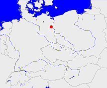
Diese Karte zeigt die Position oder den Umriss des Objekts. Haben Sie einen Fehler entdeckt? Dann würden wir uns über eine Nachricht freuen.
Übergeordnete Objekte
Legende
| | politische Verwaltung |
| | kirchliche Verwaltung |
| | gerichtliche Verwaltung |
| | Wohnplatz |
| | geographische Typen |
| | Verkehrswesen |
Quicktext
object_1081717
	has 1895-12-02 area 3.96 sagt source_1023281 (S. 30 / 31),
	has 1895-12-02 households 47 sagt source_1023281 (S. 30 / 31),
	has 1895-12-02 population 207 sagt source_1023281 (S. 30 / 31),
	has 1910-12-01 population 185 sagt source_265044,
	has 1925 population 316 sagt source_263605,
	has 1933 population 282 sagt source_190312 sagt source_263605,
	has 1939 population 261 sagt source_190312,
	has 1946 population 350 sagt source_284918,
	has 1993 population 158 sagt source_263605,
	has 1994 population 171 sagt source_263605,
	has 1995 population 172 sagt source_263605,
	has 1996 population 154 sagt source_263605,
	has 1997 population 155 sagt source_263605,
	has 1998 population 173 sagt source_263605,
	has 1999 population 171 sagt source_263605,
	has 2000 population 188 sagt source_263605,
	has 2001 population 201 sagt source_263605,
	has 2006 population 193 sagt source_284734,
	has denomination ev,
	has from 1991-07-01 until 1993-12-05 municipal id 12045050 sagt source_1077051,
	has from 1993-07-01 postal code 15245,
	has from 1993-12-06 until 2002-12-30 municipal id 12064080 sagt source_290784,
	has name (in deu) Altreetz,
	has name (in deu) Buchholz,
	has until 1993-06-30 postal code O1261,
	is (in deu) Kirchengemeinde sagt source_1043590 (Seite 29) sagt source_1085418 (Seite 264 Nr. 11 C),
	is 1895-12-02 part of object_1165018 sagt source_1023281 (S. 30 / 31),
	is 1895-12-02 part of object_285641 sagt source_1023281 (S. 30 / 31),
	is 1937 part of object_1081599 sagt source_1085418 (Seite 265 Nr. 11 c),
	is 1952-01-01 part of object_1333274 sagt source_1331591,
	is 1985 part of object_1081592 sagt source_1043590 (Seite 29),
	is 1992-12-31 part of object_1154030 sagt source_1331592,
	is from 1874-10-02 part of object_1147228 sagt source_1023281 (S. 30 / 31) sagt source_1331590 sagt source_1335057 (Beilage S. 8 Nr. 17),
	is from 1935-04-01 until 2002-12-30 (in deu) Gemeinde sagt source_1077051 sagt source_190312 sagt source_284918 sagt source_290784,
	is from 1950-07-01 until 1952-07-24 part of object_263366 sagt source_284918 sagt source_298652 (Seite 274),
	is from 1952-07-25 until 1993-12-05 part of adm_142045 sagt source_290784,
	is from 1993-06-23 until 2002-12-30 part of object_264395 sagt source_264453 sagt source_290784,
	is from 1993-12-06 until 2002-12-30 part of adm_142064 sagt source_290784,
	is until 1935-03-31 (in deu) Landgemeinde sagt source_1023281 (Nr. 25 Seite 30 / 31) sagt source_265044,
	is until 1950-06-30 part of object_263367 sagt source_1023281 (Seite 30 / 31) sagt source_265044 sagt source_298652 (Seite 274);
