Annaberg-Buchholz/St.Annenkirche
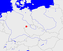
Diese Karte zeigt die Position oder den Umriss des Objekts. Haben Sie einen Fehler entdeckt? Dann würden wir uns über eine Nachricht freuen.
Übergeordnete Objekte
Legende
| | politische Verwaltung |
| | kirchliche Verwaltung |
| | gerichtliche Verwaltung |
| | Wohnplatz |
| | geographische Typen |
| | Verkehrswesen |
Übergeordnete Objekte
- Annaberg-Buchholz/St.Annen (Kirchspiel)
- Annaberg (Stadt Stadtteil)
- Annaberg-Buchholz/St.Annen (Kirchspiel)
- Annaberg (Amtshauptmannschaft Landkreis Kreis Landkreis)
- Sachsen, Saxony, Sasko, Saksonia, Саксония, Saksen (Herzogtum Kurfürstentum Königreich Freistaat Land Bundesland)
- Deutsches Reich, German Empire, Duitse Rijk (Bundesstaat)
- Bundesrepublik Deutschland, Deutschland, Federal Republic of Germany, Герма́ния, Vokietija, Nemecká spolková republika, Germany, Tyskland, Duitsland, Allemagne, Niemcy (Bundesstaat)
- Europäische Wirtschaftsgemeinschaft, Europäische Gemeinschaft, Europäische Union, Evropské hospodářské společenství, Euroopan talousyhteisö, Európske hospodárske spoločenstvo, Communauté économique européenne, Comhphobal Eacnamaíochta na hEorpa, Europese Economische Gemeenschap, European Economic Community, Comunità Economica Europea, Comunidad Económica Europea, Europese Gemeenschap, Evropské společenství, Communauté européenne, Európske spoločenstvo, Comhphobal Eorpach, Comunità Europea, Comunidad Europea, European Community, Euroopan Yhteisö, Evropská unie, Unione Europea, Euroopan Unioni, Aontais Eorpaigh, European Union, Unión Europea, Europese Unie, Union européenne, Európska únia (Staatenbund)
- Vereinte Nationen, Verenigde Naties, Организация Объединённых Наций, Organisation des Nations unies, 联合国, Organización de las Naciones Unidas, United Nations, الأمم المتحدة, Organizácia Spojených národov (Staatenbund)
- Rheinbund, Confédération du Rhin (Staatenbund)
- Sowjetische Besatzungszone, SBZ (Besatzungszone)
- Norddeutscher Bund (Staatenbund Bundesstaat)
- Deutscher Bund, German Confederation (Staatenbund)
- Obersächsischer Reichskreis (Reichskreis)
- DDR, Deutsche Demokratische Republik, German Democratic Republic, République démocratique allemande, Duitse Democratische Republiek (Staat)
- Chemnitz (Kreishauptmannschaft Regierungsbezirk Regierungsbezirk)
- Sachsen, Saxony, Sasko, Saksonia, Саксония, Saksen (Herzogtum Kurfürstentum Königreich Freistaat Land Bundesland)
- Deutsches Reich, German Empire, Duitse Rijk (Bundesstaat)
- Bundesrepublik Deutschland, Deutschland, Federal Republic of Germany, Герма́ния, Vokietija, Nemecká spolková republika, Germany, Tyskland, Duitsland, Allemagne, Niemcy (Bundesstaat)
- Europäische Wirtschaftsgemeinschaft, Europäische Gemeinschaft, Europäische Union, Evropské hospodářské společenství, Euroopan talousyhteisö, Európske hospodárske spoločenstvo, Communauté économique européenne, Comhphobal Eacnamaíochta na hEorpa, Europese Economische Gemeenschap, European Economic Community, Comunità Economica Europea, Comunidad Económica Europea, Europese Gemeenschap, Evropské společenství, Communauté européenne, Európske spoločenstvo, Comhphobal Eorpach, Comunità Europea, Comunidad Europea, European Community, Euroopan Yhteisö, Evropská unie, Unione Europea, Euroopan Unioni, Aontais Eorpaigh, European Union, Unión Europea, Europese Unie, Union européenne, Európska únia (Staatenbund)
- Vereinte Nationen, Verenigde Naties, Организация Объединённых Наций, Organisation des Nations unies, 联合国, Organización de las Naciones Unidas, United Nations, الأمم المتحدة, Organizácia Spojených národov (Staatenbund)
- Rheinbund, Confédération du Rhin (Staatenbund)
- Sowjetische Besatzungszone, SBZ (Besatzungszone)
- Norddeutscher Bund (Staatenbund Bundesstaat)
- Deutscher Bund, German Confederation (Staatenbund)
- Obersächsischer Reichskreis (Reichskreis)
- DDR, Deutsche Demokratische Republik, German Democratic Republic, République démocratique allemande, Duitse Democratische Republiek (Staat)
- Chemnitz, Karl-Marx-Stadt, Chemnitz (Bezirk)
- Chemnitz (Kreishauptmannschaft Regierungsbezirk Regierungsbezirk)
- Sachsen, Saxony, Sasko, Saksonia, Саксония, Saksen (Herzogtum Kurfürstentum Königreich Freistaat Land Bundesland)
- Deutsches Reich, German Empire, Duitse Rijk (Bundesstaat)
- Bundesrepublik Deutschland, Deutschland, Federal Republic of Germany, Герма́ния, Vokietija, Nemecká spolková republika, Germany, Tyskland, Duitsland, Allemagne, Niemcy (Bundesstaat)
- Europäische Wirtschaftsgemeinschaft, Europäische Gemeinschaft, Europäische Union, Evropské hospodářské společenství, Euroopan talousyhteisö, Európske hospodárske spoločenstvo, Communauté économique européenne, Comhphobal Eacnamaíochta na hEorpa, Europese Economische Gemeenschap, European Economic Community, Comunità Economica Europea, Comunidad Económica Europea, Europese Gemeenschap, Evropské společenství, Communauté européenne, Európske spoločenstvo, Comhphobal Eorpach, Comunità Europea, Comunidad Europea, European Community, Euroopan Yhteisö, Evropská unie, Unione Europea, Euroopan Unioni, Aontais Eorpaigh, European Union, Unión Europea, Europese Unie, Union européenne, Európska únia (Staatenbund)
- Vereinte Nationen, Verenigde Naties, Организация Объединённых Наций, Organisation des Nations unies, 联合国, Organización de las Naciones Unidas, United Nations, الأمم المتحدة, Organizácia Spojených národov (Staatenbund)
- Rheinbund, Confédération du Rhin (Staatenbund)
- Sowjetische Besatzungszone, SBZ (Besatzungszone)
- Norddeutscher Bund (Staatenbund Bundesstaat)
- Deutscher Bund, German Confederation (Staatenbund)
- Obersächsischer Reichskreis (Reichskreis)
- DDR, Deutsche Demokratische Republik, German Democratic Republic, République démocratique allemande, Duitse Democratische Republiek (Staat)
- Sachsen, Saxony, Sasko, Saksonia, Саксония, Saksen (Herzogtum Kurfürstentum Königreich Freistaat Land Bundesland)
- Deutsches Reich, German Empire, Duitse Rijk (Bundesstaat)
- Bundesrepublik Deutschland, Deutschland, Federal Republic of Germany, Герма́ния, Vokietija, Nemecká spolková republika, Germany, Tyskland, Duitsland, Allemagne, Niemcy (Bundesstaat)
- Europäische Wirtschaftsgemeinschaft, Europäische Gemeinschaft, Europäische Union, Evropské hospodářské společenství, Euroopan talousyhteisö, Európske hospodárske spoločenstvo, Communauté économique européenne, Comhphobal Eacnamaíochta na hEorpa, Europese Economische Gemeenschap, European Economic Community, Comunità Economica Europea, Comunidad Económica Europea, Europese Gemeenschap, Evropské společenství, Communauté européenne, Európske spoločenstvo, Comhphobal Eorpach, Comunità Europea, Comunidad Europea, European Community, Euroopan Yhteisö, Evropská unie, Unione Europea, Euroopan Unioni, Aontais Eorpaigh, European Union, Unión Europea, Europese Unie, Union européenne, Európska únia (Staatenbund)
- Vereinte Nationen, Verenigde Naties, Организация Объединённых Наций, Organisation des Nations unies, 联合国, Organización de las Naciones Unidas, United Nations, الأمم المتحدة, Organizácia Spojených národov (Staatenbund)
- Rheinbund, Confédération du Rhin (Staatenbund)
- Sowjetische Besatzungszone, SBZ (Besatzungszone)
- Norddeutscher Bund (Staatenbund Bundesstaat)
- Deutscher Bund, German Confederation (Staatenbund)
- Obersächsischer Reichskreis (Reichskreis)
- DDR, Deutsche Demokratische Republik, German Democratic Republic, République démocratique allemande, Duitse Democratische Republiek (Staat)
- Zwickau (Kreisdirektion)
- Sachsen, Saxony, Sasko, Saksonia, Саксония, Saksen (Herzogtum Kurfürstentum Königreich Freistaat Land Bundesland)
- Deutsches Reich, German Empire, Duitse Rijk (Bundesstaat)
- Bundesrepublik Deutschland, Deutschland, Federal Republic of Germany, Герма́ния, Vokietija, Nemecká spolková republika, Germany, Tyskland, Duitsland, Allemagne, Niemcy (Bundesstaat)
- Europäische Wirtschaftsgemeinschaft, Europäische Gemeinschaft, Europäische Union, Evropské hospodářské společenství, Euroopan talousyhteisö, Európske hospodárske spoločenstvo, Communauté économique européenne, Comhphobal Eacnamaíochta na hEorpa, Europese Economische Gemeenschap, European Economic Community, Comunità Economica Europea, Comunidad Económica Europea, Europese Gemeenschap, Evropské společenství, Communauté européenne, Európske spoločenstvo, Comhphobal Eorpach, Comunità Europea, Comunidad Europea, European Community, Euroopan Yhteisö, Evropská unie, Unione Europea, Euroopan Unioni, Aontais Eorpaigh, European Union, Unión Europea, Europese Unie, Union européenne, Európska únia (Staatenbund)
- Vereinte Nationen, Verenigde Naties, Организация Объединённых Наций, Organisation des Nations unies, 联合国, Organización de las Naciones Unidas, United Nations, الأمم المتحدة, Organizácia Spojených národov (Staatenbund)
- Rheinbund, Confédération du Rhin (Staatenbund)
- Sowjetische Besatzungszone, SBZ (Besatzungszone)
- Norddeutscher Bund (Staatenbund Bundesstaat)
- Deutscher Bund, German Confederation (Staatenbund)
- Obersächsischer Reichskreis (Reichskreis)
- DDR, Deutsche Demokratische Republik, German Democratic Republic, République démocratique allemande, Duitse Democratische Republiek (Staat)
- Zwickau (Kreishauptmannschaft Regierungsbezirk)
- Sachsen, Saxony, Sasko, Saksonia, Саксония, Saksen (Herzogtum Kurfürstentum Königreich Freistaat Land Bundesland)
- Deutsches Reich, German Empire, Duitse Rijk (Bundesstaat)
- Bundesrepublik Deutschland, Deutschland, Federal Republic of Germany, Герма́ния, Vokietija, Nemecká spolková republika, Germany, Tyskland, Duitsland, Allemagne, Niemcy (Bundesstaat)
- Europäische Wirtschaftsgemeinschaft, Europäische Gemeinschaft, Europäische Union, Evropské hospodářské společenství, Euroopan talousyhteisö, Európske hospodárske spoločenstvo, Communauté économique européenne, Comhphobal Eacnamaíochta na hEorpa, Europese Economische Gemeenschap, European Economic Community, Comunità Economica Europea, Comunidad Económica Europea, Europese Gemeenschap, Evropské společenství, Communauté européenne, Európske spoločenstvo, Comhphobal Eorpach, Comunità Europea, Comunidad Europea, European Community, Euroopan Yhteisö, Evropská unie, Unione Europea, Euroopan Unioni, Aontais Eorpaigh, European Union, Unión Europea, Europese Unie, Union européenne, Európska únia (Staatenbund)
- Vereinte Nationen, Verenigde Naties, Организация Объединённых Наций, Organisation des Nations unies, 联合国, Organización de las Naciones Unidas, United Nations, الأمم المتحدة, Organizácia Spojených národov (Staatenbund)
- Rheinbund, Confédération du Rhin (Staatenbund)
- Sowjetische Besatzungszone, SBZ (Besatzungszone)
- Norddeutscher Bund (Staatenbund Bundesstaat)
- Deutscher Bund, German Confederation (Staatenbund)
- Obersächsischer Reichskreis (Reichskreis)
- DDR, Deutsche Demokratische Republik, German Democratic Republic, République démocratique allemande, Duitse Democratische Republiek (Staat)
- Annaberg-Buchholz (Stadt)
- Erzgebirgskreis (Landkreis)
- Chemnitz (Direktionsbezirk)
- Sachsen, Saxony, Sasko, Saksonia, Саксония, Saksen (Herzogtum Kurfürstentum Königreich Freistaat Land Bundesland)
- Deutsches Reich, German Empire, Duitse Rijk (Bundesstaat)
- Bundesrepublik Deutschland, Deutschland, Federal Republic of Germany, Герма́ния, Vokietija, Nemecká spolková republika, Germany, Tyskland, Duitsland, Allemagne, Niemcy (Bundesstaat)
- Europäische Wirtschaftsgemeinschaft, Europäische Gemeinschaft, Europäische Union, Evropské hospodářské společenství, Euroopan talousyhteisö, Európske hospodárske spoločenstvo, Communauté économique européenne, Comhphobal Eacnamaíochta na hEorpa, Europese Economische Gemeenschap, European Economic Community, Comunità Economica Europea, Comunidad Económica Europea, Europese Gemeenschap, Evropské společenství, Communauté européenne, Európske spoločenstvo, Comhphobal Eorpach, Comunità Europea, Comunidad Europea, European Community, Euroopan Yhteisö, Evropská unie, Unione Europea, Euroopan Unioni, Aontais Eorpaigh, European Union, Unión Europea, Europese Unie, Union européenne, Európska únia (Staatenbund)
- Vereinte Nationen, Verenigde Naties, Организация Объединённых Наций, Organisation des Nations unies, 联合国, Organización de las Naciones Unidas, United Nations, الأمم المتحدة, Organizácia Spojených národov (Staatenbund)
- Rheinbund, Confédération du Rhin (Staatenbund)
- Sowjetische Besatzungszone, SBZ (Besatzungszone)
- Norddeutscher Bund (Staatenbund Bundesstaat)
- Deutscher Bund, German Confederation (Staatenbund)
- Obersächsischer Reichskreis (Reichskreis)
- DDR, Deutsche Demokratische Republik, German Democratic Republic, République démocratique allemande, Duitse Democratische Republiek (Staat)
- Annaberg (Amtshauptmannschaft Landkreis Kreis Landkreis)
- Sachsen, Saxony, Sasko, Saksonia, Саксония, Saksen (Herzogtum Kurfürstentum Königreich Freistaat Land Bundesland)
- Deutsches Reich, German Empire, Duitse Rijk (Bundesstaat)
- Bundesrepublik Deutschland, Deutschland, Federal Republic of Germany, Герма́ния, Vokietija, Nemecká spolková republika, Germany, Tyskland, Duitsland, Allemagne, Niemcy (Bundesstaat)
- Europäische Wirtschaftsgemeinschaft, Europäische Gemeinschaft, Europäische Union, Evropské hospodářské společenství, Euroopan talousyhteisö, Európske hospodárske spoločenstvo, Communauté économique européenne, Comhphobal Eacnamaíochta na hEorpa, Europese Economische Gemeenschap, European Economic Community, Comunità Economica Europea, Comunidad Económica Europea, Europese Gemeenschap, Evropské společenství, Communauté européenne, Európske spoločenstvo, Comhphobal Eorpach, Comunità Europea, Comunidad Europea, European Community, Euroopan Yhteisö, Evropská unie, Unione Europea, Euroopan Unioni, Aontais Eorpaigh, European Union, Unión Europea, Europese Unie, Union européenne, Európska únia (Staatenbund)
- Vereinte Nationen, Verenigde Naties, Организация Объединённых Наций, Organisation des Nations unies, 联合国, Organización de las Naciones Unidas, United Nations, الأمم المتحدة, Organizácia Spojených národov (Staatenbund)
- Rheinbund, Confédération du Rhin (Staatenbund)
- Sowjetische Besatzungszone, SBZ (Besatzungszone)
- Norddeutscher Bund (Staatenbund Bundesstaat)
- Deutscher Bund, German Confederation (Staatenbund)
- Obersächsischer Reichskreis (Reichskreis)
- DDR, Deutsche Demokratische Republik, German Democratic Republic, République démocratique allemande, Duitse Democratische Republiek (Staat)
- Chemnitz (Kreishauptmannschaft Regierungsbezirk Regierungsbezirk)
- Sachsen, Saxony, Sasko, Saksonia, Саксония, Saksen (Herzogtum Kurfürstentum Königreich Freistaat Land Bundesland)
- Deutsches Reich, German Empire, Duitse Rijk (Bundesstaat)
- Bundesrepublik Deutschland, Deutschland, Federal Republic of Germany, Герма́ния, Vokietija, Nemecká spolková republika, Germany, Tyskland, Duitsland, Allemagne, Niemcy (Bundesstaat)
- Europäische Wirtschaftsgemeinschaft, Europäische Gemeinschaft, Europäische Union, Evropské hospodářské společenství, Euroopan talousyhteisö, Európske hospodárske spoločenstvo, Communauté économique européenne, Comhphobal Eacnamaíochta na hEorpa, Europese Economische Gemeenschap, European Economic Community, Comunità Economica Europea, Comunidad Económica Europea, Europese Gemeenschap, Evropské společenství, Communauté européenne, Európske spoločenstvo, Comhphobal Eorpach, Comunità Europea, Comunidad Europea, European Community, Euroopan Yhteisö, Evropská unie, Unione Europea, Euroopan Unioni, Aontais Eorpaigh, European Union, Unión Europea, Europese Unie, Union européenne, Európska únia (Staatenbund)
- Vereinte Nationen, Verenigde Naties, Организация Объединённых Наций, Organisation des Nations unies, 联合国, Organización de las Naciones Unidas, United Nations, الأمم المتحدة, Organizácia Spojených národov (Staatenbund)
- Rheinbund, Confédération du Rhin (Staatenbund)
- Sowjetische Besatzungszone, SBZ (Besatzungszone)
- Norddeutscher Bund (Staatenbund Bundesstaat)
- Deutscher Bund, German Confederation (Staatenbund)
- Obersächsischer Reichskreis (Reichskreis)
- DDR, Deutsche Demokratische Republik, German Democratic Republic, République démocratique allemande, Duitse Democratische Republiek (Staat)
- Sachsen, Saxony, Sasko, Saksonia, Саксония, Saksen (Herzogtum Kurfürstentum Königreich Freistaat Land Bundesland)
- Deutsches Reich, German Empire, Duitse Rijk (Bundesstaat)
- Bundesrepublik Deutschland, Deutschland, Federal Republic of Germany, Герма́ния, Vokietija, Nemecká spolková republika, Germany, Tyskland, Duitsland, Allemagne, Niemcy (Bundesstaat)
- Europäische Wirtschaftsgemeinschaft, Europäische Gemeinschaft, Europäische Union, Evropské hospodářské společenství, Euroopan talousyhteisö, Európske hospodárske spoločenstvo, Communauté économique européenne, Comhphobal Eacnamaíochta na hEorpa, Europese Economische Gemeenschap, European Economic Community, Comunità Economica Europea, Comunidad Económica Europea, Europese Gemeenschap, Evropské společenství, Communauté européenne, Európske spoločenstvo, Comhphobal Eorpach, Comunità Europea, Comunidad Europea, European Community, Euroopan Yhteisö, Evropská unie, Unione Europea, Euroopan Unioni, Aontais Eorpaigh, European Union, Unión Europea, Europese Unie, Union européenne, Európska únia (Staatenbund)
- Vereinte Nationen, Verenigde Naties, Организация Объединённых Наций, Organisation des Nations unies, 联合国, Organización de las Naciones Unidas, United Nations, الأمم المتحدة, Organizácia Spojených národov (Staatenbund)
- Rheinbund, Confédération du Rhin (Staatenbund)
- Sowjetische Besatzungszone, SBZ (Besatzungszone)
- Norddeutscher Bund (Staatenbund Bundesstaat)
- Deutscher Bund, German Confederation (Staatenbund)
- Obersächsischer Reichskreis (Reichskreis)
- DDR, Deutsche Demokratische Republik, German Democratic Republic, République démocratique allemande, Duitse Democratische Republiek (Staat)
- Chemnitz, Karl-Marx-Stadt, Chemnitz (Bezirk)
- Chemnitz (Kreishauptmannschaft Regierungsbezirk Regierungsbezirk)
- Sachsen, Saxony, Sasko, Saksonia, Саксония, Saksen (Herzogtum Kurfürstentum Königreich Freistaat Land Bundesland)
- Deutsches Reich, German Empire, Duitse Rijk (Bundesstaat)
- Bundesrepublik Deutschland, Deutschland, Federal Republic of Germany, Герма́ния, Vokietija, Nemecká spolková republika, Germany, Tyskland, Duitsland, Allemagne, Niemcy (Bundesstaat)
- Europäische Wirtschaftsgemeinschaft, Europäische Gemeinschaft, Europäische Union, Evropské hospodářské společenství, Euroopan talousyhteisö, Európske hospodárske spoločenstvo, Communauté économique européenne, Comhphobal Eacnamaíochta na hEorpa, Europese Economische Gemeenschap, European Economic Community, Comunità Economica Europea, Comunidad Económica Europea, Europese Gemeenschap, Evropské společenství, Communauté européenne, Európske spoločenstvo, Comhphobal Eorpach, Comunità Europea, Comunidad Europea, European Community, Euroopan Yhteisö, Evropská unie, Unione Europea, Euroopan Unioni, Aontais Eorpaigh, European Union, Unión Europea, Europese Unie, Union européenne, Európska únia (Staatenbund)
- Vereinte Nationen, Verenigde Naties, Организация Объединённых Наций, Organisation des Nations unies, 联合国, Organización de las Naciones Unidas, United Nations, الأمم المتحدة, Organizácia Spojených národov (Staatenbund)
- Rheinbund, Confédération du Rhin (Staatenbund)
- Sowjetische Besatzungszone, SBZ (Besatzungszone)
- Norddeutscher Bund (Staatenbund Bundesstaat)
- Deutscher Bund, German Confederation (Staatenbund)
- Obersächsischer Reichskreis (Reichskreis)
- DDR, Deutsche Demokratische Republik, German Democratic Republic, République démocratique allemande, Duitse Democratische Republiek (Staat)
- Sachsen, Saxony, Sasko, Saksonia, Саксония, Saksen (Herzogtum Kurfürstentum Königreich Freistaat Land Bundesland)
- Deutsches Reich, German Empire, Duitse Rijk (Bundesstaat)
- Bundesrepublik Deutschland, Deutschland, Federal Republic of Germany, Герма́ния, Vokietija, Nemecká spolková republika, Germany, Tyskland, Duitsland, Allemagne, Niemcy (Bundesstaat)
- Europäische Wirtschaftsgemeinschaft, Europäische Gemeinschaft, Europäische Union, Evropské hospodářské společenství, Euroopan talousyhteisö, Európske hospodárske spoločenstvo, Communauté économique européenne, Comhphobal Eacnamaíochta na hEorpa, Europese Economische Gemeenschap, European Economic Community, Comunità Economica Europea, Comunidad Económica Europea, Europese Gemeenschap, Evropské společenství, Communauté européenne, Európske spoločenstvo, Comhphobal Eorpach, Comunità Europea, Comunidad Europea, European Community, Euroopan Yhteisö, Evropská unie, Unione Europea, Euroopan Unioni, Aontais Eorpaigh, European Union, Unión Europea, Europese Unie, Union européenne, Európska únia (Staatenbund)
- Vereinte Nationen, Verenigde Naties, Организация Объединённых Наций, Organisation des Nations unies, 联合国, Organización de las Naciones Unidas, United Nations, الأمم المتحدة, Organizácia Spojených národov (Staatenbund)
- Rheinbund, Confédération du Rhin (Staatenbund)
- Sowjetische Besatzungszone, SBZ (Besatzungszone)
- Norddeutscher Bund (Staatenbund Bundesstaat)
- Deutscher Bund, German Confederation (Staatenbund)
- Obersächsischer Reichskreis (Reichskreis)
- DDR, Deutsche Demokratische Republik, German Democratic Republic, République démocratique allemande, Duitse Democratische Republiek (Staat)
- Zwickau (Kreisdirektion)
- Sachsen, Saxony, Sasko, Saksonia, Саксония, Saksen (Herzogtum Kurfürstentum Königreich Freistaat Land Bundesland)
- Deutsches Reich, German Empire, Duitse Rijk (Bundesstaat)
- Bundesrepublik Deutschland, Deutschland, Federal Republic of Germany, Герма́ния, Vokietija, Nemecká spolková republika, Germany, Tyskland, Duitsland, Allemagne, Niemcy (Bundesstaat)
- Europäische Wirtschaftsgemeinschaft, Europäische Gemeinschaft, Europäische Union, Evropské hospodářské společenství, Euroopan talousyhteisö, Európske hospodárske spoločenstvo, Communauté économique européenne, Comhphobal Eacnamaíochta na hEorpa, Europese Economische Gemeenschap, European Economic Community, Comunità Economica Europea, Comunidad Económica Europea, Europese Gemeenschap, Evropské společenství, Communauté européenne, Európske spoločenstvo, Comhphobal Eorpach, Comunità Europea, Comunidad Europea, European Community, Euroopan Yhteisö, Evropská unie, Unione Europea, Euroopan Unioni, Aontais Eorpaigh, European Union, Unión Europea, Europese Unie, Union européenne, Európska únia (Staatenbund)
- Vereinte Nationen, Verenigde Naties, Организация Объединённых Наций, Organisation des Nations unies, 联合国, Organización de las Naciones Unidas, United Nations, الأمم المتحدة, Organizácia Spojených národov (Staatenbund)
- Rheinbund, Confédération du Rhin (Staatenbund)
- Sowjetische Besatzungszone, SBZ (Besatzungszone)
- Norddeutscher Bund (Staatenbund Bundesstaat)
- Deutscher Bund, German Confederation (Staatenbund)
- Obersächsischer Reichskreis (Reichskreis)
- DDR, Deutsche Demokratische Republik, German Democratic Republic, République démocratique allemande, Duitse Democratische Republiek (Staat)
- Zwickau (Kreishauptmannschaft Regierungsbezirk)
- Sachsen, Saxony, Sasko, Saksonia, Саксония, Saksen (Herzogtum Kurfürstentum Königreich Freistaat Land Bundesland)
- Deutsches Reich, German Empire, Duitse Rijk (Bundesstaat)
- Bundesrepublik Deutschland, Deutschland, Federal Republic of Germany, Герма́ния, Vokietija, Nemecká spolková republika, Germany, Tyskland, Duitsland, Allemagne, Niemcy (Bundesstaat)
- Europäische Wirtschaftsgemeinschaft, Europäische Gemeinschaft, Europäische Union, Evropské hospodářské společenství, Euroopan talousyhteisö, Európske hospodárske spoločenstvo, Communauté économique européenne, Comhphobal Eacnamaíochta na hEorpa, Europese Economische Gemeenschap, European Economic Community, Comunità Economica Europea, Comunidad Económica Europea, Europese Gemeenschap, Evropské společenství, Communauté européenne, Európske spoločenstvo, Comhphobal Eorpach, Comunità Europea, Comunidad Europea, European Community, Euroopan Yhteisö, Evropská unie, Unione Europea, Euroopan Unioni, Aontais Eorpaigh, European Union, Unión Europea, Europese Unie, Union européenne, Európska únia (Staatenbund)
- Vereinte Nationen, Verenigde Naties, Организация Объединённых Наций, Organisation des Nations unies, 联合国, Organización de las Naciones Unidas, United Nations, الأمم المتحدة, Organizácia Spojených národov (Staatenbund)
- Rheinbund, Confédération du Rhin (Staatenbund)
- Sowjetische Besatzungszone, SBZ (Besatzungszone)
- Norddeutscher Bund (Staatenbund Bundesstaat)
- Deutscher Bund, German Confederation (Staatenbund)
- Obersächsischer Reichskreis (Reichskreis)
- DDR, Deutsche Demokratische Republik, German Democratic Republic, République démocratique allemande, Duitse Democratische Republiek (Staat)
Quicktext
object_174163
	has 1875 population 136 sagt source_284413,
	has 1890 population 185 sagt source_284413,
	has 1895-12-02 area 1.941 sagt source_1023281 (S. 236 / 237),
	has 1895-12-02 households 16 sagt source_1023281 (S. 236 / 237),
	has 1895-12-02 population 96 sagt source_1023281 (S. 236 / 237),
	has 1910 population 679 sagt source_1347388 (p. 119),
	has 1910-12-01 population 88 sagt source_265044,
	has 1911 area 9.86 sagt source_1347388 (p. 119),
	has 1925 population 193 sagt source_284413,
	has 1933 population 126 sagt source_190312 sagt source_284413,
	has 1939 population 137 sagt source_190312,
	has 1946 population 198 sagt source_284918,
	has 1970 area 8.33 sagt source_1343040 (B S. 84),
	has 1970 population 505 sagt source_1343040 (B S. 84),
	has 1993 population 123 sagt source_284413,
	has 1994 population 124 sagt source_284413,
	has 1995 population 121 sagt source_284413,
	has 1996 population 114 sagt source_284413,
	has 1997 population 113 sagt source_284413,
	has 1998 population 115 sagt source_284413,
	has 1999 population 118 sagt source_284413,
	has 2000 population 119 sagt source_284413,
	has 2006 population 117 sagt source_284734,
	has URL  https://de.wikipedia.org/wiki/Dietersdorf_(Schönsee),
	has denomination lu,
	has from 1991-07-01 until 1993-12-05 municipal id 12014620 sagt source_1077051,
	has from 1993-07-01 postal code 15848,
	has from 1993-12-06 until 2001-03-30 municipal id 12067416 sagt source_290784,
	has name (in deu) Annaberg-Buchholz/St.Annenkirche sagt source_1304492 (p. 10),
	has name (in deu) Dietersdorf,
	has name (in deu) Reudnitz,
	has until 1993-06-30 postal code O1230,
	is (in deu) Kirche,
	is 1895-12-02 part of object_1273142 sagt source_1023281 (S. 236 / 237),
	is 1895-12-02 part of object_285668 sagt source_1023281 (S. 236 / 237),
	is 1952-01-01 part of object_1155305 sagt source_1331591 sagt source_1331592,
	is from 1840 until 1971-12-31 part of object_286397,
	is from 1862-07-01 until 1900-09-30 part of object_1049803,
	is from 1874-10-01 part of object_1149808 sagt source_1023281 (S. 236 / 237) sagt source_1331590 sagt source_1335058 (Außerordentliche Beilage S. 16 Nr. 24) sagt source_1336431 (§ 55),
	is from 1900-10-01 until 1971-12-31 part of object_1177091,
	is from 1935-04-01 until 2001-03-30 (in deu) Gemeinde sagt source_190312 sagt source_284918,
	is from 1950-07-01 until 1952-07-24 part of object_263384 sagt source_298652,
	is from 1952-07-25 until 1993-12-05 part of adm_142014 sagt source_290784,
	is from 1992-09-15 until 2001-03-30 part of object_152457 sagt source_290784,
	is from 1993-12-06 until 2001-03-30 part of adm_142067 sagt source_290784,
	is located in ANNERGJO60MN,
	is until 1840 part of object_286470 sagt source_1350281 sagt source_1350293 sagt source_1350294,
	is until 1935-03-31 (in deu) Landgemeinde sagt source_1023281 (Nr. 67 Seite 236 / 237) sagt source_265044,
	is until 1950-06-30 part of adm_142031 sagt source_1023281 (Seite 236 / 237) sagt source_190312 sagt source_265044 sagt source_298444,
	is until 1971-12-31 (in deu) Gemeinde,
	located at 50.5787°N 13.0051°O,
	represents  object_174162;
