Remse-Weidensdorf
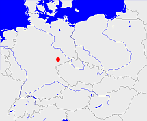
Diese Karte zeigt die Position oder den Umriss des Objekts. Haben Sie einen Fehler entdeckt? Dann würden wir uns über eine Nachricht freuen.
Übergeordnete Objekte
Legende
| | politische Verwaltung |
| | kirchliche Verwaltung |
| | gerichtliche Verwaltung |
| | Wohnplatz |
| | geographische Typen |
| | Verkehrswesen |
Übergeordnete Objekte
- Remse-Weidensdorf (Kirchspiel)
- Weidensdorf (Dorf Ortsteil)
- Remse (Gemeinde)
- Zwickau (Landkreis)
- Chemnitz (Direktionsbezirk)
- Sachsen, Saxony, Sasko, Saksonia, Саксония, Saksen (Herzogtum Kurfürstentum Königreich Freistaat Land Bundesland)
- Deutsches Reich, German Empire, Duitse Rijk (Bundesstaat)
- Bundesrepublik Deutschland, Deutschland, Federal Republic of Germany, Герма́ния, Vokietija, Nemecká spolková republika, Germany, Tyskland, Duitsland, Allemagne, Niemcy (Bundesstaat)
- Europäische Wirtschaftsgemeinschaft, Europäische Gemeinschaft, Europäische Union, Evropské hospodářské společenství, Euroopan talousyhteisö, Európske hospodárske spoločenstvo, Communauté économique européenne, Comhphobal Eacnamaíochta na hEorpa, Europese Economische Gemeenschap, European Economic Community, Comunità Economica Europea, Comunidad Económica Europea, Europese Gemeenschap, Evropské společenství, Communauté européenne, Európske spoločenstvo, Comhphobal Eorpach, Comunità Europea, Comunidad Europea, European Community, Euroopan Yhteisö, Evropská unie, Unione Europea, Euroopan Unioni, Aontais Eorpaigh, European Union, Unión Europea, Europese Unie, Union européenne, Európska únia (Staatenbund)
- Vereinte Nationen, Verenigde Naties, Организация Объединённых Наций, Organisation des Nations unies, 联合国, Organización de las Naciones Unidas, United Nations, الأمم المتحدة, Organizácia Spojených národov (Staatenbund)
- Rheinbund, Confédération du Rhin (Staatenbund)
- Sowjetische Besatzungszone, SBZ (Besatzungszone)
- Norddeutscher Bund (Staatenbund Bundesstaat)
- Deutscher Bund, German Confederation (Staatenbund)
- Obersächsischer Reichskreis (Reichskreis)
- DDR, Deutsche Demokratische Republik, German Democratic Republic, République démocratique allemande, Duitse Democratische Republiek (Staat)
- Waldenburg (Verwaltungsgemeinschaft)
- Chemnitz (Amtshauptmannschaft Landkreis Kreis Landkreis)
- Zwickau (Kreisdirektion)
- Sachsen, Saxony, Sasko, Saksonia, Саксония, Saksen (Herzogtum Kurfürstentum Königreich Freistaat Land Bundesland)
- Deutsches Reich, German Empire, Duitse Rijk (Bundesstaat)
- Bundesrepublik Deutschland, Deutschland, Federal Republic of Germany, Герма́ния, Vokietija, Nemecká spolková republika, Germany, Tyskland, Duitsland, Allemagne, Niemcy (Bundesstaat)
- Europäische Wirtschaftsgemeinschaft, Europäische Gemeinschaft, Europäische Union, Evropské hospodářské společenství, Euroopan talousyhteisö, Európske hospodárske spoločenstvo, Communauté économique européenne, Comhphobal Eacnamaíochta na hEorpa, Europese Economische Gemeenschap, European Economic Community, Comunità Economica Europea, Comunidad Económica Europea, Europese Gemeenschap, Evropské společenství, Communauté européenne, Európske spoločenstvo, Comhphobal Eorpach, Comunità Europea, Comunidad Europea, European Community, Euroopan Yhteisö, Evropská unie, Unione Europea, Euroopan Unioni, Aontais Eorpaigh, European Union, Unión Europea, Europese Unie, Union européenne, Európska únia (Staatenbund)
- Vereinte Nationen, Verenigde Naties, Организация Объединённых Наций, Organisation des Nations unies, 联合国, Organización de las Naciones Unidas, United Nations, الأمم المتحدة, Organizácia Spojených národov (Staatenbund)
- Rheinbund, Confédération du Rhin (Staatenbund)
- Sowjetische Besatzungszone, SBZ (Besatzungszone)
- Norddeutscher Bund (Staatenbund Bundesstaat)
- Deutscher Bund, German Confederation (Staatenbund)
- Obersächsischer Reichskreis (Reichskreis)
- DDR, Deutsche Demokratische Republik, German Democratic Republic, République démocratique allemande, Duitse Democratische Republiek (Staat)
- Chemnitz (Kreishauptmannschaft Regierungsbezirk Regierungsbezirk)
- Sachsen, Saxony, Sasko, Saksonia, Саксония, Saksen (Herzogtum Kurfürstentum Königreich Freistaat Land Bundesland)
- Deutsches Reich, German Empire, Duitse Rijk (Bundesstaat)
- Bundesrepublik Deutschland, Deutschland, Federal Republic of Germany, Герма́ния, Vokietija, Nemecká spolková republika, Germany, Tyskland, Duitsland, Allemagne, Niemcy (Bundesstaat)
- Europäische Wirtschaftsgemeinschaft, Europäische Gemeinschaft, Europäische Union, Evropské hospodářské společenství, Euroopan talousyhteisö, Európske hospodárske spoločenstvo, Communauté économique européenne, Comhphobal Eacnamaíochta na hEorpa, Europese Economische Gemeenschap, European Economic Community, Comunità Economica Europea, Comunidad Económica Europea, Europese Gemeenschap, Evropské společenství, Communauté européenne, Európske spoločenstvo, Comhphobal Eorpach, Comunità Europea, Comunidad Europea, European Community, Euroopan Yhteisö, Evropská unie, Unione Europea, Euroopan Unioni, Aontais Eorpaigh, European Union, Unión Europea, Europese Unie, Union européenne, Európska únia (Staatenbund)
- Vereinte Nationen, Verenigde Naties, Организация Объединённых Наций, Organisation des Nations unies, 联合国, Organización de las Naciones Unidas, United Nations, الأمم المتحدة, Organizácia Spojených národov (Staatenbund)
- Rheinbund, Confédération du Rhin (Staatenbund)
- Sowjetische Besatzungszone, SBZ (Besatzungszone)
- Norddeutscher Bund (Staatenbund Bundesstaat)
- Deutscher Bund, German Confederation (Staatenbund)
- Obersächsischer Reichskreis (Reichskreis)
- DDR, Deutsche Demokratische Republik, German Democratic Republic, République démocratique allemande, Duitse Democratische Republiek (Staat)
- Chemnitz, Karl-Marx-Stadt, Chemnitz (Bezirk)
- Zwickau (Kreishauptmannschaft Regierungsbezirk)
- Sachsen, Saxony, Sasko, Saksonia, Саксония, Saksen (Herzogtum Kurfürstentum Königreich Freistaat Land Bundesland)
- Deutsches Reich, German Empire, Duitse Rijk (Bundesstaat)
- Bundesrepublik Deutschland, Deutschland, Federal Republic of Germany, Герма́ния, Vokietija, Nemecká spolková republika, Germany, Tyskland, Duitsland, Allemagne, Niemcy (Bundesstaat)
- Europäische Wirtschaftsgemeinschaft, Europäische Gemeinschaft, Europäische Union, Evropské hospodářské společenství, Euroopan talousyhteisö, Európske hospodárske spoločenstvo, Communauté économique européenne, Comhphobal Eacnamaíochta na hEorpa, Europese Economische Gemeenschap, European Economic Community, Comunità Economica Europea, Comunidad Económica Europea, Europese Gemeenschap, Evropské společenství, Communauté européenne, Európske spoločenstvo, Comhphobal Eorpach, Comunità Europea, Comunidad Europea, European Community, Euroopan Yhteisö, Evropská unie, Unione Europea, Euroopan Unioni, Aontais Eorpaigh, European Union, Unión Europea, Europese Unie, Union européenne, Európska únia (Staatenbund)
- Vereinte Nationen, Verenigde Naties, Организация Объединённых Наций, Organisation des Nations unies, 联合国, Organización de las Naciones Unidas, United Nations, الأمم المتحدة, Organizácia Spojených národov (Staatenbund)
- Rheinbund, Confédération du Rhin (Staatenbund)
- Sowjetische Besatzungszone, SBZ (Besatzungszone)
- Norddeutscher Bund (Staatenbund Bundesstaat)
- Deutscher Bund, German Confederation (Staatenbund)
- Obersächsischer Reichskreis (Reichskreis)
- DDR, Deutsche Demokratische Republik, German Democratic Republic, République démocratique allemande, Duitse Democratische Republiek (Staat)
- Chemnitz (Kreishauptmannschaft Regierungsbezirk Regierungsbezirk)
- Sachsen, Saxony, Sasko, Saksonia, Саксония, Saksen (Herzogtum Kurfürstentum Königreich Freistaat Land Bundesland)
- Deutsches Reich, German Empire, Duitse Rijk (Bundesstaat)
- Bundesrepublik Deutschland, Deutschland, Federal Republic of Germany, Герма́ния, Vokietija, Nemecká spolková republika, Germany, Tyskland, Duitsland, Allemagne, Niemcy (Bundesstaat)
- Europäische Wirtschaftsgemeinschaft, Europäische Gemeinschaft, Europäische Union, Evropské hospodářské společenství, Euroopan talousyhteisö, Európske hospodárske spoločenstvo, Communauté économique européenne, Comhphobal Eacnamaíochta na hEorpa, Europese Economische Gemeenschap, European Economic Community, Comunità Economica Europea, Comunidad Económica Europea, Europese Gemeenschap, Evropské společenství, Communauté européenne, Európske spoločenstvo, Comhphobal Eorpach, Comunità Europea, Comunidad Europea, European Community, Euroopan Yhteisö, Evropská unie, Unione Europea, Euroopan Unioni, Aontais Eorpaigh, European Union, Unión Europea, Europese Unie, Union européenne, Európska únia (Staatenbund)
- Vereinte Nationen, Verenigde Naties, Организация Объединённых Наций, Organisation des Nations unies, 联合国, Organización de las Naciones Unidas, United Nations, الأمم المتحدة, Organizácia Spojených národov (Staatenbund)
- Rheinbund, Confédération du Rhin (Staatenbund)
- Sowjetische Besatzungszone, SBZ (Besatzungszone)
- Norddeutscher Bund (Staatenbund Bundesstaat)
- Deutscher Bund, German Confederation (Staatenbund)
- Obersächsischer Reichskreis (Reichskreis)
- DDR, Deutsche Demokratische Republik, German Democratic Republic, République démocratique allemande, Duitse Democratische Republiek (Staat)
- Sachsen, Saxony, Sasko, Saksonia, Саксония, Saksen (Herzogtum Kurfürstentum Königreich Freistaat Land Bundesland)
- Deutsches Reich, German Empire, Duitse Rijk (Bundesstaat)
- Bundesrepublik Deutschland, Deutschland, Federal Republic of Germany, Герма́ния, Vokietija, Nemecká spolková republika, Germany, Tyskland, Duitsland, Allemagne, Niemcy (Bundesstaat)
- Europäische Wirtschaftsgemeinschaft, Europäische Gemeinschaft, Europäische Union, Evropské hospodářské společenství, Euroopan talousyhteisö, Európske hospodárske spoločenstvo, Communauté économique européenne, Comhphobal Eacnamaíochta na hEorpa, Europese Economische Gemeenschap, European Economic Community, Comunità Economica Europea, Comunidad Económica Europea, Europese Gemeenschap, Evropské společenství, Communauté européenne, Európske spoločenstvo, Comhphobal Eorpach, Comunità Europea, Comunidad Europea, European Community, Euroopan Yhteisö, Evropská unie, Unione Europea, Euroopan Unioni, Aontais Eorpaigh, European Union, Unión Europea, Europese Unie, Union européenne, Európska únia (Staatenbund)
- Vereinte Nationen, Verenigde Naties, Организация Объединённых Наций, Organisation des Nations unies, 联合国, Organización de las Naciones Unidas, United Nations, الأمم المتحدة, Organizácia Spojených národov (Staatenbund)
- Rheinbund, Confédération du Rhin (Staatenbund)
- Sowjetische Besatzungszone, SBZ (Besatzungszone)
- Norddeutscher Bund (Staatenbund Bundesstaat)
- Deutscher Bund, German Confederation (Staatenbund)
- Obersächsischer Reichskreis (Reichskreis)
- DDR, Deutsche Demokratische Republik, German Democratic Republic, République démocratique allemande, Duitse Democratische Republiek (Staat)
- Glauchau (Amtshauptmannschaft Landkreis Kreis Landkreis)
- Sachsen, Saxony, Sasko, Saksonia, Саксония, Saksen (Herzogtum Kurfürstentum Königreich Freistaat Land Bundesland)
- Deutsches Reich, German Empire, Duitse Rijk (Bundesstaat)
- Bundesrepublik Deutschland, Deutschland, Federal Republic of Germany, Герма́ния, Vokietija, Nemecká spolková republika, Germany, Tyskland, Duitsland, Allemagne, Niemcy (Bundesstaat)
- Europäische Wirtschaftsgemeinschaft, Europäische Gemeinschaft, Europäische Union, Evropské hospodářské společenství, Euroopan talousyhteisö, Európske hospodárske spoločenstvo, Communauté économique européenne, Comhphobal Eacnamaíochta na hEorpa, Europese Economische Gemeenschap, European Economic Community, Comunità Economica Europea, Comunidad Económica Europea, Europese Gemeenschap, Evropské společenství, Communauté européenne, Európske spoločenstvo, Comhphobal Eorpach, Comunità Europea, Comunidad Europea, European Community, Euroopan Yhteisö, Evropská unie, Unione Europea, Euroopan Unioni, Aontais Eorpaigh, European Union, Unión Europea, Europese Unie, Union européenne, Európska únia (Staatenbund)
- Vereinte Nationen, Verenigde Naties, Организация Объединённых Наций, Organisation des Nations unies, 联合国, Organización de las Naciones Unidas, United Nations, الأمم المتحدة, Organizácia Spojených národov (Staatenbund)
- Rheinbund, Confédération du Rhin (Staatenbund)
- Sowjetische Besatzungszone, SBZ (Besatzungszone)
- Norddeutscher Bund (Staatenbund Bundesstaat)
- Deutscher Bund, German Confederation (Staatenbund)
- Obersächsischer Reichskreis (Reichskreis)
- DDR, Deutsche Demokratische Republik, German Democratic Republic, République démocratique allemande, Duitse Democratische Republiek (Staat)
- Zwickau (Kreishauptmannschaft Regierungsbezirk)
- Sachsen, Saxony, Sasko, Saksonia, Саксония, Saksen (Herzogtum Kurfürstentum Königreich Freistaat Land Bundesland)
- Deutsches Reich, German Empire, Duitse Rijk (Bundesstaat)
- Bundesrepublik Deutschland, Deutschland, Federal Republic of Germany, Герма́ния, Vokietija, Nemecká spolková republika, Germany, Tyskland, Duitsland, Allemagne, Niemcy (Bundesstaat)
- Europäische Wirtschaftsgemeinschaft, Europäische Gemeinschaft, Europäische Union, Evropské hospodářské společenství, Euroopan talousyhteisö, Európske hospodárske spoločenstvo, Communauté économique européenne, Comhphobal Eacnamaíochta na hEorpa, Europese Economische Gemeenschap, European Economic Community, Comunità Economica Europea, Comunidad Económica Europea, Europese Gemeenschap, Evropské společenství, Communauté européenne, Európske spoločenstvo, Comhphobal Eorpach, Comunità Europea, Comunidad Europea, European Community, Euroopan Yhteisö, Evropská unie, Unione Europea, Euroopan Unioni, Aontais Eorpaigh, European Union, Unión Europea, Europese Unie, Union européenne, Európska únia (Staatenbund)
- Vereinte Nationen, Verenigde Naties, Организация Объединённых Наций, Organisation des Nations unies, 联合国, Organización de las Naciones Unidas, United Nations, الأمم المتحدة, Organizácia Spojených národov (Staatenbund)
- Rheinbund, Confédération du Rhin (Staatenbund)
- Sowjetische Besatzungszone, SBZ (Besatzungszone)
- Norddeutscher Bund (Staatenbund Bundesstaat)
- Deutscher Bund, German Confederation (Staatenbund)
- Obersächsischer Reichskreis (Reichskreis)
- DDR, Deutsche Demokratische Republik, German Democratic Republic, République démocratique allemande, Duitse Democratische Republiek (Staat)
- Chemnitz, Karl-Marx-Stadt, Chemnitz (Bezirk)
- Chemnitz (Kreishauptmannschaft Regierungsbezirk Regierungsbezirk)
- Sachsen, Saxony, Sasko, Saksonia, Саксония, Saksen (Herzogtum Kurfürstentum Königreich Freistaat Land Bundesland)
- Deutsches Reich, German Empire, Duitse Rijk (Bundesstaat)
- Bundesrepublik Deutschland, Deutschland, Federal Republic of Germany, Герма́ния, Vokietija, Nemecká spolková republika, Germany, Tyskland, Duitsland, Allemagne, Niemcy (Bundesstaat)
- Europäische Wirtschaftsgemeinschaft, Europäische Gemeinschaft, Europäische Union, Evropské hospodářské společenství, Euroopan talousyhteisö, Európske hospodárske spoločenstvo, Communauté économique européenne, Comhphobal Eacnamaíochta na hEorpa, Europese Economische Gemeenschap, European Economic Community, Comunità Economica Europea, Comunidad Económica Europea, Europese Gemeenschap, Evropské společenství, Communauté européenne, Európske spoločenstvo, Comhphobal Eorpach, Comunità Europea, Comunidad Europea, European Community, Euroopan Yhteisö, Evropská unie, Unione Europea, Euroopan Unioni, Aontais Eorpaigh, European Union, Unión Europea, Europese Unie, Union européenne, Európska únia (Staatenbund)
- Vereinte Nationen, Verenigde Naties, Организация Объединённых Наций, Organisation des Nations unies, 联合国, Organización de las Naciones Unidas, United Nations, الأمم المتحدة, Organizácia Spojených národov (Staatenbund)
- Rheinbund, Confédération du Rhin (Staatenbund)
- Sowjetische Besatzungszone, SBZ (Besatzungszone)
- Norddeutscher Bund (Staatenbund Bundesstaat)
- Deutscher Bund, German Confederation (Staatenbund)
- Obersächsischer Reichskreis (Reichskreis)
- DDR, Deutsche Demokratische Republik, German Democratic Republic, République démocratique allemande, Duitse Democratische Republiek (Staat)
- Sachsen, Saxony, Sasko, Saksonia, Саксония, Saksen (Herzogtum Kurfürstentum Königreich Freistaat Land Bundesland)
- Deutsches Reich, German Empire, Duitse Rijk (Bundesstaat)
- Bundesrepublik Deutschland, Deutschland, Federal Republic of Germany, Герма́ния, Vokietija, Nemecká spolková republika, Germany, Tyskland, Duitsland, Allemagne, Niemcy (Bundesstaat)
- Europäische Wirtschaftsgemeinschaft, Europäische Gemeinschaft, Europäische Union, Evropské hospodářské společenství, Euroopan talousyhteisö, Európske hospodárske spoločenstvo, Communauté économique européenne, Comhphobal Eacnamaíochta na hEorpa, Europese Economische Gemeenschap, European Economic Community, Comunità Economica Europea, Comunidad Económica Europea, Europese Gemeenschap, Evropské společenství, Communauté européenne, Európske spoločenstvo, Comhphobal Eorpach, Comunità Europea, Comunidad Europea, European Community, Euroopan Yhteisö, Evropská unie, Unione Europea, Euroopan Unioni, Aontais Eorpaigh, European Union, Unión Europea, Europese Unie, Union européenne, Európska únia (Staatenbund)
- Vereinte Nationen, Verenigde Naties, Организация Объединённых Наций, Organisation des Nations unies, 联合国, Organización de las Naciones Unidas, United Nations, الأمم المتحدة, Organizácia Spojených národov (Staatenbund)
- Rheinbund, Confédération du Rhin (Staatenbund)
- Sowjetische Besatzungszone, SBZ (Besatzungszone)
- Norddeutscher Bund (Staatenbund Bundesstaat)
- Deutscher Bund, German Confederation (Staatenbund)
- Obersächsischer Reichskreis (Reichskreis)
- DDR, Deutsche Demokratische Republik, German Democratic Republic, République démocratique allemande, Duitse Democratische Republiek (Staat)
- Chemnitzer Land (Landkreis)
- Chemnitz (Kreishauptmannschaft Regierungsbezirk Regierungsbezirk)
- Sachsen, Saxony, Sasko, Saksonia, Саксония, Saksen (Herzogtum Kurfürstentum Königreich Freistaat Land Bundesland)
- Deutsches Reich, German Empire, Duitse Rijk (Bundesstaat)
- Bundesrepublik Deutschland, Deutschland, Federal Republic of Germany, Герма́ния, Vokietija, Nemecká spolková republika, Germany, Tyskland, Duitsland, Allemagne, Niemcy (Bundesstaat)
- Europäische Wirtschaftsgemeinschaft, Europäische Gemeinschaft, Europäische Union, Evropské hospodářské společenství, Euroopan talousyhteisö, Európske hospodárske spoločenstvo, Communauté économique européenne, Comhphobal Eacnamaíochta na hEorpa, Europese Economische Gemeenschap, European Economic Community, Comunità Economica Europea, Comunidad Económica Europea, Europese Gemeenschap, Evropské společenství, Communauté européenne, Európske spoločenstvo, Comhphobal Eorpach, Comunità Europea, Comunidad Europea, European Community, Euroopan Yhteisö, Evropská unie, Unione Europea, Euroopan Unioni, Aontais Eorpaigh, European Union, Unión Europea, Europese Unie, Union européenne, Európska únia (Staatenbund)
- Vereinte Nationen, Verenigde Naties, Организация Объединённых Наций, Organisation des Nations unies, 联合国, Organización de las Naciones Unidas, United Nations, الأمم المتحدة, Organizácia Spojených národov (Staatenbund)
- Rheinbund, Confédération du Rhin (Staatenbund)
- Sowjetische Besatzungszone, SBZ (Besatzungszone)
- Norddeutscher Bund (Staatenbund Bundesstaat)
- Deutscher Bund, German Confederation (Staatenbund)
- Obersächsischer Reichskreis (Reichskreis)
- DDR, Deutsche Demokratische Republik, German Democratic Republic, République démocratique allemande, Duitse Democratische Republiek (Staat)
- Sachsen, Saxony, Sasko, Saksonia, Саксония, Saksen (Herzogtum Kurfürstentum Königreich Freistaat Land Bundesland)
- Deutsches Reich, German Empire, Duitse Rijk (Bundesstaat)
- Bundesrepublik Deutschland, Deutschland, Federal Republic of Germany, Герма́ния, Vokietija, Nemecká spolková republika, Germany, Tyskland, Duitsland, Allemagne, Niemcy (Bundesstaat)
- Europäische Wirtschaftsgemeinschaft, Europäische Gemeinschaft, Europäische Union, Evropské hospodářské společenství, Euroopan talousyhteisö, Európske hospodárske spoločenstvo, Communauté économique européenne, Comhphobal Eacnamaíochta na hEorpa, Europese Economische Gemeenschap, European Economic Community, Comunità Economica Europea, Comunidad Económica Europea, Europese Gemeenschap, Evropské společenství, Communauté européenne, Európske spoločenstvo, Comhphobal Eorpach, Comunità Europea, Comunidad Europea, European Community, Euroopan Yhteisö, Evropská unie, Unione Europea, Euroopan Unioni, Aontais Eorpaigh, European Union, Unión Europea, Europese Unie, Union européenne, Európska únia (Staatenbund)
- Vereinte Nationen, Verenigde Naties, Организация Объединённых Наций, Organisation des Nations unies, 联合国, Organización de las Naciones Unidas, United Nations, الأمم المتحدة, Organizácia Spojených národov (Staatenbund)
- Rheinbund, Confédération du Rhin (Staatenbund)
- Sowjetische Besatzungszone, SBZ (Besatzungszone)
- Norddeutscher Bund (Staatenbund Bundesstaat)
- Deutscher Bund, German Confederation (Staatenbund)
- Obersächsischer Reichskreis (Reichskreis)
- DDR, Deutsche Demokratische Republik, German Democratic Republic, République démocratique allemande, Duitse Democratische Republiek (Staat)
- Weidensdorf (Gemeinde)
- Glauchau (Amtshauptmannschaft Landkreis Kreis Landkreis)
- Sachsen, Saxony, Sasko, Saksonia, Саксония, Saksen (Herzogtum Kurfürstentum Königreich Freistaat Land Bundesland)
- Deutsches Reich, German Empire, Duitse Rijk (Bundesstaat)
- Bundesrepublik Deutschland, Deutschland, Federal Republic of Germany, Герма́ния, Vokietija, Nemecká spolková republika, Germany, Tyskland, Duitsland, Allemagne, Niemcy (Bundesstaat)
- Europäische Wirtschaftsgemeinschaft, Europäische Gemeinschaft, Europäische Union, Evropské hospodářské společenství, Euroopan talousyhteisö, Európske hospodárske spoločenstvo, Communauté économique européenne, Comhphobal Eacnamaíochta na hEorpa, Europese Economische Gemeenschap, European Economic Community, Comunità Economica Europea, Comunidad Económica Europea, Europese Gemeenschap, Evropské společenství, Communauté européenne, Európske spoločenstvo, Comhphobal Eorpach, Comunità Europea, Comunidad Europea, European Community, Euroopan Yhteisö, Evropská unie, Unione Europea, Euroopan Unioni, Aontais Eorpaigh, European Union, Unión Europea, Europese Unie, Union européenne, Európska únia (Staatenbund)
- Vereinte Nationen, Verenigde Naties, Организация Объединённых Наций, Organisation des Nations unies, 联合国, Organización de las Naciones Unidas, United Nations, الأمم المتحدة, Organizácia Spojených národov (Staatenbund)
- Rheinbund, Confédération du Rhin (Staatenbund)
- Sowjetische Besatzungszone, SBZ (Besatzungszone)
- Norddeutscher Bund (Staatenbund Bundesstaat)
- Deutscher Bund, German Confederation (Staatenbund)
- Obersächsischer Reichskreis (Reichskreis)
- DDR, Deutsche Demokratische Republik, German Democratic Republic, République démocratique allemande, Duitse Democratische Republiek (Staat)
- Zwickau (Kreishauptmannschaft Regierungsbezirk)
- Sachsen, Saxony, Sasko, Saksonia, Саксония, Saksen (Herzogtum Kurfürstentum Königreich Freistaat Land Bundesland)
- Deutsches Reich, German Empire, Duitse Rijk (Bundesstaat)
- Bundesrepublik Deutschland, Deutschland, Federal Republic of Germany, Герма́ния, Vokietija, Nemecká spolková republika, Germany, Tyskland, Duitsland, Allemagne, Niemcy (Bundesstaat)
- Europäische Wirtschaftsgemeinschaft, Europäische Gemeinschaft, Europäische Union, Evropské hospodářské společenství, Euroopan talousyhteisö, Európske hospodárske spoločenstvo, Communauté économique européenne, Comhphobal Eacnamaíochta na hEorpa, Europese Economische Gemeenschap, European Economic Community, Comunità Economica Europea, Comunidad Económica Europea, Europese Gemeenschap, Evropské společenství, Communauté européenne, Európske spoločenstvo, Comhphobal Eorpach, Comunità Europea, Comunidad Europea, European Community, Euroopan Yhteisö, Evropská unie, Unione Europea, Euroopan Unioni, Aontais Eorpaigh, European Union, Unión Europea, Europese Unie, Union européenne, Európska únia (Staatenbund)
- Vereinte Nationen, Verenigde Naties, Организация Объединённых Наций, Organisation des Nations unies, 联合国, Organización de las Naciones Unidas, United Nations, الأمم المتحدة, Organizácia Spojených národov (Staatenbund)
- Rheinbund, Confédération du Rhin (Staatenbund)
- Sowjetische Besatzungszone, SBZ (Besatzungszone)
- Norddeutscher Bund (Staatenbund Bundesstaat)
- Deutscher Bund, German Confederation (Staatenbund)
- Obersächsischer Reichskreis (Reichskreis)
- DDR, Deutsche Demokratische Republik, German Democratic Republic, République démocratique allemande, Duitse Democratische Republiek (Staat)
- Chemnitz, Karl-Marx-Stadt, Chemnitz (Bezirk)
- Chemnitz (Kreishauptmannschaft Regierungsbezirk Regierungsbezirk)
- Sachsen, Saxony, Sasko, Saksonia, Саксония, Saksen (Herzogtum Kurfürstentum Königreich Freistaat Land Bundesland)
- Deutsches Reich, German Empire, Duitse Rijk (Bundesstaat)
- Bundesrepublik Deutschland, Deutschland, Federal Republic of Germany, Герма́ния, Vokietija, Nemecká spolková republika, Germany, Tyskland, Duitsland, Allemagne, Niemcy (Bundesstaat)
- Europäische Wirtschaftsgemeinschaft, Europäische Gemeinschaft, Europäische Union, Evropské hospodářské společenství, Euroopan talousyhteisö, Európske hospodárske spoločenstvo, Communauté économique européenne, Comhphobal Eacnamaíochta na hEorpa, Europese Economische Gemeenschap, European Economic Community, Comunità Economica Europea, Comunidad Económica Europea, Europese Gemeenschap, Evropské společenství, Communauté européenne, Európske spoločenstvo, Comhphobal Eorpach, Comunità Europea, Comunidad Europea, European Community, Euroopan Yhteisö, Evropská unie, Unione Europea, Euroopan Unioni, Aontais Eorpaigh, European Union, Unión Europea, Europese Unie, Union européenne, Európska únia (Staatenbund)
- Vereinte Nationen, Verenigde Naties, Организация Объединённых Наций, Organisation des Nations unies, 联合国, Organización de las Naciones Unidas, United Nations, الأمم المتحدة, Organizácia Spojených národov (Staatenbund)
- Rheinbund, Confédération du Rhin (Staatenbund)
- Sowjetische Besatzungszone, SBZ (Besatzungszone)
- Norddeutscher Bund (Staatenbund Bundesstaat)
- Deutscher Bund, German Confederation (Staatenbund)
- Obersächsischer Reichskreis (Reichskreis)
- DDR, Deutsche Demokratische Republik, German Democratic Republic, République démocratique allemande, Duitse Democratische Republiek (Staat)
- Sachsen, Saxony, Sasko, Saksonia, Саксония, Saksen (Herzogtum Kurfürstentum Königreich Freistaat Land Bundesland)
- Deutsches Reich, German Empire, Duitse Rijk (Bundesstaat)
- Bundesrepublik Deutschland, Deutschland, Federal Republic of Germany, Герма́ния, Vokietija, Nemecká spolková republika, Germany, Tyskland, Duitsland, Allemagne, Niemcy (Bundesstaat)
- Europäische Wirtschaftsgemeinschaft, Europäische Gemeinschaft, Europäische Union, Evropské hospodářské společenství, Euroopan talousyhteisö, Európske hospodárske spoločenstvo, Communauté économique européenne, Comhphobal Eacnamaíochta na hEorpa, Europese Economische Gemeenschap, European Economic Community, Comunità Economica Europea, Comunidad Económica Europea, Europese Gemeenschap, Evropské společenství, Communauté européenne, Európske spoločenstvo, Comhphobal Eorpach, Comunità Europea, Comunidad Europea, European Community, Euroopan Yhteisö, Evropská unie, Unione Europea, Euroopan Unioni, Aontais Eorpaigh, European Union, Unión Europea, Europese Unie, Union européenne, Európska únia (Staatenbund)
- Vereinte Nationen, Verenigde Naties, Организация Объединённых Наций, Organisation des Nations unies, 联合国, Organización de las Naciones Unidas, United Nations, الأمم المتحدة, Organizácia Spojených národov (Staatenbund)
- Rheinbund, Confédération du Rhin (Staatenbund)
- Sowjetische Besatzungszone, SBZ (Besatzungszone)
- Norddeutscher Bund (Staatenbund Bundesstaat)
- Deutscher Bund, German Confederation (Staatenbund)
- Obersächsischer Reichskreis (Reichskreis)
- DDR, Deutsche Demokratische Republik, German Democratic Republic, République démocratique allemande, Duitse Democratische Republiek (Staat)
- Chemnitz (Kreishauptmannschaft Regierungsbezirk Regierungsbezirk)
- Sachsen, Saxony, Sasko, Saksonia, Саксония, Saksen (Herzogtum Kurfürstentum Königreich Freistaat Land Bundesland)
- Deutsches Reich, German Empire, Duitse Rijk (Bundesstaat)
- Bundesrepublik Deutschland, Deutschland, Federal Republic of Germany, Герма́ния, Vokietija, Nemecká spolková republika, Germany, Tyskland, Duitsland, Allemagne, Niemcy (Bundesstaat)
- Europäische Wirtschaftsgemeinschaft, Europäische Gemeinschaft, Europäische Union, Evropské hospodářské společenství, Euroopan talousyhteisö, Európske hospodárske spoločenstvo, Communauté économique européenne, Comhphobal Eacnamaíochta na hEorpa, Europese Economische Gemeenschap, European Economic Community, Comunità Economica Europea, Comunidad Económica Europea, Europese Gemeenschap, Evropské společenství, Communauté européenne, Európske spoločenstvo, Comhphobal Eorpach, Comunità Europea, Comunidad Europea, European Community, Euroopan Yhteisö, Evropská unie, Unione Europea, Euroopan Unioni, Aontais Eorpaigh, European Union, Unión Europea, Europese Unie, Union européenne, Európska únia (Staatenbund)
- Vereinte Nationen, Verenigde Naties, Организация Объединённых Наций, Organisation des Nations unies, 联合国, Organización de las Naciones Unidas, United Nations, الأمم المتحدة, Organizácia Spojených národov (Staatenbund)
- Rheinbund, Confédération du Rhin (Staatenbund)
- Sowjetische Besatzungszone, SBZ (Besatzungszone)
- Norddeutscher Bund (Staatenbund Bundesstaat)
- Deutscher Bund, German Confederation (Staatenbund)
- Obersächsischer Reichskreis (Reichskreis)
- DDR, Deutsche Demokratische Republik, German Democratic Republic, République démocratique allemande, Duitse Democratische Republiek (Staat)
- Sachsen, Saxony, Sasko, Saksonia, Саксония, Saksen (Herzogtum Kurfürstentum Königreich Freistaat Land Bundesland)
- Deutsches Reich, German Empire, Duitse Rijk (Bundesstaat)
- Bundesrepublik Deutschland, Deutschland, Federal Republic of Germany, Герма́ния, Vokietija, Nemecká spolková republika, Germany, Tyskland, Duitsland, Allemagne, Niemcy (Bundesstaat)
- Europäische Wirtschaftsgemeinschaft, Europäische Gemeinschaft, Europäische Union, Evropské hospodářské společenství, Euroopan talousyhteisö, Európske hospodárske spoločenstvo, Communauté économique européenne, Comhphobal Eacnamaíochta na hEorpa, Europese Economische Gemeenschap, European Economic Community, Comunità Economica Europea, Comunidad Económica Europea, Europese Gemeenschap, Evropské společenství, Communauté européenne, Európske spoločenstvo, Comhphobal Eorpach, Comunità Europea, Comunidad Europea, European Community, Euroopan Yhteisö, Evropská unie, Unione Europea, Euroopan Unioni, Aontais Eorpaigh, European Union, Unión Europea, Europese Unie, Union européenne, Európska únia (Staatenbund)
- Vereinte Nationen, Verenigde Naties, Организация Объединённых Наций, Organisation des Nations unies, 联合国, Organización de las Naciones Unidas, United Nations, الأمم المتحدة, Organizácia Spojených národov (Staatenbund)
- Rheinbund, Confédération du Rhin (Staatenbund)
- Sowjetische Besatzungszone, SBZ (Besatzungszone)
- Norddeutscher Bund (Staatenbund Bundesstaat)
- Deutscher Bund, German Confederation (Staatenbund)
- Obersächsischer Reichskreis (Reichskreis)
- DDR, Deutsche Demokratische Republik, German Democratic Republic, République démocratique allemande, Duitse Democratische Republiek (Staat)
- Remse-Weidensdorf (Kirchspiel)
Quicktext
object_174809
	has 1875 population 272 sagt source_284410,
	has 1890 population 225 sagt source_284410,
	has 1895-12-02 area 3.272 sagt source_1023281 (S. 238 / 239),
	has 1895-12-02 households 37 sagt source_1023281 (S. 238 / 239),
	has 1895-12-02 population 179 sagt source_1023281 (S. 238 / 239),
	has 1910-12-01 population 177 sagt source_265044,
	has 1925 population 192 sagt source_284410,
	has 1933 population 162 sagt source_190312 sagt source_284410,
	has 1939 population 163 sagt source_190312,
	has 1946 population 255 sagt source_284918,
	has 1993 population 147 sagt source_284410,
	has 1994 population 146 sagt source_284410,
	has 1995 population 144 sagt source_284410,
	has 1996 population 145 sagt source_284410,
	has 1997 population 139 sagt source_284410,
	has 1998 population 136 sagt source_284410,
	has 1999 population 131 sagt source_284410,
	has 2000 population 134 sagt source_284410,
	has 2001 population 129 sagt source_284410,
	has 2002 population 131 sagt source_284410,
	has 2006 population 153 sagt source_284734,
	has denomination lu,
	has external reference  geonames:2820269,
	has external reference  opengeodb:25208,
	has from 1991-07-01 until 1993-12-05 municipal id 12014780 sagt source_1077051,
	has from 1993-07-01 postal code 15868,
	has from 1993-12-06 until 2003-10-25 municipal id 12061508 sagt source_290784,
	has name (in deu) Remse-Weidensdorf,
	has name (in deu) Ullersdorf,
	has name (in dsb) Ullerojce,
	has until 1993-06-30 postal code O1231,
	is (in deu) Kirche,
	is 1895-12-02 part of object_1273141 sagt source_1023281 (S. 238 / 239),
	is 1895-12-02 part of object_285661 sagt source_1023281 (S. 238 / 239),
	is 1952-01-01 part of object_1151232 sagt source_1331591,
	is 1992-12-31 part of object_1151228 sagt source_1331592,
	is from 1874-10-01 part of object_1149811 sagt source_1023281 (S. 238 / 239) sagt source_1331590 sagt source_1335058 (Außerordentliche Beilage S. 15 Nr. 22) sagt source_1336431 (§ 55),
	is from 1935-04-01 until 2003-10-25 (in deu) Gemeinde sagt source_190312 sagt source_284918,
	is from 1950-07-01 until 1952-07-24 part of object_263384 sagt source_298652,
	is from 1952-07-25 until 1993-12-05 part of adm_142014 sagt source_290784,
	is from 1992-08-30 until 2003-10-25 part of object_152406 sagt source_290784,
	is from 1993-12-06 until 2003-10-25 part of adm_142061 sagt source_290784,
	is located in BOCKU1JO31UQ,
	is located in WEIORFJO60GU,
	is until 1935-03-31 (in deu) Landgemeinde sagt source_1023281 (Nr. 81 Seite 238 / 239) sagt source_265044,
	is until 1950-06-30 part of adm_142031 sagt source_1023281 (Seite 238 / 239) sagt source_190312 sagt source_265044 sagt source_298444,
	located at 50.84766°N 12.5379°O,
	located at 51.69436°N 7.745592°O,
	represents  HAMM_BOCKUM_HÖVEL_KATH,
	represents  object_174808;
